Prev Post
Can Anyone Buy Land in Maharashtra’s Green Zones A Complete Guide
Land is one of the most critical natural resource components, and it is the basis for all other uses, such as agriculture, infrastructure, housing, ecology, and economic development. To comprehend its value and potential, it is divided in various ways according to its uses, physical characteristics, vegetative types, ownership, and scientific standards.
1. Land Classification by Use (Land Use Categories)
a) Agriculture Land
It comprises agricultural land that is used for growing crops and also for the purpose of feeding and raising livestock. This agricultural land comprises:
Cropland: This refers to the agricultural land that is actually cultivated and harvested
Fallow land: Land not used for growing but which can be used for growing at a later time
Pastures: These refer to grazing land for livestock.
Plantations and Orchards: An area of land employed for planting fruits, growing commercial plants, or rearing plants for agriculture.
b) Forest land
Forested land includes natural forestland and plantation forestland, as well as densely forested areas
c) Land Under Non-Agricultural Use
It includes non-GPW land areas that are designated for regions
- Housing and Residential Colonies
- Residential colonies
- Offices, malls, and business centers
- Roads, railways, and transportation infrastructure
- Roads
Manufacturing facilities, storage areas, and industry sectors
It involves the territory with signs of modernization, urban development, and industries.
d) Barren and Uncultivable Lands
Such regions include areas that are not cultivable due to lack of fertile soil, rocky surfaces, harsh climates, or slopes. Examples include a desert region, a rocky hill region, or a wasteland area.
e) Culturable waste land
This land can be cultivated but is not being utilized for agriculture purposes due to certain social, economic, or technological reasons. With proper planning and investment, cultivable wasteland can be developed into productive land.
f) Water Bodies & Wetlands
Examples of wetlands include ponds, lakes, rivers, marshes, and swamps. Such areas play an important role in sustaining the groundwater level and the flood cycles.
2. Land Classification by Physical Features
a) Plains
Level and low-lying areas, sometimes so fertile that they provide the best land for agricultural and residential purposes as well as land for transporting goods.
b) Plateaus
High flatlands with very steep slopes. Plateaus are known for having mineral deposits, grasslands, and special weather conditions.
Industrial and mining regions are mostly found on plateaus.
c) Mountains and Hills
Highlands characterized by rugged terrain. These areas are densely populated by forests, water resources, and wildlife. Although agriculture is low, mountains play a significant role regarding tourisim development, hydro electric energy generation, and water resources.
d) Coastal Areas
Regions around or along coastal areas like beaches, or estuaries. These coastal areas include fishing grounds, ports, holiday resorts, salt ponds, and specialized ecosystems
e) Desert and Arid Land
Areas receiving less rainfall, fewer plants, and soil consisting of sand or rocks. Deserts have fewer irrigation prospects, but they have rich solar energy and mineral deposits.
3. Administrative or Legal Classification
a) Residential land
The land designated for habitation.
b) Commercial Land
Used in shops, offices, and business premises.
c) Industrial Land
Exclusively reserved for factories, workshops, and manufacturing activities.
d) Conservation and Protected Land
Covers the national parks, wildlife sanctuaries, and ecologically sensitive areas.
These categories stimulate order in land-use planning. Furthermore, they help in the conservation of significant ecosystems.
4. Scientific Land Classification
Using satellite imagery and remote sensing, land is categorized into:
- Built-up land
- Agricultural land
- Forest land
- Wasteland
- Water bodies
- Snow or barren land
This method helps monitor environmental changes, track deforestation, manage disasters, and plan resources.
Conclusion
The different categories of land are very useful and vary in what they are employed for since each serves a different task. Land classification can be done in different ways, depending on whether one considers geographical characteristics, usage, laws governing it, or scientific observations, to maximize its use and ensure sustainability.
Next Post
Top Benefits of Carbon Credits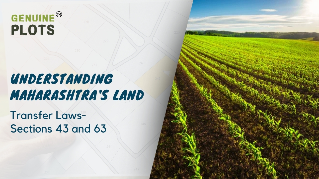
In Maharashtra, a state known for its bustling urban centers and rich agricultural heritage, a delicate dance between urbanization and the preservation of agricultural lands is underway. As rural populations flock to urban cities in search of better opportunities, the very essence of village life undergoes a transformation, with farmland often being acquired by non-agricultural entities. However, amidst this dynamic shift, the state has implemented crucial legal safeguards to protect the interests of agricultural communities.
Sections 43 and Section 63 of the Bombay Tenancy Act and Agricultural Lands Act, 1948
Sections 43 and Section 63 of the Bombay Tenancy Act and Agricultural Lands Act, of 1948, serve as pillars of protection for agricultural lands and the communities that depend on them. These sections impose restrictions on the transfer of agricultural lands, ensuring that they remain in the hands of cultivators and agricultural laborers. The intent is clear: to prevent the exploitation of vulnerable groups and safeguard the vital connection between cultivators and their land.
Amendments in Section 63
Recent amendments to Section 63 have introduced provisions aimed at striking a balance between urban development and agricultural preservation. While the transfer of agricultural lands for non-agricultural purposes is no longer barred within certain municipal and planning authority limits, stringent conditions have been imposed to regulate such transactions.
The amended Section 63 outlines a series of provisos designed to prevent speculative land hoarding and ensure responsible land utilization:
- Lands transferred for non-agricultural purposes must be utilized within five years, preventing stagnation and misuse.
- Failure to utilize the land within the stipulated timeframe incurs non-utilization charges and potential land resumption by the Collector.
- Defaulting transferees face consequences, including land forfeiture and auctioning by the Collector.
- Original landowners are given opportunities to repurchase land if the transferee fails to meet obligations.
- Transferees seeking to sell land before the expiration of ten years must obtain prior permission, discouraging premature land speculation.
These provisions serve as a blueprint for sustainable land management, promoting responsible urbanization while safeguarding agricultural interests. By balancing the needs of both urban and rural communities, Maharashtra strives to achieve equitable development and preserve its agricultural heritage for generations to come.
In the face of rapid urbanization, Maharashtra stands as a beacon of proactive land governance, setting a precedent for other regions grappling with similar challenges.
Guide to Buying Land in Maharashtra: Simple Steps for Safe and Smart Land Purchases

Are you thinking about buying land in India? Whether it's for investment or to build your dream home, it's important to do your homework before making any decisions. In this easy-to-understand guide, we'll take you through the steps to check plot details in India, ensuring a smooth and safe land purchase.
Step 1: Find the Plot Location
First, you need to know exactly where the plot is located. You can do this in a few ways:
- Visit the site yourself to see where it is and what's around it.
- If you have GPS coordinates, you can use online maps like Google Maps to pinpoint the location and see satellite images.
- Note any landmarks or boundaries mentioned in the property documents to help you accurately identify the plot.
Step 2: Verify Ownership and Title Documents
Once you know where the plot is, you need to make sure the right person owns it and that there are no legal issues. Here's how:
- Get a copy of the sale deed from the current owner, which should have all the details about the plot's history.
- Ask for an encumbrance certificate from the local office to confirm no legal problems are attached to the plot.
- Check the mutation records to make sure the plot's ownership has been transferred legally.
Step 3: Do a Legal Search
To be extra safe, it's a good idea to check for any legal issues related to the plot:
- Look for any pending legal disputes by consulting a lawyer or searching at the local court or land records office.
- Make sure the plot has all the necessary approvals and permissions from the local authorities for its intended use.
Step 4: Check Zoning and Land Use
Before you buy, make sure the plot is suitable for what you want to do with it:
- Check the local zoning regulations to see what kind of activities are allowed on the plot.
- If the plot's current use is different from what you want to do, make sure it's been approved for the change by the relevant authorities.
Step 5: Confirm Infrastructure and Amenities
Lastly, make sure the plot has all the basic necessities nearby:
- Check if it has access to utilities like water, electricity, sewage, and drainage systems.
- See how close it is to important facilities like schools, hospitals, markets, and transportation hubs.
Following these steps ensures that buying land in India is a safe and hassle-free experience.
When verifying documentation for land-related purchases, it's essential to seek expert guidance for a seamless experience. At Genuine Plots, we specialize in ensuring the authenticity and legality of property documents, providing our clients with peace of mind and confidence in their investments. Our team of experts meticulously examines each document, offering comprehensive guidance and assistance every step of the way. Trust Genuine Plots TM for reliable expertise in land documentation verification.

Takeaway Points:
- Understanding Legal Documents: Familiarize yourself with essential documents like the title deed when buying land or property to navigate the process smoothly.
- Title Deed vs. Sales Deed: Differentiate between the title deed, which confirms ownership rights, and the sales deed, which formalizes property transfer agreements.
- Legal Proof of Ownership: The title deed serves as legal proof of ownership, obtained through property registration after reaching an agreement with the seller.
- Registration Act of 1908: In India, the Registration Act mandates the registration of sale deeds to establish legal proof of property transfer.
- Defending Property Claims: Possessing a title deed is crucial for defending property claims, especially in disputes involving agricultural or ancestral properties.
- Requirement for Bank Loans: Banks require a title deed as proof of property ownership when granting loans, particularly for construction purposes.
- Ensuring Smooth Transactions: Understanding the importance of the title deed and securing it properly ensures a hassle-free property ownership experience.
When it comes to buying land or property, understanding the necessary documents is crucial to ensure a smooth process. One of the most important documents you'll encounter is the title deed, which differs from a sales deed.
Title Deed
A title deed represents your legal right to own a piece of land or property. It confirms your ownership and is obtained after you and the seller reach an agreement. This agreement is formalized through property registration, and the document that reflects this transaction is the sale deed.
Registration of Sale Deed
In India, the Registration Act of 1908 mandates the registration of sale deeds to establish legal proof of property transfer. Once registered and validated in court, the sale deed effectively becomes the title deed for the new owner. These terms are often used interchangeably.
Importance of Title Deed
Having a title deed is essential when purchasing land, especially for building a new home. It serves as evidence of ownership, which is crucial for defending property claims, particularly in agricultural or ancestral property disputes.
Moreover, possessing a title deed is necessary when seeking bank loans. If you plan to construct a house after purchasing land, the title deed provides proof of your property rights to the bank. This document allows the bank to transfer ownership of the land to them temporarily until the loan is repaid.
Summary
The title deed is vital to confirm your legal ownership of land or property. It not only safeguards your rights but also facilitates transactions such as property sales and obtaining loans for construction purposes. Understanding its importance and securing it properly ensures a hassle-free property ownership experience.
Buying Property in India as a Non Resident: Everything You Need to Know

Owning land or property in India, even after becoming a non-resident, is indeed possible, offering a valuable investment opportunity for those who have relocated abroad. Suppose you've purchased property in India while residing there and later moved overseas. In that case, you're entitled to retain ownership, regardless of the type of property, including agricultural land, which may otherwise be restricted for NRIs.
For non-resident Indians (NRIs) looking to invest in property in India, the process closely mirrors that of residents. However, there are notable differences, particularly in the requirement for acquiring power of attorney if you're not physically present in the country.
Procuring property as an NRI entails several crucial steps, and it's imperative to seek expert guidance to navigate legal intricacies effectively, especially if you're not currently residing in India. This ensures compliance with all legal requisites and minimizes potential risks associated with property acquisition.
Here's a concise guide outlining the procedure for NRIs to purchase property in India:
- Research and Consultation: Begin by conducting thorough research on properties and legal regulations governing property ownership in India. Seek guidance from local experts or legal advisors to gain insights into the process and ensure compliance with all legal requirements.
- Financial Planning: Assess your financial capacity and explore financing options available to NRIs for property investment in India. This includes understanding currency exchange regulations, taxation, and financing options such as NRI home loans.
- Property Selection: Choose the property that aligns with your investment goals and preferences. Before finalizing your property purchase, it's essential to thoroughly investigate the ownership status, legal title, and any potential issues or obligations tied to the property.
- Documentation and Legal Formalities: Prepare and review all necessary documents meticulously, including sale agreements, property deeds, and clearances from regulatory authorities. Ensure that all documentation adheres to legal standards and is duly executed.
- Power of Attorney: If you're unable to be physically present in India during the property transaction, appoint a trusted individual as your attorney through a power of attorney document. This authorized representative can act on your behalf to complete legal formalities and execute property transactions.
- Registration and Transfer: Complete the registration process for the property at the relevant sub-registrar office. Transfer the property ownership in your name as per legal procedures, ensuring compliance with stamp duty and registration fees.
Conclusion:
In summary, owning property in India as a non-resident offers lucrative investment prospects, but it requires careful planning and adherence to legal protocols. By seeking expert advice and guidance from experts like Genuine Plots, NRIs can navigate the property acquisition process seamlessly and safeguard their investments effectively. With proper due diligence and compliance with legal requirements, NRIs can confidently pursue property ownership in India as a rewarding long-term investment strategy.
A Step by Step Guide by Genuine Plots to Purchasing Your Perfect Property

A Step-by-Step Guide by Genuine Plots to Purchasing Your Perfect Property
So, you've found that dream property online – the pictures look perfect, the description is enticing, and it's everything you've ever imagined. Before you dive headfirst into the excitement of making it yours, take a moment to consider the critical steps you can't afford to skip in the land-buying journey.
- Explore the Property with a Comprehensive Walk-Through
Before you commit to anything, put those boots on the ground. Virtual admiration can be deceiving; sometimes, reality hits harder than the pictures. A visit lets you see the surroundings, gauge the accessibility, and avoid potential surprises.
- Check Deed Restrictions:
Deed restrictions can be the fine print that alters your homesteading plans. Investigate if there are limits on dwelling sizes, rules against certain structures, or other constraints. Unexpected rules could govern your dream, so thoroughly checking the property's deed is essential. Don't let hidden restrictions sneak up on your dreams.
- Check on Mineral, Electricity, Water, and Access Rights:
Understanding what comes with the land – be it mineral rights water access – is crucial. Sometimes, a property might not come with all the rights you assume it does. Consulting a legal expert or experts from Genuine Plots can help you navigate these complexities and ensure your homestead dreams aren't compromised by overlooked rights.
- Verify Zoning and Ordinances:
Dreaming of a cozy cabin or a sustainable homestead? Zoning and ordinances can either be your ally or your obstacle. Ensure your plans align with the local regulations. From square footage requirements to setback rules, every detail matters. Don't let zoning complexities stumble your path to a perfect homestead.
- Double-Check Your Finances:
Your financial groundwork is as vital as the land itself. Whether paying in cash, exploring land leases, or opting for owner financing, ensure your finances are secure. Reviewing documents with a legal expert can prevent any financial hiccups, safeguarding your opportunity to turn that dream homestead into a reality.
Remember, the journey to your homestead involves more than just online admiration. It's about turning your dream into a reality, and these steps ensure you're on the right path. So, lace up those boots, do your due diligence, and get ready to build the homestead you've always envisioned!
Recent Posts
Tags
Bhunaksha,
genuine plots,
Land For Sale,
Maharashtra Bhunaksha,
plots for sale,
Gunthewari,
Gunthewari Land,
Gunthewari Rules,
Extract Documents,
Plots and Lands,
Saat Baara,
Extract Saat,
Baara Utara,
Jamabandi,
property tax payments,
Gram Panchayat,
lower prices,
non-agricultural land,
Lower Investment Cost,
Gram Panchayat lands,
Fresh Land Settlements,
Growing demand,
affordable homes,
genuine p,
legal Land,
bungalow plots,
Konkan,
Maharashtra,
Purandar,
Pune,
Karnataka,
Bangalore,
Farm Land,
Kolkata,
Rajarhat,
Indore,
Chhatrapati Sambhajinagar,
Aurangabad,
Mundhwa,
Agricultural Land,
Farmhouse Plot,
Rules And Penalties,
Residential Plots,
NA PLots,
Residential NA Plots,
Commercial NA Plots,
Animal Husbandry Land,
Tathawade,
Vahivat Land Maps,
Vahivat,
Indian Land Records,
Ownership Rights,
Red zone,
PCMC,
Dehu Road,
Land Registration Rules,
Land Investing,
Infrastructure Growth,
Land Ownership,
Land Encroachment,
Panshet Dam,
Varasgaon Dam,
Verified Land,
Plot For Sale,
Land Investment,
Verified Plots,
Land Acquisiton,
Hydrological Survey,
Invest In Land,
Verified Land Plots,
Panshet,
Khadakwasla,
Land Rules,
Dakhil Kharij,
Land Registry,
Property Onwership,
Clean Title Check List,
Property Verification,
Digital Registry,
Farm Plots,
Agro Property,
Land Value Growth,
Urban Expansion,
Senapati Bapat Road,
Registered Land,
Agricultral Plot,
Purandar Airport,
Safe Investment,
Secure Property,
Plot Buyers,
Approved Plots,
Land ROI,
NA Approved Plots,
NA Land,
Welspun One,
Logistic Park,
Talegaon,
PMC Bharat Mandapam,
Urban Development,
Lohgaon,
Close To Nature,
Gated Community Plots,
Buy Land VS Gold Investment,
NRI Investment,
Future Ready Living,
Trusted Plots,
Plot Investment,
Authentic Land,
Safe Land Buying,
Mumbai,
Premium Plots,
MMR Land Investment,
MMR Infrastructure,
Metro Connectivity,
Plots in Mahabaleshwar hill station investment,
Mahabaleshwar land prices and future growth,
Scenic residential plots in Mahabaleshwar,
Mumbai 3.0,
Mumbai 3.0 vs Mumbai 2.0,
Mumbai property investment,
Real estate investment in Mumbai,
Upcoming residential projects in Mumbai,
CIDCO plot auctions,
CIDCO auction Navi Mumbai,
Upcoming CIDCO plot auctions 2026,
CIDCO land auction dates,
Navi Mumbai plot auctions,
CIDCO plots in Navi Mumbai,
CIDCO plots in Kharghar,
CIDCO plots in Ulwe,
NMIA investment opportunities,
Mumbai 3.0 plotted development,
Mumbai 3.0 real estate,
Plots in Mumbai 3.0,
Land investment in Maharashtra,
Residential plots near Mumbai,
Land appreciation in Mumbai 3.0,
Residential land for sale in Mumbai 3.0,
Altamura NA Plots,
Altamura Nadar City,
NA Plots in Nadar City,
Nadar City Plots,
Plots in Nadar City,
YEIDA plots,
YEIDA plots near Noida Airport,
Noida Airport plots,
Jewar Airport investment,
Yamuna Expressway plots,
YEIDA plot scheme 2026,
Noida Airport real estate,
Zepto,
Zepto effect,
D2C brands India,
Urban consumer trends,
Marketplace evolution,
Urban infrastructure growth,
YEIDA Residential Plot Scheme,
Yamuna Expressway Plot Scheme,
YEIDA Residential Plots,
Yamuna Expressway Authority,
Noida Investment,
Residential Plots in Lucknow,
LDA Plots in Lucknow,
Lucknow Real Estate,
LDA Approved Plots,
Plots for Sale in Lucknow,
Lucknow Property Investment,
Land Investment in Lucknow,
Residential Land in Lucknow,
Buy Plot in Lucknow,
Lucknow Development Authority,
Maharashtra Fragmentation Law 2025,
Fragmentation Act Maharashtra,
Maharashtra land law update 2025,
Maharashtra land reforms 2025,
Land subdivision rules Maharashtra,
Maharashtra agriculture land purchase rules,
Agricultural land purchase restrictions Maharashtra,
Can non-farmers buy agricultural land in Maharashtra,
NA conversion process Maharashtra,
Collector permission for land purchase,
farmland prices in Nagpur,
agricultural land price in Nagpur per acre,
farmland cost in Nagpur Maharashtra,
Nagpur agricultural land investment,
per acre agricultural land rate in Nagpur,
Tukdebandi Law Maharashtra,
Maharashtra Fragmentation Act update,
Land subdivision law Maharashtra,
Agricultural land division Maharashtra,
Maharashtra land reform ordinance,
Plot registration Maharashtra,
Farmland prices Nagpur,
Nagpur agricultural land rates,
Farmland per acre Maharashtra,
Agricultural land price Nagpur,
Farm land cost Nagpur,
Nagpur real estate trends,
Land investment Nagpur,
Avani Farms,
Avani Farms Pune,
Farmland near Pune,
Farm plots for sale,
Agricultural land investment,
Gated farmland near Pune,
NRI agricultural land rules India,
Can NRI buy agricultural land in India,
FEMA rules for NRI property purchase,
RBI guidelines for NRI land investment,
NRI farmland investment India,
Agricultural land purchase by NRI,
Maharashtra Fragmentation Act,
Minimum plot size in Maharashtra,
Guntha rules Maharashtra,
Agricultural land division rules,
Minimum land area for sale in Maharashtra,
Legal plot size in guntha,
Guntha conversion rules,
NRI land purchase in India,
Can NRIs buy agricultural land in India,
NRI property investment India,
NRI buying residential land,
NRI real estate guidelines India,
Investment tips for NRIs in India,
Mutation Entry Process,
Land Mutation in India,
Property Mutation Process,
Land Ownership Transfer,
1 guntha na plot prices in pune 2026,
1 guntha plot price in pune,
na plots in pune,
residential na plots pune,
guntha plot rate in pune,
na plot investment in pune,
plots near purandar airport,
1 Acre Land Price in Pune,
Pune Land Rates 2025,
Pune Land Price 2026,
Pune Acre Land Cost,
Land Value Pune,
Agricultural Land Price Pune,
gated community plots in Hinjewadi,
Hinjewadi plots for sale,
residential plots in Hinjewadi Pune,
premium plots in Hinjewadi,
plots near Rajiv Gandhi Infotech Park,
land for sale in Hinjewadi Pune,
Pune property investment,
plots for sale in Pune below 5 lakhs,
Pune rural land investment,
gated plotting projects Pune,
MIDC growth corridor plots,
Residential plots for sale in Hinjewadi,
Plots in Hinjewadi Pune,
Land for sale in Hinjewadi,
Residential NA plots Hinjewadi,
Hinjewadi real estate trends 2026,
Nashik land investment,
Trimbakeshwar land for sale,
Simhastha Kumbh 2026,
Simhastha Kumbh 2027 real estate impact,
Trimbakeshwar property investment,
Land appreciation in Nashik,
plots for sale in pune,
types of plots in pune,
residential plots in pune,
agricultural land in pune,
villa plots in pune,
NRI agricultural land purchase India,
NRI property investment in India,
Agricultural land rules for NRIs,
NRI real estate investment India,
NA plot meaning,
what is NA land,
NA land in Maharashtra,
land investment guide,
NRI agricultural land in Telangana,
Telangana land laws for NRI,
Telangana real estate laws,
NRI investment guide Telangana,
Legal compliance for NRI property,
NRI farmhouse purchase India,
RBI guidelines for NRI property,
NRI land buying rules,
Godham Eco Village,
Godham Eco Village for NRIs,
NRI land investment in India,
Investment plots for NRIs,
Secure land investment India,
NRI property buying guide,
plots in Pune,
NRI buying property in India,
NRI guide to buying land in Pune,
NRI land investment in Pune,
NRI property documents checklist,
Maharashtra land reform 2025,
Maharashtra land laws update,
Agricultural land rules in Maharashtra,
Buying agricultural land in Maharashtra,
Non-agricultural land conversion Maharashtra,
Maharashtra agricultural land rules 2024,
agricultural land purchase in Maharashtra,
non agriculturist land purchase rules,
who can buy agricultural land in Maharashtra,
Maharashtra land laws for non farmers,
Guntha based land rules,
Minimum guntha rule Maharashtra,
Maharashtra land laws,
Maharashtra agricultural land laws,
farmland investment Maharashtra,
buying farmland legally in Maharashtra,
NA conversion rules Maharashtra,
agricultural land eligibility criteria,
Property Mutation in India,
Land Record Update,
Revenue Records,
Property Ownership Transfer,
Mutation of Property,
Farmhouse Plots Near Pune,
NRI Investment in Pune,
Pune Real Estate,
Plots for Sale Near Pune,
Luxury Farmhouse Plots,
Pune plot scams,
Plot buying checklist,
Legal verification for plots,
NA plot verification,
Plot buying tips Pune,
Godrej Properties,
Evora Estate Panipat,
Luxury plots in Panipat,
Premium land investment,
Residential plots in Panipat,
Lodha Developers,
Lodha Developers Q3 acquisition,
Lodha land parcels Q3,
Indian real estate news,
New residential projects India,
Real estate investment news,
Premium housing projects,
Srijan Group,
Kolkata Tech Park,
Commercial Real Estate,
Real Estate Investment,
Real Estate Deal News,
NRI investment in India,
NRI land investment,
Plots for sale in India,
NRI property investment,
Can NRI buy residential plot in India,
NRI land purchase rules,
Residential plots for NRIs,
NRI real estate investment,
NRIs buying property in India,
Can NRIs buy plots in India 2026,
RBI rules for NRI property purchase,
NRI land investment rules,
MMR 3.0,
MMR real estate 2026,
Mumbai real estate market,
Navi Mumbai investment,
Thane property market,
Mumbai property trends 2026,
Land investment in MMR,
Mumbai smart city project,
Korea Mumbai partnership,
MMRDA infrastructure projects,
Korean investment in India,
MMR GDP growth,
MMR economic roadmap 2030,
Mumbai real estate,
Public private partnership projects Mumbai,
Investment opportunities in MMR,
Mumbai Metropolitan Region,
Mumbai urban development,
MMR 2047 vision,
Mumbai infrastructure projects,
Navi Mumbai development,
Goa property investment,
Invest in Goa 2026,
Goa real estate market 2026,
Best places to invest in Goa,
North Goa property,
Property appreciation in Goa,
Goa plots for sale,
Commercial property in Goa,
Buy property in Goa,
YEIDA plots 2026,
Residential plots in YEIDA,
YEIDA new scheme update,
Plots near Noida International Airport,
Yamuna Expressway Authority plots,
YEIDA housing scheme details,
Lucknow land investment,
Property in Lucknow,
Buy plots in Lucknow,
Nashik plots for sale,
Kumbh Mela 2026 Nashik,
Land investment in Nashik,
Nashik property market 2026,
Plots near Kumbh Mela Nashik,
Residential plots in Nashik,
Upcoming projects in Nashik,
Property appreciation in Nashik,
Maharashtra land investment,
Nashik Kumbh Mela 2026,
Kumbh Mela investment opportunities,
Infrastructure development in Nashik,
Plots near Nashik Kumbh Mela,
High ROI land investment,
MIHAN,
MIHAN Nagpur,
Nagpur Real Estate,
Agricultural Land Nagpur,
Nagpur Property,
Plots Near In MIHAN,
Pune residential plots,
best areas to buy plots in Pune,
Pune land investment,
investment plots in Pune,
buy land in Pune,
real estate investment in Pune,
Godrej Plots Doddaballapur,
Doddaballapur plots for sale,
Plots in North Bangalore,
Godrej Properties plots,
Residential plots in Doddaballapur,
Investment plots near Bangalore,
Gated community plots Bangalore,
Premium plots in Doddaballapur,
plots in Mahabaleshwar,
Mahabaleshwar villa plots,
farmhouse plots in Mahabaleshwar,
land for sale in Mahabaleshwar,
bungalow plots in Mahabaleshwar,
hill station property investment,
agricultural land in Mahabaleshwar,
premium land in Mahabaleshwar,
Plots in Pune under 3 lakhs for sale,
Budget residential plots near Pune,
Low cost plots near Pune highway connectivity,
plots in Pune under 3 lakhs,
farmland plots near Pune city,
Investment plots near Pune under budget,
Residential land near Pune,
Godrej plots in Pune,
Premium plotted development by Godrej in Pune,
Residential land for sale by Godrej,
Premium plot by Godrej,
Plots for sale in Hadapsar Pune,
Residential plots in Hadapsar,
Investment plots in Hadapsar,
Gated community plots in Hadapsar,
Ready to build plots in Hadapsar,
1 Guntha plot in Pune,
1 Guntha plot in Pune for sale,
1 Guntha plots near Pune city,
Residential 1 Guntha land in Pune,
Clear title 1 Guntha plot in Pune,
1 guntha plot price in village,
village plot rate per guntha,
affordable 1 guntha land in rural area,
residential plot in village Pune,
farmland plot price per guntha,
Residential 1 Guntha plot near Pune city,
Investment plots in Pune 1 Guntha,
Clear title 1 Guntha land in Pune,
Agricultural 1 Guntha plot near Pune,
1 Guntha plot in Pune Katraj for sale,
Residential plot in Katraj Pune 1 Guntha,
Katraj Pune land for home construction,
1 Guntha NA plot in Katraj Pune,
Pune Katraj plot near highway connectivity,
Gated plot project in Katraj Pune,
NA plots in Pune under 10 lakhs,
Affordable NA plots near Pune city,
NA residential plots in Pune,
NA approved plots in Pune under 10 lakhs,
Investment plots in Pune under 10 lakhs,
Residential NA plots near Pune highway,
Best plots in Pune below 10 lakhs,
Premium villa plots in Pune,
Residential villa plots in Pune near city outskirts,
Luxury villa plots in Pune,
Gated villa plot project in Pune,
Villa plot site visit in Pune,
NA plots in Pimpri Chinchwad for sale,
Residential NA plots in PCMC area,
NA approved plots in Pimpri Chinchwad,
NA land with clear title in PCMC,
NA plots near Pune Mumbai Highway PCMC,
Godrej Villa Plots Doddaballapur,
Godrej plotted development Bangalore,
villa plots in North Bangalore,
premium villa plots Bangalore,
Godrej Properties plots Bangalore,
Brigade Plots Malur,
Brigade Malur plots,
plots in Malur East Bangalore,
investment plots in East Bangalore,
residential plots in Malur Bangalore,
Brigade Group plots Bangalore,
land investment in East Bangalore,
gated community plots in Malur,
prestige plots devanahalli,
prestige plots in devanahalli bangalore,
plots for sale in devanahalli,
prestige plots investment,
premium plots in devanahalli,
residential plots near kempegowda airport,
What is NA plot in real estate,
NA land meaning in property,
NA approved plotsDifference between NA and agricultural land,
Buying NA plots in Maharashtra,
NA plot vs agricultural land,
Plot prices in Mysore,
Mysore infrastructure projects,
Mysore property investment,
Land investment in Mysore,
Plot investment opportunities,
land buying guide in goa,
buy land in goa,
plots for sale in goa,
legal process to buy land in goa,
property in goa,
residential plots in goa,
Nashik Simhastha Kumbh Mela 2026,
Sadhugram expansion Nashik,
Maharashtra Kumbh Mela planning,
Nashik Kumbh Mela preparations,
tourism development in Nashik,
plots in Nagpur,
Nagpur plot investment,
land for sale in Nagpur,
residential plots in Nagpur,
golden rules before buying plots in Nagpur,
Nagpur land investment,
plot investment in Nagpur,
land investment in Nagpur,
plots for sale in Nagpur,
best areas to buy plots in Nagpur,
buying plots in Nagpur,
plot purchase checklist,
legal checklist for buying land,
documents required for plot purchase,
NA plots in Nagpur,
Tattvana,
Tattvana in Kamshet,
Moregaon Farmland Estates,
farmland investment Pune,
agricultural land investment,,
farmland for sale near Pune,
farm plots in Pune,
gated farmland projects,
agricultural plots Maharashtra,
open plot vs NA plot,
difference between open plot and NA plot,
what is NA plot in India,
open plot meaning in real estate,
NA land vs agricultural land,
residential NA plots benefits,
land investment in India,
buying NA plot vs open land,
capital gains on agricultural land,
rural vs urban agricultural land tax,
agricultural land tax rules India,
capital gains tax India property,
is agricultural land taxable,
rural agricultural land exemption,
urban agricultural land tax India,
Runwal Enterprises Alibaug township,
Alibaug real estate,
coastal real estate India,
township projects in Alibaug,
luxury properties in Alibaug,
Mumbai weekend homes investment,
Alibaug property investment,
isprava south goa,
ultra luxury villas in goa,
south goa real estate,
luxury homes in goa,
isprava projects goa,
premium villas in south goa,
land investment advisory services,
secure land investment,
real estate advisory services,
verified land deals,
investment plots near Pune,
land buying guide India,,
#KanpurRealEstate,
#KDAPlots,
#KanpurProperty,
#RealEstateKanpur,
#PropertyTrends,
Gokul Plots investment,,
real estate investment Gokul,,
plots with high appreciation potential,
smart land investment strategies,
plots for sale in North Bangalore,
land investment Bangalore,,
emerging areas in North Bangalore,
residential plots Bangalore,,
Bangalore real estate investment,,
North Bangalore property trends,,
plots near airport Bangalore,,
HUDA plots in Gurgaon,
HUDA plots in Faridabad,
residential plots Haryana,
HUDA approved plots,
plots for sale in Gurgaon,
plots in Faridabad investment,
Prestige Marigold plots,,
Bangalore plotted developments,
land investment Bangalore,
best plots in North Bangalore,
#PlotsForSaleInNellore,
#NelloreRealEstate,
#NellorePlots,
#RealEstate2026,
#PropertyInvestment,
#NelloreProperty,
#AndhraPradeshRealEstate,
GMADA E Auction 2026,
GMADA plots Mohali,
plots in Mohali for sale,
GMADA Mohali auction process,
buy plots in Mohali,
Punjab property investment,
GMADA scheme 2026,
Mohali real estate,
HSVP plots 2026,
HSVP plot investment,
HSVP plots Haryana,
land investment benefits,
residential plots investment,
government approved plots,
buy plot in New Chandigarh,
flats in New Chandigarh,
New Chandigarh real estate,
property investment in New Chandigarh,
residential plots in New Chandigarh,
apartments in New Chandigarh,
#WaveCityGhaziabad,
#GhaziabadPlots,
#PlotsInGhaziabad,
#NCRRealEstate,
#RealEstateInvestment,
#ResidentialPlots,
APIIC vacant plots,
APIIC plots for sale,
industrial plots in Andhra Pradesh,
commercial land for MSMEs,
startup investment plots,
APIIC industrial land,
HUDA plots,
HUDA plots investment,
property appreciation,
plot investment benefits,
high return property investment,
land appreciation,
#GDAPlotsInGhaziabad,
#PlotsForSaleInGhaziabad,
#ResidentialPlotsGhaziabad,
#InvestmentPlots,
#RealEstateGhaziabad,
#GDAApprovedPlots,
#BaliProperty,
#PropertyInBali,
#IndiansInBali,
#BaliRealEstate,
#InternationalPropertyInvestment,
buy plots in Sarjapur Road Bangalore,
plots in Sarjapur Road,
residential plots in Sarjapur Road,
land for sale in Sarjapur Road Bangalore,
investment plots in Bangalore,
plots near IT corridor Bangalore,
how Indians can buy property in Bali,
buy property in Bali for Indians,
Bali property investment,
property in Bali for Indian buyers,
Bali real estate guide,
foreign property investment Bali,
legal checks before buying property in Bali,
Indians invest in Bali property,
due diligence for Bali property,
Bali real estate for Indians,
Bali property legal verification,
verified farmland plots,
100% verified farmland plots,
farmland investment India,
legal farmland plots,
farmland plots for sale,
Konkan land investment,,
high-growth corridors Maharashtra,
land investment 2026,
plots for sale in Maharashtra,


