Prev Post
K Raheja Corp Subsidiary Acquires 7.43 Acres in Mahalunge, Pune for ₹195 CrorePMRDA, District Administration Push for Land Acquisition for Nashik Phata–Khed Elevated Corridor
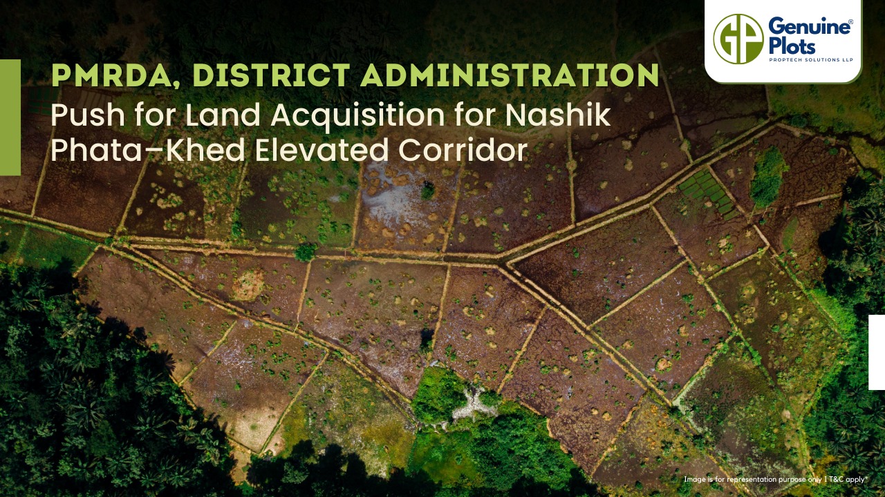
In order to alleviate traffic congestion along the Pune–Nashik highway, the district administration and the Pune Metropolitan Region Development Authority (PMRDA) have stepped up their efforts to finish the land acquisition for the upcoming Nashik Phata–Khed elevated corridor.
Project Overview
The 30-km elevated corridor between Nashik Phata and Rajgurunagar (Khed) will be developed by the National Highways Authority of India (NHAI). The project, estimated at ₹7,827 crore, is expected to significantly reduce travel time and traffic snarls on this vital route, especially near industrial hubs like Chakan.
Land Requirement & Acquisition
Authorities have identified around 14 hectares of land needed for the project, primarily for entry and exit points. Out of this, 9.74 hectares belonging to around 150 landowners within PMRDA limits—covering villages such as Nanekarwadi, Waki Khurd, Waki Budruk, Chimbali, Kuruli, Medankarwadi, and parts of Chakan have been earmarked.
In areas under the Pimpri-Chinchwad Municipal Corporation (PCMC), particularly in Bhosari and Moshi, land acquisition is being facilitated through Transfer of Development Rights (TDR) and Floor Space Index (FSI) transfers.
Financial Support
To cover remaining acquisition costs, a proposal seeking ₹262 crore in state aid has already been submitted. Authorities have assured that landowners will receive due compensation for the acquired land.
Challenges Ahead
Concerns have been voiced by a few Chakan landowners who demand payment for their holdings and assert that previous acquisitions for highway construction were never formally transferred. If these disagreements are not settled right away, the process may be delayed.
Road Ahead
The district administration has set a goal to finish the land acquisition by October 2025. Following the conclusion of the bidding process, construction is anticipated to start. Once the corridor is up and running, it should improve connectivity to the Chakan MIDC belt and beyond while also providing relief to thousands of daily commuters.
Source: Times of India
Maharashtra Government Introduces Vacant Land Tax for Asset Registration

One significant change is the requirement for property owners to submit payment receipts of vacant land tax or property tax for asset registration. This step aims to ensure that property owners fulfill their tax obligations promptly.Moreover, the government has made it mandatory to include the title owner's details in the adangal copy for agricultural land.
The decision to introduce these rules stemmed from observations that many vacant land owners were not paying taxes on time.Furthermore, urban and rural local authorities encountered difficulties in gathering vacant land taxes because they lacked a comprehensive database of property owners.
Local civic bodies and rural authorities have been urging the state government to provide details of land sellers and purchasers immediately after registration. This would facilitate tracking and collection of vacant land tax. However, technical constraints have hindered the government's ability to share this data.
The Maharashtra Government also revamped the property tax system in urban areas by transitioning from the annual rental value (ARV) tax calculation method to the capital value (CV) tax system. This change ensures uniformity in tax imposition on properties based on market value determined by the registration department. The reform aims to prevent irregularities in tax collection by revenue officials in urban civic bodies.
Previously, vacant land tax (VLT) was not mandatory for selling or purchasing property. To address this gap, the government now requires the submission of VLT receipts for the registration of open plots.
These measures underscore the government's commitment to promoting transparency, accountability, and fair taxation in property transactions. By implementing these rules, the Maharashtra Government aims to streamline property registration processes and enhance revenue collection for the welfare of the state.

When you're buying property, whether it's a house or just land, it might seem like they're the same thing, but there are some important differences to know about, especially when it comes to getting a loan. Let's break it down in easy terms.
Similarities:
- Doing Your Homework: Whether you're getting a loan for a home or land, the process is pretty similar. Lenders will check your background and finances before giving you the green light.
- Monthly Payments: Both types of loans usually involve paying a fixed amount every month, called an Equated Monthly Installment (EMI). And if you're applying with someone else, like a spouse, the rules are usually the same for both kinds of loans.
Differences:
- Location and Purpose: Home loans are for when you're buying a house that's already built, one that's being built, or if you're planning to build it yourself. Land loans, on the other hand, are just for buying land where you might want to build a house later.
- How Much You Can Borrow: This is where it gets a bit different. With a home loan, you can usually borrow a bigger percentage of the property's value, somewhere between 75% to 90%. But with a land loan, it's usually capped at 75% to 80% of the land's value.
- How Long You Have to Pay Back: Home loans usually give you a longer time to pay back the money, up to 30 years sometimes. But with land loans, you've got a shorter window, usually around 15 years.
- Tax Breaks: When you're paying back a home loan, you might get some tax benefits, like being able to deduct the interest you pay from your taxes. But with a land loan, you don't usually get those benefits unless you build a house on the land later.
Knowing these distinctions can simplify your decision-making process when deciding whether to secure a loan to purchase a home or acquire land.

Plot loans, also known as land loans, are an essential financial tool for individuals aspiring to own a piece of land. Unlike home loans, which are tailored for purchasing constructed properties, plot loans cater specifically to acquiring land for future construction purposes. Understanding the features, benefits, and eligibility criteria associated with plot loans can empower potential buyers to make informed decisions about their investments.
Features of Plot Loans:
- Loan Tenure: Lenders typically offer repayment periods ranging from 10 to 20 years, considering the borrower's repayment capacity and monthly EMI contributions.
- Loan-to-Value Ratio (LTV): Up to 80% of the plot's value can be financed by the loan, with the final ratio determined by the lender's credit risk assessment. Factors such as the plot's location, market value, and the borrower's credit profile influence this assessment.
- Tax Benefits: While the repayment of principal and interest components of the plot loan itself does not qualify for tax deductions, home loans taken for constructing a residential property on the purchased plot are eligible for tax benefits under Section 24 and 80C of the Income Tax Act.
- Balance Transfer Facility: Borrowers can transfer their outstanding plot loan amount to other lenders at competitive rates, subject to credit risk assessment by the new lender.
- Prepayment Charges and Processing Fees: Processing fees typically range from 0.25% to 1.50% of the loan amount. As per the regulations set by the Reserve Bank of India (RBI), prepayment charges do not apply to floating-rate loans. However, for fixed-rate loans, there is a possibility of these charges being imposed.
Benefits of Taking Plot Loans:
- Purchase of Residential Land: Plot loans enable individuals to acquire land for future residential construction, facilitating long-term investment and asset building.
- Attractive Interest Rates: Lenders often offer competitive interest rates on plot loans, making them an affordable financing option.
- Affordable Repayment Tenures: Flexible repayment periods ensure that borrowers can manage their loan obligations comfortably over time.
- No Pre-payment Penalty: The absence of pre-payment penalties on floating-rate loans allows borrowers to repay their loans ahead of schedule without incurring additional charges.
- Low Processing Fees and Minimal Documentation: Plot loans typically involve minimal paperwork and low processing fees, streamlining the borrowing process for applicants.
- Tax Benefits: Tax deductions on home loans taken for constructing residential properties on the purchased plot offer additional financial incentives for borrowers.
Eligibility Criteria for Plot Loans:
- Resident Indian: Applicants must be Indian residents to qualify for plot loans.
- Salaried or Self-Employed: Both salaried individuals and self-employed professionals are eligible to apply for plot loans.
Age Criteria: Applicants should fall within the age bracket of 18 to 65 years to be considered for loan approval.

The Tukde Bandi Kayda, or Land Holding Act of 2015, prevents the division of land into small pieces in Maharashtra and requires land to be consolidated. This law was enforced by the Maharashtra State Revenue and Stamping Department in July 2021. Earlier, the law did not allow the purchase of land in pieces smaller than 20 guntha. This caused problems for many people, such as difficulties in building homes, accessing roads for farming, and digging wells. However, on March 14, 2024, the government changed the law. Now, it allows the purchase of land in pieces as small as 1 to 5 guntha.
Key Points:
- Previous Restrictions: The law previously restricted the sale of irrigated land less than half an acre and non-irrigated land less than two acres.
- New Amendments: On March 14, 2024, amendments were made to allow easier land sales for specific needs like building homes or creating access roads.
- Permissions: Buyers now need the district collector’s approval, and the land must be used for the stated purpose.
- Farmers can purchase up to five gunthas of land to dig a well, and they must provide a certificate from the Groundwater Survey Department confirming the presence of water in the area.
These changes aim to resolve issues caused by small land parcels left after government projects and make land transactions smoother.
Can NRIs Buy Agricultural Land in India Understanding the Legal Landscape

In India, Non-Resident Indians (NRIs) may dream of owning a slice of rural paradise, but the legal path to acquiring agricultural land is filled with complexities and restrictions. Let's delve into the legal landscape to understand if NRIs can buy agricultural plots in India.
The Legal Prohibition:
First things first, NRIs are legally prohibited from directly purchasing agricultural land in India. This prohibition is enforced by the Foreign Exchange Management Act (FEMA). If an NRI attempts to buy agricultural land, it could lead to severe consequences like confiscation of the land and hefty fines.
Exceptions:
However, there's a glimmer of hope for NRIs who wish to own agricultural land. They are allowed to inherit agricultural land from their family members, providing an opportunity for NRIs to own rural property in India. Additionally, NRIs can acquire agricultural land as gifts from Resident Indians, though gifting between NRIs is not permitted.
Seeking RBI Permission:
There's a special provision where NRIs can seek permission from the Reserve Bank of India (RBI) to acquire agricultural land. This involves a detailed application process, demonstrating the necessity of the purchase and ensuring the land won't be used for speculative purposes.
Essential Documents for Transactions:
When embarking on property transactions, it's essential to have all legal documents in order. These include the Mother Deed, sale deed, legal heir certificates (for inheritance cases), tax receipts, and compliance certificates, among others.
Tax Implications and Benami Transactions:
Selling agricultural land involves navigating through various tax implications, especially capital gains tax. Additionally, NRIs need to be cautious about compliance with the Benami Act to avoid illegal transactions.
State-Specific Considerations:
Land laws vary across Indian states, with some requiring buyers to have a farmer's license or prove an agricultural background. NRIs need to be aware of these state-specific regulations when considering purchasing agricultural land.
Seeking Legal Counsel:
Given the complexities involved, it's advisable for NRIs to seek legal counsel to navigate the regulatory hurdles effectively. By adhering closely to guidelines from the government and the RBI, NRIs can ensure compliance and safeguard their investments.
While NRIs may have aspirations of owning agricultural land in India, the legal landscape presents several challenges. Understanding the regulations, seeking proper permissions, and ensuring compliance with the law are crucial steps for NRIs looking to venture into agricultural land ownership in India.
Recent Posts
Tags
Bhunaksha,
genuine plots,
Land For Sale,
Maharashtra Bhunaksha,
plots for sale,
Gunthewari,
Gunthewari Land,
Gunthewari Rules,
Extract Documents,
Plots and Lands,
Saat Baara,
Extract Saat,
Baara Utara,
Jamabandi,
property tax payments,
Gram Panchayat,
lower prices,
non-agricultural land,
Lower Investment Cost,
Gram Panchayat lands,
Fresh Land Settlements,
Growing demand,
affordable homes,
genuine p,
legal Land,
bungalow plots,
Konkan,
Maharashtra,
Purandar,
Pune,
Karnataka,
Bangalore,
Farm Land,
Kolkata,
Rajarhat,
Indore,
Chhatrapati Sambhajinagar,
Aurangabad,
Mundhwa,
Agricultural Land,
Farmhouse Plot,
Rules And Penalties,
Residential Plots,
NA PLots,
Residential NA Plots,
Commercial NA Plots,
Animal Husbandry Land,
Tathawade,
Vahivat Land Maps,
Vahivat,
Indian Land Records,
Ownership Rights,
Red zone,
PCMC,
Dehu Road,
Land Registration Rules,
Land Investing,
Infrastructure Growth,
Land Ownership,
Land Encroachment,
Panshet Dam,
Varasgaon Dam,
Verified Land,
Plot For Sale,
Land Investment,
Verified Plots,
Land Acquisiton,
Hydrological Survey,
Invest In Land,
Verified Land Plots,
Panshet,
Khadakwasla,
Land Rules,
Dakhil Kharij,
Land Registry,
Property Onwership,
Clean Title Check List,
Property Verification,
Digital Registry,
Farm Plots,
Agro Property,
Land Value Growth,
Urban Expansion,
Senapati Bapat Road,
Registered Land,
Agricultral Plot,
Purandar Airport,
Safe Investment,
Secure Property,
Plot Buyers,
Approved Plots,
Land ROI,
NA Approved Plots,
NA Land,
Welspun One,
Logistic Park,
Talegaon,
PMC Bharat Mandapam,
Urban Development,
Lohgaon,
Close To Nature,
Gated Community Plots,
Buy Land VS Gold Investment,
NRI Investment,
Future Ready Living,
Trusted Plots,
Plot Investment,
Authentic Land,
Safe Land Buying,
Mumbai,
Premium Plots,
MMR Land Investment,
MMR Infrastructure,
Metro Connectivity,
Plots in Mahabaleshwar hill station investment,
Mahabaleshwar land prices and future growth,
Scenic residential plots in Mahabaleshwar,
Mumbai 3.0,
Mumbai 3.0 vs Mumbai 2.0,
Mumbai property investment,
Real estate investment in Mumbai,
Upcoming residential projects in Mumbai,
CIDCO plot auctions,
CIDCO auction Navi Mumbai,
Upcoming CIDCO plot auctions 2026,
CIDCO land auction dates,
Navi Mumbai plot auctions,
CIDCO plots in Navi Mumbai,
CIDCO plots in Kharghar,
CIDCO plots in Ulwe,
NMIA investment opportunities,
Mumbai 3.0 plotted development,
Mumbai 3.0 real estate,
Plots in Mumbai 3.0,
Land investment in Maharashtra,
Residential plots near Mumbai,
Land appreciation in Mumbai 3.0,
Residential land for sale in Mumbai 3.0,
Altamura NA Plots,
Altamura Nadar City,
NA Plots in Nadar City,
Nadar City Plots,
Plots in Nadar City,
YEIDA plots,
YEIDA plots near Noida Airport,
Noida Airport plots,
Jewar Airport investment,
Yamuna Expressway plots,
YEIDA plot scheme 2026,
Noida Airport real estate,
Zepto,
Zepto effect,
D2C brands India,
Urban consumer trends,
Marketplace evolution,
Urban infrastructure growth,
YEIDA Residential Plot Scheme,
Yamuna Expressway Plot Scheme,
YEIDA Residential Plots,
Yamuna Expressway Authority,
Noida Investment,
Residential Plots in Lucknow,
LDA Plots in Lucknow,
Lucknow Real Estate,
LDA Approved Plots,
Plots for Sale in Lucknow,
Lucknow Property Investment,
Land Investment in Lucknow,
Residential Land in Lucknow,
Buy Plot in Lucknow,
Lucknow Development Authority,
Maharashtra Fragmentation Law 2025,
Fragmentation Act Maharashtra,
Maharashtra land law update 2025,
Maharashtra land reforms 2025,
Land subdivision rules Maharashtra,
Maharashtra agriculture land purchase rules,
Agricultural land purchase restrictions Maharashtra,
Can non-farmers buy agricultural land in Maharashtra,
NA conversion process Maharashtra,
Collector permission for land purchase,
farmland prices in Nagpur,
agricultural land price in Nagpur per acre,
farmland cost in Nagpur Maharashtra,
Nagpur agricultural land investment,
per acre agricultural land rate in Nagpur,
Tukdebandi Law Maharashtra,
Maharashtra Fragmentation Act update,
Land subdivision law Maharashtra,
Agricultural land division Maharashtra,
Maharashtra land reform ordinance,
Plot registration Maharashtra,
Farmland prices Nagpur,
Nagpur agricultural land rates,
Farmland per acre Maharashtra,
Agricultural land price Nagpur,
Farm land cost Nagpur,
Nagpur real estate trends,
Land investment Nagpur,
Avani Farms,
Avani Farms Pune,
Farmland near Pune,
Farm plots for sale,
Agricultural land investment,
Gated farmland near Pune,
NRI agricultural land rules India,
Can NRI buy agricultural land in India,
FEMA rules for NRI property purchase,
RBI guidelines for NRI land investment,
NRI farmland investment India,
Agricultural land purchase by NRI,
Maharashtra Fragmentation Act,
Minimum plot size in Maharashtra,
Guntha rules Maharashtra,
Agricultural land division rules,
Minimum land area for sale in Maharashtra,
Legal plot size in guntha,
Guntha conversion rules,
NRI land purchase in India,
Can NRIs buy agricultural land in India,
NRI property investment India,
NRI buying residential land,
NRI real estate guidelines India,
Investment tips for NRIs in India,
Mutation Entry Process,
Land Mutation in India,
Property Mutation Process,
Land Ownership Transfer,
1 guntha na plot prices in pune 2026,
1 guntha plot price in pune,
na plots in pune,
residential na plots pune,
guntha plot rate in pune,
na plot investment in pune,
plots near purandar airport,
1 Acre Land Price in Pune,
Pune Land Rates 2025,
Pune Land Price 2026,
Pune Acre Land Cost,
Land Value Pune,
Agricultural Land Price Pune,
gated community plots in Hinjewadi,
Hinjewadi plots for sale,
residential plots in Hinjewadi Pune,
premium plots in Hinjewadi,
plots near Rajiv Gandhi Infotech Park,
land for sale in Hinjewadi Pune,
Pune property investment,
plots for sale in Pune below 5 lakhs,
Pune rural land investment,
gated plotting projects Pune,
MIDC growth corridor plots,
Residential plots for sale in Hinjewadi,
Plots in Hinjewadi Pune,
Land for sale in Hinjewadi,
Residential NA plots Hinjewadi,
Hinjewadi real estate trends 2026,
Nashik land investment,
Trimbakeshwar land for sale,
Simhastha Kumbh 2026,
Simhastha Kumbh 2027 real estate impact,
Trimbakeshwar property investment,
Land appreciation in Nashik,
plots for sale in pune,
types of plots in pune,
residential plots in pune,
agricultural land in pune,
villa plots in pune,
NRI agricultural land purchase India,
NRI property investment in India,
Agricultural land rules for NRIs,
NRI real estate investment India,
NA plot meaning,
what is NA land,
NA land in Maharashtra,
land investment guide,
NRI agricultural land in Telangana,
Telangana land laws for NRI,
Telangana real estate laws,
NRI investment guide Telangana,
Legal compliance for NRI property,
NRI farmhouse purchase India,
RBI guidelines for NRI property,
NRI land buying rules,
Godham Eco Village,
Godham Eco Village for NRIs,
NRI land investment in India,
Investment plots for NRIs,
Secure land investment India,
NRI property buying guide,
plots in Pune,
NRI buying property in India,
NRI guide to buying land in Pune,
NRI land investment in Pune,
NRI property documents checklist,
Maharashtra land reform 2025,
Maharashtra land laws update,
Agricultural land rules in Maharashtra,
Buying agricultural land in Maharashtra,
Non-agricultural land conversion Maharashtra,
Maharashtra agricultural land rules 2024,
agricultural land purchase in Maharashtra,
non agriculturist land purchase rules,
who can buy agricultural land in Maharashtra,
Maharashtra land laws for non farmers,
Guntha based land rules,
Minimum guntha rule Maharashtra,
Maharashtra land laws,
Maharashtra agricultural land laws,
farmland investment Maharashtra,
buying farmland legally in Maharashtra,
NA conversion rules Maharashtra,
agricultural land eligibility criteria,
Property Mutation in India,
Land Record Update,
Revenue Records,
Property Ownership Transfer,
Mutation of Property,
Farmhouse Plots Near Pune,
NRI Investment in Pune,
Pune Real Estate,
Plots for Sale Near Pune,
Luxury Farmhouse Plots,
Pune plot scams,
Plot buying checklist,
Legal verification for plots,
NA plot verification,
Plot buying tips Pune,
Godrej Properties,
Evora Estate Panipat,
Luxury plots in Panipat,
Premium land investment,
Residential plots in Panipat,
Lodha Developers,
Lodha Developers Q3 acquisition,
Lodha land parcels Q3,
Indian real estate news,
New residential projects India,
Real estate investment news,
Premium housing projects,
Srijan Group,
Kolkata Tech Park,
Commercial Real Estate,
Real Estate Investment,
Real Estate Deal News,
NRI investment in India,
NRI land investment,
Plots for sale in India,
NRI property investment,
Can NRI buy residential plot in India,
NRI land purchase rules,
Residential plots for NRIs,
NRI real estate investment,
NRIs buying property in India,
Can NRIs buy plots in India 2026,
RBI rules for NRI property purchase,
NRI land investment rules,
MMR 3.0,
MMR real estate 2026,
Mumbai real estate market,
Navi Mumbai investment,
Thane property market,
Mumbai property trends 2026,
Land investment in MMR,
Mumbai smart city project,
Korea Mumbai partnership,
MMRDA infrastructure projects,
Korean investment in India,
MMR GDP growth,
MMR economic roadmap 2030,
Mumbai real estate,
Public private partnership projects Mumbai,
Investment opportunities in MMR,
Mumbai Metropolitan Region,
Mumbai urban development,
MMR 2047 vision,
Mumbai infrastructure projects,
Navi Mumbai development,
Goa property investment,
Invest in Goa 2026,
Goa real estate market 2026,
Best places to invest in Goa,
North Goa property,
Property appreciation in Goa,
Goa plots for sale,
Commercial property in Goa,
Buy property in Goa,
YEIDA plots 2026,
Residential plots in YEIDA,
YEIDA new scheme update,
Plots near Noida International Airport,
Yamuna Expressway Authority plots,
YEIDA housing scheme details,
Lucknow land investment,
Property in Lucknow,
Buy plots in Lucknow,
Nashik plots for sale,
Kumbh Mela 2026 Nashik,
Land investment in Nashik,
Nashik property market 2026,
Plots near Kumbh Mela Nashik,
Residential plots in Nashik,
Upcoming projects in Nashik,
Property appreciation in Nashik,
Maharashtra land investment,
Nashik Kumbh Mela 2026,
Kumbh Mela investment opportunities,
Infrastructure development in Nashik,
Plots near Nashik Kumbh Mela,
High ROI land investment,
MIHAN,
MIHAN Nagpur,
Nagpur Real Estate,
Agricultural Land Nagpur,
Nagpur Property,
Plots Near In MIHAN,
Pune residential plots,
best areas to buy plots in Pune,
Pune land investment,
investment plots in Pune,
buy land in Pune,
real estate investment in Pune,
Godrej Plots Doddaballapur,
Doddaballapur plots for sale,
Plots in North Bangalore,
Godrej Properties plots,
Residential plots in Doddaballapur,
Investment plots near Bangalore,
Gated community plots Bangalore,
Premium plots in Doddaballapur,
plots in Mahabaleshwar,
Mahabaleshwar villa plots,
farmhouse plots in Mahabaleshwar,
land for sale in Mahabaleshwar,
bungalow plots in Mahabaleshwar,
hill station property investment,
agricultural land in Mahabaleshwar,
premium land in Mahabaleshwar,
Plots in Pune under 3 lakhs for sale,
Budget residential plots near Pune,
Low cost plots near Pune highway connectivity,
plots in Pune under 3 lakhs,
farmland plots near Pune city,
Investment plots near Pune under budget,
Residential land near Pune,
Godrej plots in Pune,
Premium plotted development by Godrej in Pune,
Residential land for sale by Godrej,
Premium plot by Godrej,
Plots for sale in Hadapsar Pune,
Residential plots in Hadapsar,
Investment plots in Hadapsar,
Gated community plots in Hadapsar,
Ready to build plots in Hadapsar,
1 Guntha plot in Pune,
1 Guntha plot in Pune for sale,
1 Guntha plots near Pune city,
Residential 1 Guntha land in Pune,
Clear title 1 Guntha plot in Pune,
1 guntha plot price in village,
village plot rate per guntha,
affordable 1 guntha land in rural area,
residential plot in village Pune,
farmland plot price per guntha,
Residential 1 Guntha plot near Pune city,
Investment plots in Pune 1 Guntha,
Clear title 1 Guntha land in Pune,
Agricultural 1 Guntha plot near Pune,
1 Guntha plot in Pune Katraj for sale,
Residential plot in Katraj Pune 1 Guntha,
Katraj Pune land for home construction,
1 Guntha NA plot in Katraj Pune,
Pune Katraj plot near highway connectivity,
Gated plot project in Katraj Pune,
NA plots in Pune under 10 lakhs,
Affordable NA plots near Pune city,
NA residential plots in Pune,
NA approved plots in Pune under 10 lakhs,
Investment plots in Pune under 10 lakhs,
Residential NA plots near Pune highway,
Best plots in Pune below 10 lakhs,
Premium villa plots in Pune,
Residential villa plots in Pune near city outskirts,
Luxury villa plots in Pune,
Gated villa plot project in Pune,
Villa plot site visit in Pune,
NA plots in Pimpri Chinchwad for sale,
Residential NA plots in PCMC area,
NA approved plots in Pimpri Chinchwad,
NA land with clear title in PCMC,
NA plots near Pune Mumbai Highway PCMC,
Godrej Villa Plots Doddaballapur,
Godrej plotted development Bangalore,
villa plots in North Bangalore,
premium villa plots Bangalore,
Godrej Properties plots Bangalore,
Brigade Plots Malur,
Brigade Malur plots,
plots in Malur East Bangalore,
investment plots in East Bangalore,
residential plots in Malur Bangalore,
Brigade Group plots Bangalore,
land investment in East Bangalore,
gated community plots in Malur,
prestige plots devanahalli,
prestige plots in devanahalli bangalore,
plots for sale in devanahalli,
prestige plots investment,
premium plots in devanahalli,
residential plots near kempegowda airport,
What is NA plot in real estate,
NA land meaning in property,
NA approved plotsDifference between NA and agricultural land,
Buying NA plots in Maharashtra,
NA plot vs agricultural land,
Plot prices in Mysore,
Mysore infrastructure projects,
Mysore property investment,
Land investment in Mysore,
Plot investment opportunities,
land buying guide in goa,
buy land in goa,
plots for sale in goa,
legal process to buy land in goa,
property in goa,
residential plots in goa,
Nashik Simhastha Kumbh Mela 2026,
Sadhugram expansion Nashik,
Maharashtra Kumbh Mela planning,
Nashik Kumbh Mela preparations,
tourism development in Nashik,
plots in Nagpur,
Nagpur plot investment,
land for sale in Nagpur,
residential plots in Nagpur,
golden rules before buying plots in Nagpur,
Nagpur land investment,
plot investment in Nagpur,
land investment in Nagpur,
plots for sale in Nagpur,
best areas to buy plots in Nagpur,
buying plots in Nagpur,
plot purchase checklist,
legal checklist for buying land,
documents required for plot purchase,
NA plots in Nagpur,
Tattvana,
Tattvana in Kamshet,
Moregaon Farmland Estates,
farmland investment Pune,
agricultural land investment,,
farmland for sale near Pune,
farm plots in Pune,
gated farmland projects,
agricultural plots Maharashtra,
open plot vs NA plot,
difference between open plot and NA plot,
what is NA plot in India,
open plot meaning in real estate,
NA land vs agricultural land,
residential NA plots benefits,
land investment in India,
buying NA plot vs open land,
capital gains on agricultural land,
rural vs urban agricultural land tax,
agricultural land tax rules India,
capital gains tax India property,
is agricultural land taxable,
rural agricultural land exemption,
urban agricultural land tax India,
Runwal Enterprises Alibaug township,
Alibaug real estate,
coastal real estate India,
township projects in Alibaug,
luxury properties in Alibaug,
Mumbai weekend homes investment,
Alibaug property investment,
isprava south goa,
ultra luxury villas in goa,
south goa real estate,
luxury homes in goa,
isprava projects goa,
premium villas in south goa,
land investment advisory services,
secure land investment,
real estate advisory services,
verified land deals,
investment plots near Pune,
land buying guide India,,
#KanpurRealEstate,
#KDAPlots,
#KanpurProperty,
#RealEstateKanpur,
#PropertyTrends,
Gokul Plots investment,,
real estate investment Gokul,,
plots with high appreciation potential,
smart land investment strategies,
plots for sale in North Bangalore,
land investment Bangalore,,
emerging areas in North Bangalore,
residential plots Bangalore,,
Bangalore real estate investment,,
North Bangalore property trends,,
plots near airport Bangalore,,
HUDA plots in Gurgaon,
HUDA plots in Faridabad,
residential plots Haryana,
HUDA approved plots,
plots for sale in Gurgaon,
plots in Faridabad investment,
Prestige Marigold plots,,
Bangalore plotted developments,
land investment Bangalore,
best plots in North Bangalore,
#PlotsForSaleInNellore,
#NelloreRealEstate,
#NellorePlots,
#RealEstate2026,
#PropertyInvestment,
#NelloreProperty,
#AndhraPradeshRealEstate,
GMADA E Auction 2026,
GMADA plots Mohali,
plots in Mohali for sale,
GMADA Mohali auction process,
buy plots in Mohali,
Punjab property investment,
GMADA scheme 2026,
Mohali real estate,
HSVP plots 2026,
HSVP plot investment,
HSVP plots Haryana,
land investment benefits,
residential plots investment,
government approved plots,
buy plot in New Chandigarh,
flats in New Chandigarh,
New Chandigarh real estate,
property investment in New Chandigarh,
residential plots in New Chandigarh,
apartments in New Chandigarh,
#WaveCityGhaziabad,
#GhaziabadPlots,
#PlotsInGhaziabad,
#NCRRealEstate,
#RealEstateInvestment,
#ResidentialPlots,
APIIC vacant plots,
APIIC plots for sale,
industrial plots in Andhra Pradesh,
commercial land for MSMEs,
startup investment plots,
APIIC industrial land,
HUDA plots,
HUDA plots investment,
property appreciation,
plot investment benefits,
high return property investment,
land appreciation,
#GDAPlotsInGhaziabad,
#PlotsForSaleInGhaziabad,
#ResidentialPlotsGhaziabad,
#InvestmentPlots,
#RealEstateGhaziabad,
#GDAApprovedPlots,
#BaliProperty,
#PropertyInBali,
#IndiansInBali,
#BaliRealEstate,
#InternationalPropertyInvestment,
buy plots in Sarjapur Road Bangalore,
plots in Sarjapur Road,
residential plots in Sarjapur Road,
land for sale in Sarjapur Road Bangalore,
investment plots in Bangalore,
plots near IT corridor Bangalore,
how Indians can buy property in Bali,
buy property in Bali for Indians,
Bali property investment,
property in Bali for Indian buyers,
Bali real estate guide,
foreign property investment Bali,
legal checks before buying property in Bali,
Indians invest in Bali property,
due diligence for Bali property,
Bali real estate for Indians,
Bali property legal verification,
verified farmland plots,
100% verified farmland plots,
farmland investment India,
legal farmland plots,
farmland plots for sale,
Konkan land investment,,
high-growth corridors Maharashtra,
land investment 2026,
plots for sale in Maharashtra,


