Prev Post
Is Investing in Land Plots a Good Idea
Buying land in Maharashtra is an exciting investment, but it’s important to know what to look for. Here is a simple guide that will help you find the right plot, avoid legal issues, and make sure you’re investing in land that meets your needs.
Essential Amenities and Factors to Check
Connectivity
Good connectivity is important. Make sure the land has easy access to major roads, highways, and public transportation. Check if you can quickly reach nearby towns and cities, as well as essential services like schools, hospitals, and markets.
Utilities
For proper and smooth living or for business establishment, land should provide access to the most basic utilities:
Electricity: It should have an adequate supply of power.
Water Supply: The water supply should be clean, regular, and constant.
Drainage: It should have a sufficient drainage system so that it is not flooded or water-logged during the rainy season.
Legal Documents
Verification of legal documents is one of the very important steps while buying a piece of land. Here are the documents you should verify:
Encumbrance Certificate: It shall show that the land is free of loans, mortgages, and other financial or legal issues. This ensures that the land is safe to buy.
Title Deed: This would prove who the owner of the land. You have to check this for confirmation whether the current owner has the right to sell the land or not.A Sale Deed is a legally accepted transfer of land from the seller to you,
7/12 Extract This is a particular document in Maharashtra showing details about the land like ownership history and any agricultural use. It makes it important to verify the history and purpose of the land.
Security
Security is highly important if you are looking to buy land in an urban area. Some features include:
CCTV Surveillance: Plot surveillance through cameras ensures one has security.
Security Personnel: Guards or security staff increase safety for huge or commercial areas.

Recreational Amenities
Generally, some lands have extra benefits that usually come free. Examples of such benefits include recreational amenities in residential areas. Parks, playgrounds, or open areas close by make the location more enjoyable. When the proximity to the land is near natural areas such as lakes or forests, it adds to the attractiveness of the area.
Land Type
Land can either be agricultural, residential, or commercial, and every type of land will have its rules. Confirm that the land you are going to buy is fit for your purpose. For example, residential land can only allow home building, not agricultural land.
Building Permits Plan
If you are going to construct on that parcel, check if the land is zoned for development. Plans of building construction must be approved by the local government, and you must ensure that there is no zoning restriction or limit on such a plot of land.
Environmental Factors
Last but not least, consider other environmental factors that may affect the land:
Topography: It should be stable ground, meaning that it should not be on a steep slope.
Soil Quality: Good soil is important if you plan to build a house or grow plants.
Flood Risks: Check if the area has a history of flooding, especially during monsoons.
Final Thoughts
Buying a piece of land in Maharashtra can be an excellent investment if one keeps the following in view as the most important one. This land should be well connected with available utilities, and it should be legally safe for purchase. Thus, these steps would ensure a safe investment in land.
Encumbrance Certificates: Importance, Types, and Benefits for Property Transactions

An Encumbrance Certificate (EC) is an important document that proves a property is free from any legal or financial problems. This certificate is issued by the Department of Registration and Stamping in the state or union territory where the property is located. It is needed when you are registering ownership, selling, or transferring property. The EC is also required by banks when you apply for a home loan or a loan against your property.
What Does the Encumbrance Certificate Show?
The Encumbrance Certificate gives a history of the property, showing who owns it and listing all transactions related to it. This can include sales, purchases, loans, leases, and other changes in ownership, like inheritance. The EC can go back as far as 30 years and also include information about any legal disputes or fraud related to the property.
Why is the Encumbrance Certificate Important?
- Proof of Ownership
- The EC is a key document that proves who owns the property. If you want to buy land or a property, the EC helps ensure that no one else can claim it later. It confirms that the property is legally yours.
- Tax Records
- If property taxes haven’t been paid for more than three years, the EC is used to update the tax records with the local Panchayat or Village administrator. This keeps the property tax information accurate.
- Loan Applications
- When you apply for a loan using your property as collateral, the bank will ask for an EC. The certificate shows that the property has no legal issues, making it easier for the bank to approve the loan.
- Property Mutation
- After buying a property, you need to update the ownership records with the local municipal corporation. This process, called mutation, requires an EC to confirm the transfer of ownership.


Types of Encumbrance Certificates
There are two types of Encumbrance Certificates, which are issued by the sub-registrar office (SRO):
- Form 15:
- This form is issued when the property has had transactions like sales, purchases, loans, leases, gifts, or inheritance. It shows that the property has been involved in these transactions.
- Form 16:
• This is issued when there have been no transactions recorded for the property during the period the certificate covers. It is also known as a “nil-encumbrance certificate,” meaning there are no encumbrances (issues) on the property.

Investing in plots of land is a smart choice in 2024. Here’s why buying land could be a great decision for your future:
Tangible Asset with Lasting Value
Owning a plot of land means you possess something real and valuable. Land generally retains its worth over time. As a finite resource, land often appreciates, providing a stable and reliable investment.
Flexible Use
A plot of land offers incredible flexibility. Whether you want to build your dream home, set up a business, or sell it later for a profit, land provides a blank canvas for various uses.
Potential to Increase in Value
Historically, land values tend to rise over time. As populations grow and available land becomes scarcer, your plot’s value is likely to increase. This potential for appreciation can be a significant financial advantage, making land a lucrative long-term investment.

Low Maintenance
Compared to properties with buildings, land requires minimal upkeep. You don’t have to worry about repairs, renovations, or managing tenants. This low-maintenance nature reduces costs and stress, making land a hassle-free investment.
Protects Against Inflation
Land acts as a hedge against inflation. As living costs rise, land values often increase, helping to preserve your investment’s value. This protection against inflation ensures that your asset maintains its purchasing power over time.
Opportunity for Future Income
While land doesn’t provide immediate income, it can be a source of future revenue. You might sell it at a higher price later or develop it to generate rental income. This potential for future cash flow adds to the attractiveness of land as an investment.
Investing in plots in 2024 offers numerous benefits. With its enduring value, flexibility, appreciation potential, and low maintenance, land is a solid investment choice. It provides protection against inflation and opportunities for future income, making it a wise addition to your investment portfolio. Start exploring land opportunities today to secure a prosperous future.

Land-locked land means a piece of land that doesn’t have direct access to roads or other public places. Valuing this type of land can be a bit tricky, but here’s a simple guide to help you understand it better.
- Understand the Location:
- Check where the land is located. Is it close to important places like markets, schools, or factories? Even though it is land-locked, if it is near valuable places, it may be worth more.
- Check the Land’s Size:
- Measure how big the land is. Bigger land usually costs more, but the value also depends on other factors.
- Look at Similar Land:
- Find other land pieces that are similar and see how much they cost. This will give you an idea of how much your land might be worth.
- Consider Future Use:
- Think about what the land can be used for in the future. If it can be used for something important or profitable, it might increase in value.
- Find Out About Access:
- Even if the land is land-locked, check if there are plans to improve access in the future. Easier access can make the land more valuable.
- Check for Legal Issues:
- Make sure there are no legal problems with the land. Clear legal status adds to the land’s value.
- Consult an Expert:
- If you’re unsure, ask a real estate expert for help. They can provide a more accurate valuation.
In summary, valuing land-locked land involves understanding its location, size, similar land prices, future use, access, legal issues, and sometimes getting professional advice.To learn more and find verified, clean land with expert advice and online booking options, contact Genuine Plots today!
Plot vs. Flat: Weighing the Pros and Cons of Real Estate Investments
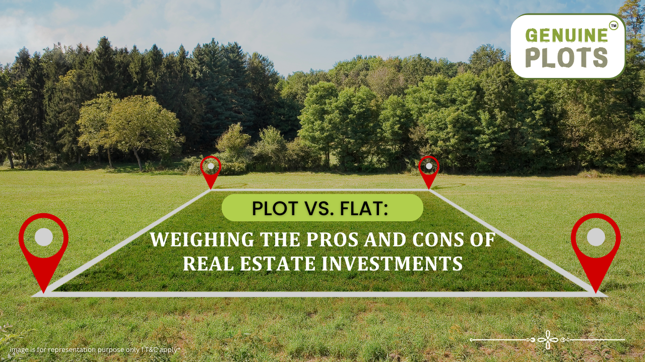
When it comes to real estate investment, whether it's land or an apartment, both options offer lucrative opportunities, but each comes with its own set of advantages and drawbacks. Here’s a comprehensive comparison to help you make an informed choice.
Appreciation Potential:
Plots: Land typically appreciates over time more reliably than apartments. The limited availability of land means its value tends to increase, reflecting the growing demand and scarcity. Unlike buildings, land does not deteriorate but instead appreciates as urban areas expand and develop.
Apartments: While apartments can also appreciate in value, this growth can be slower and is often influenced by factors like the property's age, maintenance, and the surrounding area's development. Apartments depreciate over time due to wear and tear, and their value is closely tied to the building’s condition and location amenities.
Customization and Development:
Plots: Purchasing a plot of land offers flexibility which allows you to create a home or commercial space that meets your specific needs without limitations.
Apartments: Apartments come pre-built, with limited scope for customization. While this can be advantageous if you prefer a ready-to-move-in option, it may not meet all personal preferences and needs.
- Symbol of Wealth and Lifestyle:
Plots: Owning land is often seen as a status symbol and can significantly enhance one’s lifestyle. A plot provides the potential to build a spacious home or a large commercial space, reflecting a higher standard of living.
Apartments: While apartments can offer a comfortable and convenient lifestyle, they generally come with size limitations and might not convey the same level of wealth as owning substantial land.
- Ownership and Possession:
Plots: Land can be acquired and possessed relatively quickly. The transaction process is usually more straightforward, allowing buyers to take control of the property sooner.
Apartments: The process of buying an apartment can be lengthy, involving legal procedures and potential delays in development. It can take months or even years before you are granted ownership, during which time the project’s completion might face setbacks.
- Quality and Maintenance Issues:
Plots: As land does not require immediate maintenance, it is free from concerns related to wear and tear. The value of the land remains unaffected by the passage of time.
Apartments:The quality of an apartment can suffer due to construction delays and cost-cutting measures by builders. Over time, apartments require regular maintenance and repairs, which can affect their long-term value and living conditions.
Conclusion:
Choosing between a plot and an apartment depends on your investment goals and personal preferences. If you value long-term appreciation, customization, and a symbol of wealth, investing in land might be the better option. Conversely, if you prefer immediate use and are willing to accept some level of depreciation, an apartment could be a suitable choice.
Key Budget Highlights: Boosting Affordable Housing and Modernizing Land Records

On July 23, Finance Minister Nirmala Sitharaman delivered a significant speech outlining the government's plans to boost affordable housing and modernize land records. Here's a simplified overview of the key points:
Introduction of Bhu-Aadhaar and Land Record Digitization
To streamline land administration, the government proposed the introduction of a unique identification number for land in rural areas, known as 'Bhu-Aadhaar.' This will be part of a broader effort to digitize all land records in urban areas. Such reforms are expected to simplify land transactions and increase transparency.
For rural areas, the focus will be on:
- Creating a land identification system (Bhu-Aadhaar) for better land management.
- Digitizing cadastral maps to accurately reflect land ownership.
- Surveying and updating land records as per current ownership.
- Establishing a land registry and linking it to farmers' records.
Urban areas will see:
- Digitization of land records with GIS (Geographic Information System) mapping.
- Implementation of an IT-based system for property records and tax administration, which will improve the financial position of urban local bodies.
Incentives for States and Reforms
The Finance Minister mentioned that states will be incentivized for implementing land-related reforms over the next three years. This includes both rural and urban areas, covering aspects like land administration, urban planning, and building regulations.
Urban Development Proposals
Under the PM Awas Yojana Urban 2.0, the government plans to address the housing needs of 1 crore urban poor and middle-class families. This initiative will involve an investment of ₹10 lakh crore, with a central assistance of ₹2.2 lakh crore over the next five years. Additionally, there will be provisions for interest subsidies to make housing loans more affordable.
Impact on the Real Estate Sector
These measures are expected to boost home-buyer sentiment across major cities by rationalizing stamp duty and supporting women homebuyers. The digitization of land records and the introduction of new technologies will enhance transparency and efficiency in the real estate sector.
Conclusion
Need expert guidance for your land purchase? Get stress-free documentation and Sseamless transactions with our specialist support at Genuine Plots.
Recent Posts
Tags
Bhunaksha,
genuine plots,
Land For Sale,
Maharashtra Bhunaksha,
plots for sale,
Gunthewari,
Gunthewari Land,
Gunthewari Rules,
Extract Documents,
Plots and Lands,
Saat Baara,
Extract Saat,
Baara Utara,
Jamabandi,
property tax payments,
Gram Panchayat,
lower prices,
non-agricultural land,
Lower Investment Cost,
Gram Panchayat lands,
Fresh Land Settlements,
Growing demand,
affordable homes,
genuine p,
legal Land,
bungalow plots,
Konkan,
Maharashtra,
Purandar,
Pune,
Karnataka,
Bangalore,
Farm Land,
Kolkata,
Rajarhat,
Indore,
Chhatrapati Sambhajinagar,
Aurangabad,
Mundhwa,
Agricultural Land,
Farmhouse Plot,
Rules And Penalties,
Residential Plots,
NA PLots,
Residential NA Plots,
Commercial NA Plots,
Animal Husbandry Land,
Tathawade,
Vahivat Land Maps,
Vahivat,
Indian Land Records,
Ownership Rights,
Red zone,
PCMC,
Dehu Road,
Land Registration Rules,
Land Investing,
Infrastructure Growth,
Land Ownership,
Land Encroachment,
Panshet Dam,
Varasgaon Dam,
Verified Land,
Plot For Sale,
Land Investment,
Verified Plots,
Land Acquisiton,
Hydrological Survey,
Invest In Land,
Verified Land Plots,
Panshet,
Khadakwasla,
Land Rules,
Dakhil Kharij,
Land Registry,
Property Onwership,
Clean Title Check List,
Property Verification,
Digital Registry,
Farm Plots,
Agro Property,
Land Value Growth,
Urban Expansion,
Senapati Bapat Road,
Registered Land,
Agricultral Plot,
Purandar Airport,
Safe Investment,
Secure Property,
Plot Buyers,
Approved Plots,
Land ROI,
NA Approved Plots,
NA Land,
Welspun One,
Logistic Park,
Talegaon,
PMC Bharat Mandapam,
Urban Development,
Lohgaon,
Close To Nature,
Gated Community Plots,
Buy Land VS Gold Investment,
NRI Investment,
Future Ready Living,
Trusted Plots,
Plot Investment,
Authentic Land,
Safe Land Buying,
Mumbai,
Premium Plots,
MMR Land Investment,
MMR Infrastructure,
Metro Connectivity,
Plots in Mahabaleshwar hill station investment,
Mahabaleshwar land prices and future growth,
Scenic residential plots in Mahabaleshwar,
Mumbai 3.0,
Mumbai 3.0 vs Mumbai 2.0,
Mumbai property investment,
Real estate investment in Mumbai,
Upcoming residential projects in Mumbai,
CIDCO plot auctions,
CIDCO auction Navi Mumbai,
Upcoming CIDCO plot auctions 2026,
CIDCO land auction dates,
Navi Mumbai plot auctions,
CIDCO plots in Navi Mumbai,
CIDCO plots in Kharghar,
CIDCO plots in Ulwe,
NMIA investment opportunities,
Mumbai 3.0 plotted development,
Mumbai 3.0 real estate,
Plots in Mumbai 3.0,
Land investment in Maharashtra,
Residential plots near Mumbai,
Land appreciation in Mumbai 3.0,
Residential land for sale in Mumbai 3.0,
Altamura NA Plots,
Altamura Nadar City,
NA Plots in Nadar City,
Nadar City Plots,
Plots in Nadar City,
YEIDA plots,
YEIDA plots near Noida Airport,
Noida Airport plots,
Jewar Airport investment,
Yamuna Expressway plots,
YEIDA plot scheme 2026,
Noida Airport real estate,
Zepto,
Zepto effect,
D2C brands India,
Urban consumer trends,
Marketplace evolution,
Urban infrastructure growth,
YEIDA Residential Plot Scheme,
Yamuna Expressway Plot Scheme,
YEIDA Residential Plots,
Yamuna Expressway Authority,
Noida Investment,
Residential Plots in Lucknow,
LDA Plots in Lucknow,
Lucknow Real Estate,
LDA Approved Plots,
Plots for Sale in Lucknow,
Lucknow Property Investment,
Land Investment in Lucknow,
Residential Land in Lucknow,
Buy Plot in Lucknow,
Lucknow Development Authority,
Maharashtra Fragmentation Law 2025,
Fragmentation Act Maharashtra,
Maharashtra land law update 2025,
Maharashtra land reforms 2025,
Land subdivision rules Maharashtra,
Maharashtra agriculture land purchase rules,
Agricultural land purchase restrictions Maharashtra,
Can non-farmers buy agricultural land in Maharashtra,
NA conversion process Maharashtra,
Collector permission for land purchase,
farmland prices in Nagpur,
agricultural land price in Nagpur per acre,
farmland cost in Nagpur Maharashtra,
Nagpur agricultural land investment,
per acre agricultural land rate in Nagpur,
Tukdebandi Law Maharashtra,
Maharashtra Fragmentation Act update,
Land subdivision law Maharashtra,
Agricultural land division Maharashtra,
Maharashtra land reform ordinance,
Plot registration Maharashtra,
Farmland prices Nagpur,
Nagpur agricultural land rates,
Farmland per acre Maharashtra,
Agricultural land price Nagpur,
Farm land cost Nagpur,
Nagpur real estate trends,
Land investment Nagpur,
Avani Farms,
Avani Farms Pune,
Farmland near Pune,
Farm plots for sale,
Agricultural land investment,
Gated farmland near Pune,
NRI agricultural land rules India,
Can NRI buy agricultural land in India,
FEMA rules for NRI property purchase,
RBI guidelines for NRI land investment,
NRI farmland investment India,
Agricultural land purchase by NRI,
Maharashtra Fragmentation Act,
Minimum plot size in Maharashtra,
Guntha rules Maharashtra,
Agricultural land division rules,
Minimum land area for sale in Maharashtra,
Legal plot size in guntha,
Guntha conversion rules,
NRI land purchase in India,
Can NRIs buy agricultural land in India,
NRI property investment India,
NRI buying residential land,
NRI real estate guidelines India,
Investment tips for NRIs in India,
Mutation Entry Process,
Land Mutation in India,
Property Mutation Process,
Land Ownership Transfer,
1 guntha na plot prices in pune 2026,
1 guntha plot price in pune,
na plots in pune,
residential na plots pune,
guntha plot rate in pune,
na plot investment in pune,
plots near purandar airport,
1 Acre Land Price in Pune,
Pune Land Rates 2025,
Pune Land Price 2026,
Pune Acre Land Cost,
Land Value Pune,
Agricultural Land Price Pune,
gated community plots in Hinjewadi,
Hinjewadi plots for sale,
residential plots in Hinjewadi Pune,
premium plots in Hinjewadi,
plots near Rajiv Gandhi Infotech Park,
land for sale in Hinjewadi Pune,
Pune property investment,
plots for sale in Pune below 5 lakhs,
Pune rural land investment,
gated plotting projects Pune,
MIDC growth corridor plots,
Residential plots for sale in Hinjewadi,
Plots in Hinjewadi Pune,
Land for sale in Hinjewadi,
Residential NA plots Hinjewadi,
Hinjewadi real estate trends 2026,
Nashik land investment,
Trimbakeshwar land for sale,
Simhastha Kumbh 2026,
Simhastha Kumbh 2027 real estate impact,
Trimbakeshwar property investment,
Land appreciation in Nashik,
plots for sale in pune,
types of plots in pune,
residential plots in pune,
agricultural land in pune,
villa plots in pune,
NRI agricultural land purchase India,
NRI property investment in India,
Agricultural land rules for NRIs,
NRI real estate investment India,
NA plot meaning,
what is NA land,
NA land in Maharashtra,
land investment guide,
NRI agricultural land in Telangana,
Telangana land laws for NRI,
Telangana real estate laws,
NRI investment guide Telangana,
Legal compliance for NRI property,
NRI farmhouse purchase India,
RBI guidelines for NRI property,
NRI land buying rules,
Godham Eco Village,
Godham Eco Village for NRIs,
NRI land investment in India,
Investment plots for NRIs,
Secure land investment India,
NRI property buying guide,
plots in Pune,
NRI buying property in India,
NRI guide to buying land in Pune,
NRI land investment in Pune,
NRI property documents checklist,
Maharashtra land reform 2025,
Maharashtra land laws update,
Agricultural land rules in Maharashtra,
Buying agricultural land in Maharashtra,
Non-agricultural land conversion Maharashtra,
Maharashtra agricultural land rules 2024,
agricultural land purchase in Maharashtra,
non agriculturist land purchase rules,
who can buy agricultural land in Maharashtra,
Maharashtra land laws for non farmers,
Guntha based land rules,
Minimum guntha rule Maharashtra,
Maharashtra land laws,
Maharashtra agricultural land laws,
farmland investment Maharashtra,
buying farmland legally in Maharashtra,
NA conversion rules Maharashtra,
agricultural land eligibility criteria,
Property Mutation in India,
Land Record Update,
Revenue Records,
Property Ownership Transfer,
Mutation of Property,
Farmhouse Plots Near Pune,
NRI Investment in Pune,
Pune Real Estate,
Plots for Sale Near Pune,
Luxury Farmhouse Plots,
Pune plot scams,
Plot buying checklist,
Legal verification for plots,
NA plot verification,
Plot buying tips Pune,
Godrej Properties,
Evora Estate Panipat,
Luxury plots in Panipat,
Premium land investment,
Residential plots in Panipat,
Lodha Developers,
Lodha Developers Q3 acquisition,
Lodha land parcels Q3,
Indian real estate news,
New residential projects India,
Real estate investment news,
Premium housing projects,
Srijan Group,
Kolkata Tech Park,
Commercial Real Estate,
Real Estate Investment,
Real Estate Deal News,
NRI investment in India,
NRI land investment,
Plots for sale in India,
NRI property investment,
Can NRI buy residential plot in India,
NRI land purchase rules,
Residential plots for NRIs,
NRI real estate investment,
NRIs buying property in India,
Can NRIs buy plots in India 2026,
RBI rules for NRI property purchase,
NRI land investment rules,
MMR 3.0,
MMR real estate 2026,
Mumbai real estate market,
Navi Mumbai investment,
Thane property market,
Mumbai property trends 2026,
Land investment in MMR,
Mumbai smart city project,
Korea Mumbai partnership,
MMRDA infrastructure projects,
Korean investment in India,
MMR GDP growth,
MMR economic roadmap 2030,
Mumbai real estate,
Public private partnership projects Mumbai,
Investment opportunities in MMR,
Mumbai Metropolitan Region,
Mumbai urban development,
MMR 2047 vision,
Mumbai infrastructure projects,
Navi Mumbai development,
Goa property investment,
Invest in Goa 2026,
Goa real estate market 2026,
Best places to invest in Goa,
North Goa property,
Property appreciation in Goa,
Goa plots for sale,
Commercial property in Goa,
Buy property in Goa,
YEIDA plots 2026,
Residential plots in YEIDA,
YEIDA new scheme update,
Plots near Noida International Airport,
Yamuna Expressway Authority plots,
YEIDA housing scheme details,
Lucknow land investment,
Property in Lucknow,
Buy plots in Lucknow,
Nashik plots for sale,
Kumbh Mela 2026 Nashik,
Land investment in Nashik,
Nashik property market 2026,
Plots near Kumbh Mela Nashik,
Residential plots in Nashik,
Upcoming projects in Nashik,
Property appreciation in Nashik,
Maharashtra land investment,
Nashik Kumbh Mela 2026,
Kumbh Mela investment opportunities,
Infrastructure development in Nashik,
Plots near Nashik Kumbh Mela,
High ROI land investment,
MIHAN,
MIHAN Nagpur,
Nagpur Real Estate,
Agricultural Land Nagpur,
Nagpur Property,
Plots Near In MIHAN,
Pune residential plots,
best areas to buy plots in Pune,
Pune land investment,
investment plots in Pune,
buy land in Pune,
real estate investment in Pune,
Godrej Plots Doddaballapur,
Doddaballapur plots for sale,
Plots in North Bangalore,
Godrej Properties plots,
Residential plots in Doddaballapur,
Investment plots near Bangalore,
Gated community plots Bangalore,
Premium plots in Doddaballapur,
plots in Mahabaleshwar,
Mahabaleshwar villa plots,
farmhouse plots in Mahabaleshwar,
land for sale in Mahabaleshwar,
bungalow plots in Mahabaleshwar,
hill station property investment,
agricultural land in Mahabaleshwar,
premium land in Mahabaleshwar,
Plots in Pune under 3 lakhs for sale,
Budget residential plots near Pune,
Low cost plots near Pune highway connectivity,
plots in Pune under 3 lakhs,
farmland plots near Pune city,
Investment plots near Pune under budget,
Residential land near Pune,
Godrej plots in Pune,
Premium plotted development by Godrej in Pune,
Residential land for sale by Godrej,
Premium plot by Godrej,
Plots for sale in Hadapsar Pune,
Residential plots in Hadapsar,
Investment plots in Hadapsar,
Gated community plots in Hadapsar,
Ready to build plots in Hadapsar,
1 Guntha plot in Pune,
1 Guntha plot in Pune for sale,
1 Guntha plots near Pune city,
Residential 1 Guntha land in Pune,
Clear title 1 Guntha plot in Pune,
1 guntha plot price in village,
village plot rate per guntha,
affordable 1 guntha land in rural area,
residential plot in village Pune,
farmland plot price per guntha,
Residential 1 Guntha plot near Pune city,
Investment plots in Pune 1 Guntha,
Clear title 1 Guntha land in Pune,
Agricultural 1 Guntha plot near Pune,
1 Guntha plot in Pune Katraj for sale,
Residential plot in Katraj Pune 1 Guntha,
Katraj Pune land for home construction,
1 Guntha NA plot in Katraj Pune,
Pune Katraj plot near highway connectivity,
Gated plot project in Katraj Pune,
NA plots in Pune under 10 lakhs,
Affordable NA plots near Pune city,
NA residential plots in Pune,
NA approved plots in Pune under 10 lakhs,
Investment plots in Pune under 10 lakhs,
Residential NA plots near Pune highway,
Best plots in Pune below 10 lakhs,
Premium villa plots in Pune,
Residential villa plots in Pune near city outskirts,
Luxury villa plots in Pune,
Gated villa plot project in Pune,
Villa plot site visit in Pune,
NA plots in Pimpri Chinchwad for sale,
Residential NA plots in PCMC area,
NA approved plots in Pimpri Chinchwad,
NA land with clear title in PCMC,
NA plots near Pune Mumbai Highway PCMC,
Godrej Villa Plots Doddaballapur,
Godrej plotted development Bangalore,
villa plots in North Bangalore,
premium villa plots Bangalore,
Godrej Properties plots Bangalore,
Brigade Plots Malur,
Brigade Malur plots,
plots in Malur East Bangalore,
investment plots in East Bangalore,
residential plots in Malur Bangalore,
Brigade Group plots Bangalore,
land investment in East Bangalore,
gated community plots in Malur,
prestige plots devanahalli,
prestige plots in devanahalli bangalore,
plots for sale in devanahalli,
prestige plots investment,
premium plots in devanahalli,
residential plots near kempegowda airport,
What is NA plot in real estate,
NA land meaning in property,
NA approved plotsDifference between NA and agricultural land,
Buying NA plots in Maharashtra,
NA plot vs agricultural land,
Plot prices in Mysore,
Mysore infrastructure projects,
Mysore property investment,
Land investment in Mysore,
Plot investment opportunities,
land buying guide in goa,
buy land in goa,
plots for sale in goa,
legal process to buy land in goa,
property in goa,
residential plots in goa,
Nashik Simhastha Kumbh Mela 2026,
Sadhugram expansion Nashik,
Maharashtra Kumbh Mela planning,
Nashik Kumbh Mela preparations,
tourism development in Nashik,
plots in Nagpur,
Nagpur plot investment,
land for sale in Nagpur,
residential plots in Nagpur,
golden rules before buying plots in Nagpur,
Nagpur land investment,
plot investment in Nagpur,
land investment in Nagpur,
plots for sale in Nagpur,
best areas to buy plots in Nagpur,
buying plots in Nagpur,
plot purchase checklist,
legal checklist for buying land,
documents required for plot purchase,
NA plots in Nagpur,
Tattvana,
Tattvana in Kamshet,
Moregaon Farmland Estates,
farmland investment Pune,
agricultural land investment,,
farmland for sale near Pune,
farm plots in Pune,
gated farmland projects,
agricultural plots Maharashtra,
open plot vs NA plot,
difference between open plot and NA plot,
what is NA plot in India,
open plot meaning in real estate,
NA land vs agricultural land,
residential NA plots benefits,
land investment in India,
buying NA plot vs open land,
capital gains on agricultural land,
rural vs urban agricultural land tax,
agricultural land tax rules India,
capital gains tax India property,
is agricultural land taxable,
rural agricultural land exemption,
urban agricultural land tax India,
Runwal Enterprises Alibaug township,
Alibaug real estate,
coastal real estate India,
township projects in Alibaug,
luxury properties in Alibaug,
Mumbai weekend homes investment,
Alibaug property investment,
isprava south goa,
ultra luxury villas in goa,
south goa real estate,
luxury homes in goa,
isprava projects goa,
premium villas in south goa,
land investment advisory services,
secure land investment,
real estate advisory services,
verified land deals,
investment plots near Pune,
land buying guide India,,
#KanpurRealEstate,
#KDAPlots,
#KanpurProperty,
#RealEstateKanpur,
#PropertyTrends,
Gokul Plots investment,,
real estate investment Gokul,,
plots with high appreciation potential,
smart land investment strategies,
plots for sale in North Bangalore,
land investment Bangalore,,
emerging areas in North Bangalore,
residential plots Bangalore,,
Bangalore real estate investment,,
North Bangalore property trends,,
plots near airport Bangalore,,
HUDA plots in Gurgaon,
HUDA plots in Faridabad,
residential plots Haryana,
HUDA approved plots,
plots for sale in Gurgaon,
plots in Faridabad investment,
Prestige Marigold plots,,
Bangalore plotted developments,
land investment Bangalore,
best plots in North Bangalore,
#PlotsForSaleInNellore,
#NelloreRealEstate,
#NellorePlots,
#RealEstate2026,
#PropertyInvestment,
#NelloreProperty,
#AndhraPradeshRealEstate,
GMADA E Auction 2026,
GMADA plots Mohali,
plots in Mohali for sale,
GMADA Mohali auction process,
buy plots in Mohali,
Punjab property investment,
GMADA scheme 2026,
Mohali real estate,
HSVP plots 2026,
HSVP plot investment,
HSVP plots Haryana,
land investment benefits,
residential plots investment,
government approved plots,
buy plot in New Chandigarh,
flats in New Chandigarh,
New Chandigarh real estate,
property investment in New Chandigarh,
residential plots in New Chandigarh,
apartments in New Chandigarh,
#WaveCityGhaziabad,
#GhaziabadPlots,
#PlotsInGhaziabad,
#NCRRealEstate,
#RealEstateInvestment,
#ResidentialPlots,
APIIC vacant plots,
APIIC plots for sale,
industrial plots in Andhra Pradesh,
commercial land for MSMEs,
startup investment plots,
APIIC industrial land,
HUDA plots,
HUDA plots investment,
property appreciation,
plot investment benefits,
high return property investment,
land appreciation,
#GDAPlotsInGhaziabad,
#PlotsForSaleInGhaziabad,
#ResidentialPlotsGhaziabad,
#InvestmentPlots,
#RealEstateGhaziabad,
#GDAApprovedPlots,
#BaliProperty,
#PropertyInBali,
#IndiansInBali,
#BaliRealEstate,
#InternationalPropertyInvestment,
buy plots in Sarjapur Road Bangalore,
plots in Sarjapur Road,
residential plots in Sarjapur Road,
land for sale in Sarjapur Road Bangalore,
investment plots in Bangalore,
plots near IT corridor Bangalore,
how Indians can buy property in Bali,
buy property in Bali for Indians,
Bali property investment,
property in Bali for Indian buyers,
Bali real estate guide,
foreign property investment Bali,
legal checks before buying property in Bali,
Indians invest in Bali property,
due diligence for Bali property,
Bali real estate for Indians,
Bali property legal verification,
verified farmland plots,
100% verified farmland plots,
farmland investment India,
legal farmland plots,
farmland plots for sale,
Konkan land investment,,
high-growth corridors Maharashtra,
land investment 2026,
plots for sale in Maharashtra,


