Prev Post
How 100% Verified Farmland Plots Are Changing the Way India InvestsTop High-Growth Corridors in Maharashtra & Konkan for Land Investment in 2026

Investment in land in Maharashtra is shifting to a new phase of momentum with the transformation of infrastructure, industrialisation, and tourism-driven growth. As we look forward to 2026, we are seeing investors increasingly looking at key corridors driven by enhanced connectivity upgrades and growth initiatives taken by the government. The Konkan region, which is next to Maharashtra, is also showing signs of becoming another key location with tourism and large-scale growth drivers.
Raigad–Pen Growth Centre: A Rising Power Zone
Raigad Pen has witnessed growing interest in land investment due to its close proximity to the upcoming Navi Mumbai International Airport. New initiatives taken by FDI are making this region one of the most promising sectors for investments in residential layouts as well as for acquiring industrial plots of land.
Nashik’s Trimbak Road & Pathardi Phatha: A 2027-Ready Growth Corridor
The city of Nashik is witnessing unprecedented growth and development in the run-up to the 2027 Kumbh Mela. The city's major roads, such as the Trimbak Road and the Pathardi Phatha, are witnessing road widening and smart city developments, as well as the establishment of many new commercial establishments. The area of Pathardi Phatha is witnessing the development of a hybrid industrial and residential area.
The Mumbai–Nagpur Expressway: Unlocking Tier-2 Investment Potential
The Mumbai–Nagpur Expressway has become a catalyst for opening up central Maharashtra. Enhanced logistics efficiency is turning several Tier-2 and Tier-3 towns into industrial magnets. The expressway is reshaping movement between metros and facilitating rapid urbanisation in intermediate regions, making land along the corridor highly sought after.
Pune Peripheral Growth Belt: Kondhwa & Emerging East Pune Zones
The city of Pune has remained an unstoppable real estate hotspot in the country. The peripheral areas, such as Kondhwa, have now been recommended as promising zones due to the infrastructure development and rising residential demands in the region. Established locations such as Kharadi and Balewadi have remained successful due to the economic growth generated by the IT industry; however, the outskirts have now begun to emerge as promising locations.
Konkan’s Coastal Belt: A New Hub for Tourism-Driven Appreciation
The Konkan belt is fast becoming the most promising zone in the country due to its rising popularity as a hub for tourism-driven investments. The development of the coastal highways, as well as the rise of eco-tourism and hospitality projects, has begun to generate increased demand for the purchase of picturesque tracts of land in the region.
Key Drivers Powering 2026 Land Investment
- Infrastructural Development
Development of new expressways, airport facilities, and coastal routes, particularly the Mumbai-Nagpur Expressway, is opening new towns to investment opportunities while shortening travel times in the state of Maharashtra.
- Industrialisation
Development of new industrial hubs along routes such as Pune, Raigad, and Nashik is creating new opportunities for new industries, logistics, and warehousing facilities, thereby creating demand for both industrial and residential land.
- Expansion of Tourism Infrastructure
Increased tourist activity in the Konkan belt, coupled with the upcoming Kumbh Mela in Nashik in 2027, provides a promising opportunity for land investment in the state of Maharashtra.
Conclusion
Land investment opportunities in Maharashtra, as well as the Konkan belt, are likely to be driven by infrastructural alignment, industrialisation, and tourism activities in the state of Maharashtra until the year 2026. Raigad-Pen, Nashik, Pune, as well as the Mumbai-Nagpur Expressway, are some of the best opportunities for land appreciation in Western India, and investors are likely to reap huge benefits as the regions develop into hubs of economic activity in the coming years.
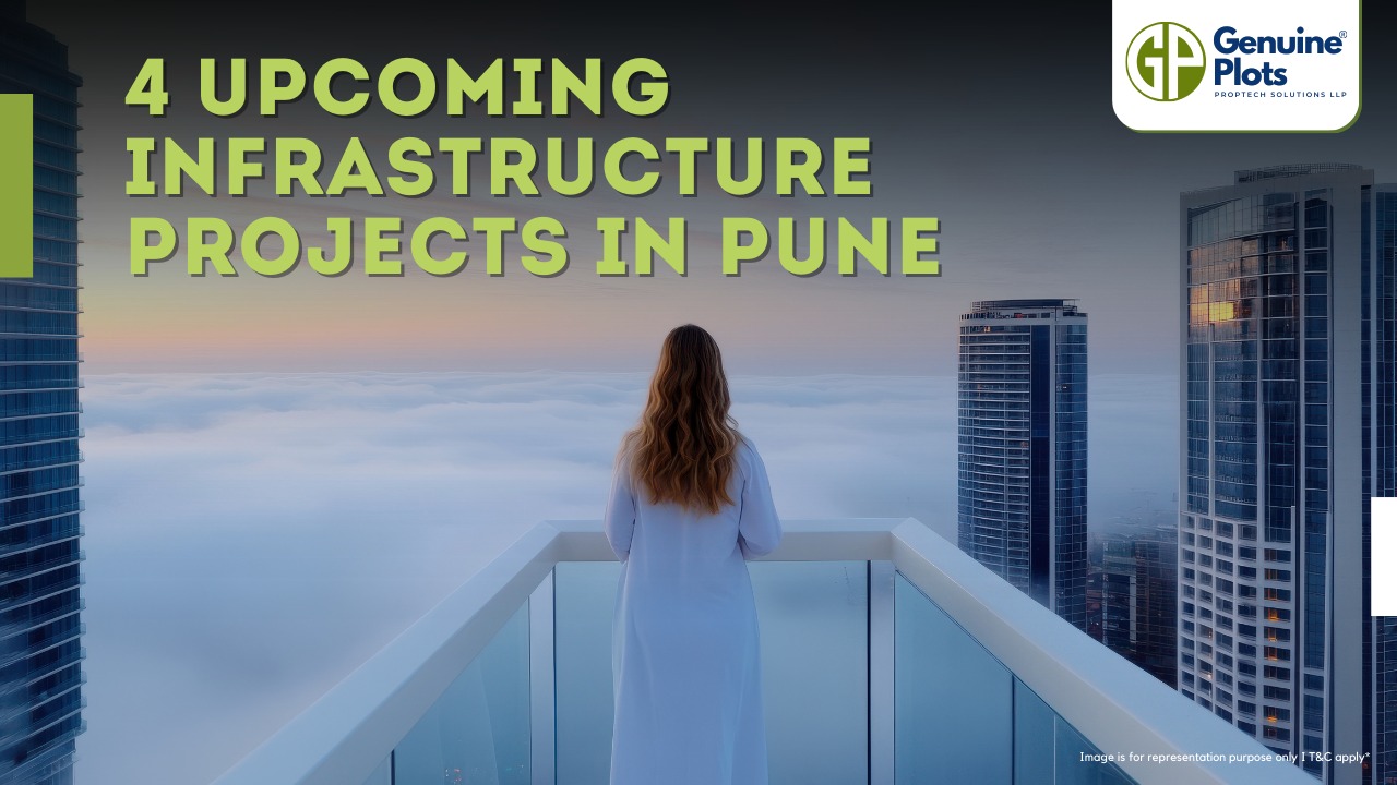
Pune's infrastructure is set for a significant boost with upcoming projects like the Airport Expansion, Ring Road, Metro Rail, and Smart City Mission, promising improved connectivity and enhanced living standards for residents.Let’s check out the current updates of these projects.
Pune Airport Expansion Project
Photo Credit- Zee News
The expansion of Pune International Airport is ongoing, and a new terminal building is nearly completed. Initially, the new airport was planned within Pune City but faced objections from residents, leading to a shift in location to Purandar tehsil in 2015. However, due to opposition from some farmers owning the land, a revised proposal was presented to the Centre, and the final decision on the new airport is yet to be confirmed. Meanwhile, the current airport's expansion is being pursued.
Benefits Benefits of Pune Airport Expansion:
- Increased capacity to handle more passengers and cargo, reducing congestion and meeting growing demand for air travel in the region.
- Improved infrastructure with a new terminal building, taxiway, and apron parking bays, offering a better travel experience.
- Boost tourism and the local economy, attracting more tourists and enabling handling of increased international flights, making Pune a more accessible global destination.
Current Status
The expansion work is 55% complete, and the entire new building and the existing terminal are set to finish by the end of 2023. The combined space will cover 7,50,000 square feet, accommodating 16 MPPA passenger capacity, featuring 72 check-in counters, 10 passenger boarding bridges, and an in-line luggage handling system.
Pune Ring Road Project
Photo Credit- Business Standard
The ambitious Pune Ring Road Project is set to span 128 kilometers, seamlessly connecting the city to 29 neighboring villages and main highways. This eight-lane motorway, with a maximum speed limit of 120 km/h, promises efficient and swift transportation for residents and travelers alike.
The project boasts six flyovers, three tunnels spanning 3.75 kilometers, 18 major bridges, and 5 minor bridges, adding to its architectural marvel. Divided into four phases, the road's course thoughtfully weaves through numerous villages, facilitating enhanced connectivity, fostering economic growth, and bringing the vision of a well-connected and modernized Pune to reality.
Current Status
This ambitious project is strategically divided into two sections, east, and west, with the construction of the western portion already underway. The second phase is scheduled to kick off by the end of 2023. Anticipated to reach its full fruition by 2026, the completion of the entire Pune Ring Road is eagerly awaited.
Pune Metro Rail Project
Photo Credit- PMC Gov.
The Maharashtra Metro Rail Corporation Limited (MMRCL) is all set to transform Pune's transportation landscape with its ambitious project featuring three corridors. The first corridor, Line 1, will connect PCMC to Swargate, marked by its distinctive Purple Line. Meanwhile, Line 2, the Aqua Line, will link Vanaz to Ramwadi, catering to the city's growing urban needs. Lastly, Line 3 will stretch from Hinjawadi to Civil Court, promising improved connectivity and efficiency across these vital destinations. With MMRCL at the helm of this groundbreaking initiative, Pune is poised to witness a revolutionary shift in public transportation, offering convenience and accessibility to its residents like never before.
Pune Smart City Mission
Photo Credit- Square Yards
Pune leads India's smart city movement with five-phase planning: visualize, identify issues, propose ideas, implement solutions, and raise awareness. These initiatives aim to transform Pune into India's finest smart city. The project is expected to be completed by 2023.
The goal of Pune Smart City
Ensuring uninterrupted electricity supply, revolutionizing sanitation through efficient waste management, and redefining urban mobility with seamless public transport. But that's not all! Pune Smart City also champions affordable housing for the underprivileged, making dreams come true for all its residents!
Current Status- The project was launched in 2015 and is expected to be completed by 2023.

Zoning is like a map the government makes to organize how land can be used. It's really important for planning our towns and cities. Here's a simple explanation for everyone:
What is Zoning?
Zoning is when the government rules what you can do on different pieces of land. They do this to make sure land is used properly and safely. Without zoning, things could get messy, and people might build things anywhere they want.
How Zoning Works:
Zoning divides land into different categories:
- Residential: This is for houses and places where people live.
- Commercial: It's for businesses like shops and offices.
- Agricultural: This is for farming.
- Industrial: It's for factories and heavy machines.
- Public: These areas are for things like schools and parks.
- Mixed Use: This is when you have a mix of homes and businesses in one area.
Colors and What They Mean:
Zoning maps use colors to show what each area is for:
- Light Yellow: It's for homes.
- Dark Yellow: This is mixed - you can have some stores and services here.
- Red: This is for schools, temples, and public stuff.
- Green: Green areas are for nature like parks and forests.
- Light Blue: It's for offices and business areas.
- Dark Blue: This is where you find malls and places to eat.
- Light Purple: It's for factories and industry.
- Dark Purple: This is for high-tech stuff.
- Gray: It's for really heavy industry.
Patterns on Maps:
Sometimes, you'll see patterns on the map:
- Cross Hatches: Means it's for houses.
- Slanted Lines: This is for businesses.
- Points, Diamonds, Stars: These show land for different things like industry or transportation.
- Vertical Lines: It's for public things like schools.
- Stipple Patterns: These are for parks and fun places.
- Curved Lines: For farming areas.
Final Thoughts:
In India, zoning is a bit different. Sometimes, you can have houses and businesses together. The main idea is to keep things organized and safe. Zoning helps our cities and towns work better, so everyone can live and work happily.

In Maharashtra, the government has made important rules called the Unified Comprehensive Development Control Regulations (UCDCR), also known as Maharashtra Building Bye-Laws. These rules make sure that building and construction are done safely and correctly. They are for homes and shops and make everything fair and clear.
Who the Rules Apply To:
These rules are for everyone who builds things in Maharashtra, India. This includes builders, architects, engineers, and anyone who plans or makes buildings. The rules are like a guide everyone must follow when building.
Getting Permission to Build:
Before building, people have to tell the government about their plans. They need to give some papers and fees to the people in charge. Within sixty days, the chief officer will check the plans and approve them. If they don't respond in time, it means the plans are approved. People also need a special paper, called a commencement certificate, to start building.
Making Changes During Construction:
If someone wants to change the plans while building, they need permission from the chief officer. They have to show the new plans and follow the same process as before. If they do changes without permission, it's not allowed and they might get in trouble.
Saying the Building is Done:
When the building is finished, the owner has to tell the chief officer. They need a paper from professionals like architects and engineers to show that everything is done correctly. This paper is called a building completion certificate. It proves that the building follows the rules.
Safety and Penalties:
The rules care a lot about safety. If a building is unsafe, it must be fixed or taken down. Anyone who doesn't follow the rules might have to pay fines or stop their work. Even the people who helped build might lose their licenses.
Uniform Rules for Fair Development:
The Unified Comprehensive Development Control Regulations want buildings to look similar across Maharashtra. They also give rewards for good things. For example, they allow more space for building in some cases. They also give bonuses for building near train stations and fixing old buildings.
These rules are important to make sure buildings are safe and fair for everyone in Maharashtra. They help keep our homes and shops good places to live and work.

Are you dreaming of owning your own agricultural land? Finding the perfect piece of land for your farming endeavors can be a rewarding and challenging task. Explore the essential points you need to consider when searching for agricultural land for sale.
Learn About the Land's Previous Use
One of the first crucial steps in finding the perfect agricultural land is to learn about its previous use. The land's history can significantly impact its current state and potential for agricultural activities.
If the land has been left unused for decades, it may lack essential nutrients for healthy crop growth. Moreover, if the property was previously used for industrial purposes, it could contain toxic substances in the soil and water, posing potential hazards for your farming endeavours.
To evaluate the land's previous use, consult local authorities and historical records. This information will provide valuable insights into the land's past and help you determine its suitability for your farming needs.
Test the Soil's Acidity and Nutrients
Understanding the soil quality is crucial to finding the perfect agricultural land. Testing the soil's acidity and nutrient levels is essential to ensure that it can support the crops you intend to grow.
Different crops have specific pH and nutrient requirements, and a soil test will indicate whether the land can meet these needs.You can conduct a soil test through local agricultural extensions or hire a professional soil testing service. The results will help you determine if the soil needs any amendments to improve its fertility and productivity.
Observe Farmland Soil Drainage
The drainage of farmland soil plays a significant role in crop health and productivity. Most crops prefer soil that quickly drains after rain, preventing waterlogged conditions that can lead to root rot and other plant diseases. Well-drained soil ensures optimal oxygen levels for plant roots, promoting healthy growth and nutrient uptake.
During your land inspection, observe how water drains from the property after rainfall. Puddles and waterlogged areas may indicate poor drainage, which could negatively affect your farming efforts.
Analyze the Topology of the Agricultural Land
Understanding the topology of agricultural land is crucial for effective farm planning. Topography refers to the land's physical features, including elevation, slope, and contour. Most farmers avoid steep hillside terrain because heavy rainfall can wash away essential nutrients, leaving the soil less fertile.
Agricultural Land Should Meet Your Needs
To find the perfect agricultural land, it should align with your specific farming requirements. Consider the following factors:
- Infrastructure: Ensure the land has adequate infrastructure to support your farming activities. Access to roads, electricity, and irrigation facilities is essential for smooth farming operations.
- Size and Layout. Consider the available space for cultivation, storage, and any future expansion plans.
- Soil Type: Different crops thrive in various soil types. Determine if the land's soil type suits the crops you wish to cultivate.
- Climate and Weather: Assess the local climate and weather patterns to understand how they might affect your crops. Choose a location with a climate suitable for your desired crops.
- Water Availability: Access to a reliable water source is vital for successful agriculture. Verify the availability of water for irrigation purposes.
- Proximity to Markets: Consider the proximity of the land to potential markets for your produce. Shorter distances can reduce transportation costs and ensure fresher products for consumers.
FAQs
Q: How can the land's previous use impact my farming plans?
A: The land's previous use can significantly impact its soil quality and potential for agricultural activities.
Q: Why is soil testing essential when looking for agricultural land?
A: Soil testing helps determine the soil's pH and nutrient levels, critical for successful crop cultivation. Different crops require specific pH and nutrient conditions for optimal growth. Soil testing ensures that the land's soil can support the crops you intend to grow.
Q: How does soil drainage affect crop health?
A: Proper soil drainage is crucial for crop health as it prevents waterlogged conditions that can lead to root rot and diseases. Well-drained soil allows optimal oxygen levels in the root zone, promoting healthy plant growth and nutrient absorption.
Q: What should I consider when analyzing the topology of the land?
A: When analyzing the topology of the land, look for gentle slopes and level areas. Steep hillside terrain can lead to nutrient erosion, making the soil less fertile. Flat or slightly sloping land is ideal for most farming activities and efficient irrigation practices.
Q: Why is it important for agricultural land to meet my specific needs?
A: Agricultural land should align with your specific farming requirements to ensure the success of your farming endeavors. Consider factors like infrastructure, soil type, climate, water availability, and market proximity when selecting the perfect agricultural land.
Q: How can I ensure the land has adequate infrastructure?
A: To ensure the land has adequate infrastructure, conduct a thorough inspection and take Genuine Plot's expert guidance to verify access to roads, electricity, and irrigation facilities.
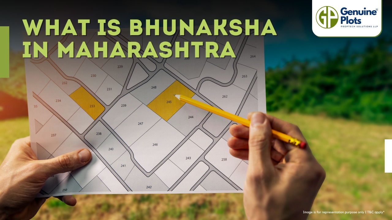
Bhunaksha is a special computer software created by NIC (National Informatics Centre) that helps manage digitized cadastral maps. But what does all that mean?
- Cadastral maps: These are maps that show the boundaries and ownership of land parcels. They help keep track of who owns which piece of land.
- NIC: The National Informatics Centre is an organization that develops and implements technology solutions for the Indian government.
- Open source applications and libraries: Bhunaksha is made using software, a free version for use, modification, and share.
- Facilitate management: Bhunaksha makes handling and organizing digitized cadastral maps easier. Instead of dealing with paper maps, the software lets you work with maps on a computer.
- Integration with existing Land Records application: If a state already has a computer system for keeping track of land records (information about land ownership, etc.), Bhunaksha can be connected to it to work together.
How to Login Bhunaksha?
- Open your web browser. Enter the URL. Your system administrator will provide it.
- You will see a login page once you access the Bhunaksha web application.
- On the login page, you need to select your location. This ensures that you are accessing the correct cadastral maps for your area.
- After selecting your location, enter your unique user ID in the designated field.
- Next, enter your password in the password field. Make sure to enter the correct password associated with your user ID.
- Double-check that you've entered both your user ID and password correctly.
- Finally, click the "Login" or "Sign In" button to proceed.
Benefits of Maharashtra Bhunaksha
- Verify details of the plot owners
- Know the plot size
- Provide the details of the landowners, including name, address, etc.
- Viewing plot record online saves your time
Contact Information of Bhunaksha, Maharashtra
The state coordinator for Bhunaksha Maharashtra can be reached at
Datar SP
TD, NIC, Office of SC & DLR, Pune
FAQ
Is Bhunaksha only for Maharashtra?
No, Bhunaksha is not limited to Maharashtra alone. It is a software solution developed by NIC and can be implemented in various states across India.
Can I access Bhunaksha from any device?
Yes, Bhunaksha is accessible from any device with internet connectivity, including computers, laptops, tablets, and smartphones.
Is Bhunaksha available for free?
Yes, Bhunaksha is an open-source application, which means it is available for use, modification, and sharing at no cost.
Can private individuals use Bhunaksha?
While Bhunaksha is primarily designed for government use and land administration purposes, some states may allow limited access to private individuals for specific tasks.
How accurate are the cadastral maps in Bhunaksha?
The accuracy of cadastral maps in Bhunaksha is generally high. However, it is essential to cross-verify with official records and conduct surveys for critical transactions or land development projects.
Are the maps updated regularly?
Bhunaksha maps are regularly updated to reflect land ownership and boundary changes. However, users should verify the latest information with relevant authorities.
Is There an Official Mobile App for Bhunaksha Maharashtra?
Currently, there is no official mobile application provided by the Maharashtra government for searching your Bhunaksha document. The only source for accessing Bhunaksha Maharashtra is the official web application provided by the National Informatics Centre (NIC).
Recent Posts
Tags
Bhunaksha,
genuine plots,
Land For Sale,
Maharashtra Bhunaksha,
plots for sale,
Gunthewari,
Gunthewari Land,
Gunthewari Rules,
Extract Documents,
Plots and Lands,
Saat Baara,
Extract Saat,
Baara Utara,
Jamabandi,
property tax payments,
Gram Panchayat,
lower prices,
non-agricultural land,
Lower Investment Cost,
Gram Panchayat lands,
Fresh Land Settlements,
Growing demand,
affordable homes,
genuine p,
legal Land,
bungalow plots,
Konkan,
Maharashtra,
Purandar,
Pune,
Karnataka,
Bangalore,
Farm Land,
Kolkata,
Rajarhat,
Indore,
Chhatrapati Sambhajinagar,
Aurangabad,
Mundhwa,
Agricultural Land,
Farmhouse Plot,
Rules And Penalties,
Residential Plots,
NA PLots,
Residential NA Plots,
Commercial NA Plots,
Animal Husbandry Land,
Tathawade,
Vahivat Land Maps,
Vahivat,
Indian Land Records,
Ownership Rights,
Red zone,
PCMC,
Dehu Road,
Land Registration Rules,
Land Investing,
Infrastructure Growth,
Land Ownership,
Land Encroachment,
Panshet Dam,
Varasgaon Dam,
Verified Land,
Plot For Sale,
Land Investment,
Verified Plots,
Land Acquisiton,
Hydrological Survey,
Invest In Land,
Verified Land Plots,
Panshet,
Khadakwasla,
Land Rules,
Dakhil Kharij,
Land Registry,
Property Onwership,
Clean Title Check List,
Property Verification,
Digital Registry,
Farm Plots,
Agro Property,
Land Value Growth,
Urban Expansion,
Senapati Bapat Road,
Registered Land,
Agricultral Plot,
Purandar Airport,
Safe Investment,
Secure Property,
Plot Buyers,
Approved Plots,
Land ROI,
NA Approved Plots,
NA Land,
Welspun One,
Logistic Park,
Talegaon,
PMC Bharat Mandapam,
Urban Development,
Lohgaon,
Close To Nature,
Gated Community Plots,
Buy Land VS Gold Investment,
NRI Investment,
Future Ready Living,
Trusted Plots,
Plot Investment,
Authentic Land,
Safe Land Buying,
Mumbai,
Premium Plots,
MMR Land Investment,
MMR Infrastructure,
Metro Connectivity,
Plots in Mahabaleshwar hill station investment,
Mahabaleshwar land prices and future growth,
Scenic residential plots in Mahabaleshwar,
Mumbai 3.0,
Mumbai 3.0 vs Mumbai 2.0,
Mumbai property investment,
Real estate investment in Mumbai,
Upcoming residential projects in Mumbai,
CIDCO plot auctions,
CIDCO auction Navi Mumbai,
Upcoming CIDCO plot auctions 2026,
CIDCO land auction dates,
Navi Mumbai plot auctions,
CIDCO plots in Navi Mumbai,
CIDCO plots in Kharghar,
CIDCO plots in Ulwe,
NMIA investment opportunities,
Mumbai 3.0 plotted development,
Mumbai 3.0 real estate,
Plots in Mumbai 3.0,
Land investment in Maharashtra,
Residential plots near Mumbai,
Land appreciation in Mumbai 3.0,
Residential land for sale in Mumbai 3.0,
Altamura NA Plots,
Altamura Nadar City,
NA Plots in Nadar City,
Nadar City Plots,
Plots in Nadar City,
YEIDA plots,
YEIDA plots near Noida Airport,
Noida Airport plots,
Jewar Airport investment,
Yamuna Expressway plots,
YEIDA plot scheme 2026,
Noida Airport real estate,
Zepto,
Zepto effect,
D2C brands India,
Urban consumer trends,
Marketplace evolution,
Urban infrastructure growth,
YEIDA Residential Plot Scheme,
Yamuna Expressway Plot Scheme,
YEIDA Residential Plots,
Yamuna Expressway Authority,
Noida Investment,
Residential Plots in Lucknow,
LDA Plots in Lucknow,
Lucknow Real Estate,
LDA Approved Plots,
Plots for Sale in Lucknow,
Lucknow Property Investment,
Land Investment in Lucknow,
Residential Land in Lucknow,
Buy Plot in Lucknow,
Lucknow Development Authority,
Maharashtra Fragmentation Law 2025,
Fragmentation Act Maharashtra,
Maharashtra land law update 2025,
Maharashtra land reforms 2025,
Land subdivision rules Maharashtra,
Maharashtra agriculture land purchase rules,
Agricultural land purchase restrictions Maharashtra,
Can non-farmers buy agricultural land in Maharashtra,
NA conversion process Maharashtra,
Collector permission for land purchase,
farmland prices in Nagpur,
agricultural land price in Nagpur per acre,
farmland cost in Nagpur Maharashtra,
Nagpur agricultural land investment,
per acre agricultural land rate in Nagpur,
Tukdebandi Law Maharashtra,
Maharashtra Fragmentation Act update,
Land subdivision law Maharashtra,
Agricultural land division Maharashtra,
Maharashtra land reform ordinance,
Plot registration Maharashtra,
Farmland prices Nagpur,
Nagpur agricultural land rates,
Farmland per acre Maharashtra,
Agricultural land price Nagpur,
Farm land cost Nagpur,
Nagpur real estate trends,
Land investment Nagpur,
Avani Farms,
Avani Farms Pune,
Farmland near Pune,
Farm plots for sale,
Agricultural land investment,
Gated farmland near Pune,
NRI agricultural land rules India,
Can NRI buy agricultural land in India,
FEMA rules for NRI property purchase,
RBI guidelines for NRI land investment,
NRI farmland investment India,
Agricultural land purchase by NRI,
Maharashtra Fragmentation Act,
Minimum plot size in Maharashtra,
Guntha rules Maharashtra,
Agricultural land division rules,
Minimum land area for sale in Maharashtra,
Legal plot size in guntha,
Guntha conversion rules,
NRI land purchase in India,
Can NRIs buy agricultural land in India,
NRI property investment India,
NRI buying residential land,
NRI real estate guidelines India,
Investment tips for NRIs in India,
Mutation Entry Process,
Land Mutation in India,
Property Mutation Process,
Land Ownership Transfer,
1 guntha na plot prices in pune 2026,
1 guntha plot price in pune,
na plots in pune,
residential na plots pune,
guntha plot rate in pune,
na plot investment in pune,
plots near purandar airport,
1 Acre Land Price in Pune,
Pune Land Rates 2025,
Pune Land Price 2026,
Pune Acre Land Cost,
Land Value Pune,
Agricultural Land Price Pune,
gated community plots in Hinjewadi,
Hinjewadi plots for sale,
residential plots in Hinjewadi Pune,
premium plots in Hinjewadi,
plots near Rajiv Gandhi Infotech Park,
land for sale in Hinjewadi Pune,
Pune property investment,
plots for sale in Pune below 5 lakhs,
Pune rural land investment,
gated plotting projects Pune,
MIDC growth corridor plots,
Residential plots for sale in Hinjewadi,
Plots in Hinjewadi Pune,
Land for sale in Hinjewadi,
Residential NA plots Hinjewadi,
Hinjewadi real estate trends 2026,
Nashik land investment,
Trimbakeshwar land for sale,
Simhastha Kumbh 2026,
Simhastha Kumbh 2027 real estate impact,
Trimbakeshwar property investment,
Land appreciation in Nashik,
plots for sale in pune,
types of plots in pune,
residential plots in pune,
agricultural land in pune,
villa plots in pune,
NRI agricultural land purchase India,
NRI property investment in India,
Agricultural land rules for NRIs,
NRI real estate investment India,
NA plot meaning,
what is NA land,
NA land in Maharashtra,
land investment guide,
NRI agricultural land in Telangana,
Telangana land laws for NRI,
Telangana real estate laws,
NRI investment guide Telangana,
Legal compliance for NRI property,
NRI farmhouse purchase India,
RBI guidelines for NRI property,
NRI land buying rules,
Godham Eco Village,
Godham Eco Village for NRIs,
NRI land investment in India,
Investment plots for NRIs,
Secure land investment India,
NRI property buying guide,
plots in Pune,
NRI buying property in India,
NRI guide to buying land in Pune,
NRI land investment in Pune,
NRI property documents checklist,
Maharashtra land reform 2025,
Maharashtra land laws update,
Agricultural land rules in Maharashtra,
Buying agricultural land in Maharashtra,
Non-agricultural land conversion Maharashtra,
Maharashtra agricultural land rules 2024,
agricultural land purchase in Maharashtra,
non agriculturist land purchase rules,
who can buy agricultural land in Maharashtra,
Maharashtra land laws for non farmers,
Guntha based land rules,
Minimum guntha rule Maharashtra,
Maharashtra land laws,
Maharashtra agricultural land laws,
farmland investment Maharashtra,
buying farmland legally in Maharashtra,
NA conversion rules Maharashtra,
agricultural land eligibility criteria,
Property Mutation in India,
Land Record Update,
Revenue Records,
Property Ownership Transfer,
Mutation of Property,
Farmhouse Plots Near Pune,
NRI Investment in Pune,
Pune Real Estate,
Plots for Sale Near Pune,
Luxury Farmhouse Plots,
Pune plot scams,
Plot buying checklist,
Legal verification for plots,
NA plot verification,
Plot buying tips Pune,
Godrej Properties,
Evora Estate Panipat,
Luxury plots in Panipat,
Premium land investment,
Residential plots in Panipat,
Lodha Developers,
Lodha Developers Q3 acquisition,
Lodha land parcels Q3,
Indian real estate news,
New residential projects India,
Real estate investment news,
Premium housing projects,
Srijan Group,
Kolkata Tech Park,
Commercial Real Estate,
Real Estate Investment,
Real Estate Deal News,
NRI investment in India,
NRI land investment,
Plots for sale in India,
NRI property investment,
Can NRI buy residential plot in India,
NRI land purchase rules,
Residential plots for NRIs,
NRI real estate investment,
NRIs buying property in India,
Can NRIs buy plots in India 2026,
RBI rules for NRI property purchase,
NRI land investment rules,
MMR 3.0,
MMR real estate 2026,
Mumbai real estate market,
Navi Mumbai investment,
Thane property market,
Mumbai property trends 2026,
Land investment in MMR,
Mumbai smart city project,
Korea Mumbai partnership,
MMRDA infrastructure projects,
Korean investment in India,
MMR GDP growth,
MMR economic roadmap 2030,
Mumbai real estate,
Public private partnership projects Mumbai,
Investment opportunities in MMR,
Mumbai Metropolitan Region,
Mumbai urban development,
MMR 2047 vision,
Mumbai infrastructure projects,
Navi Mumbai development,
Goa property investment,
Invest in Goa 2026,
Goa real estate market 2026,
Best places to invest in Goa,
North Goa property,
Property appreciation in Goa,
Goa plots for sale,
Commercial property in Goa,
Buy property in Goa,
YEIDA plots 2026,
Residential plots in YEIDA,
YEIDA new scheme update,
Plots near Noida International Airport,
Yamuna Expressway Authority plots,
YEIDA housing scheme details,
Lucknow land investment,
Property in Lucknow,
Buy plots in Lucknow,
Nashik plots for sale,
Kumbh Mela 2026 Nashik,
Land investment in Nashik,
Nashik property market 2026,
Plots near Kumbh Mela Nashik,
Residential plots in Nashik,
Upcoming projects in Nashik,
Property appreciation in Nashik,
Maharashtra land investment,
Nashik Kumbh Mela 2026,
Kumbh Mela investment opportunities,
Infrastructure development in Nashik,
Plots near Nashik Kumbh Mela,
High ROI land investment,
MIHAN,
MIHAN Nagpur,
Nagpur Real Estate,
Agricultural Land Nagpur,
Nagpur Property,
Plots Near In MIHAN,
Pune residential plots,
best areas to buy plots in Pune,
Pune land investment,
investment plots in Pune,
buy land in Pune,
real estate investment in Pune,
Godrej Plots Doddaballapur,
Doddaballapur plots for sale,
Plots in North Bangalore,
Godrej Properties plots,
Residential plots in Doddaballapur,
Investment plots near Bangalore,
Gated community plots Bangalore,
Premium plots in Doddaballapur,
plots in Mahabaleshwar,
Mahabaleshwar villa plots,
farmhouse plots in Mahabaleshwar,
land for sale in Mahabaleshwar,
bungalow plots in Mahabaleshwar,
hill station property investment,
agricultural land in Mahabaleshwar,
premium land in Mahabaleshwar,
Plots in Pune under 3 lakhs for sale,
Budget residential plots near Pune,
Low cost plots near Pune highway connectivity,
plots in Pune under 3 lakhs,
farmland plots near Pune city,
Investment plots near Pune under budget,
Residential land near Pune,
Godrej plots in Pune,
Premium plotted development by Godrej in Pune,
Residential land for sale by Godrej,
Premium plot by Godrej,
Plots for sale in Hadapsar Pune,
Residential plots in Hadapsar,
Investment plots in Hadapsar,
Gated community plots in Hadapsar,
Ready to build plots in Hadapsar,
1 Guntha plot in Pune,
1 Guntha plot in Pune for sale,
1 Guntha plots near Pune city,
Residential 1 Guntha land in Pune,
Clear title 1 Guntha plot in Pune,
1 guntha plot price in village,
village plot rate per guntha,
affordable 1 guntha land in rural area,
residential plot in village Pune,
farmland plot price per guntha,
Residential 1 Guntha plot near Pune city,
Investment plots in Pune 1 Guntha,
Clear title 1 Guntha land in Pune,
Agricultural 1 Guntha plot near Pune,
1 Guntha plot in Pune Katraj for sale,
Residential plot in Katraj Pune 1 Guntha,
Katraj Pune land for home construction,
1 Guntha NA plot in Katraj Pune,
Pune Katraj plot near highway connectivity,
Gated plot project in Katraj Pune,
NA plots in Pune under 10 lakhs,
Affordable NA plots near Pune city,
NA residential plots in Pune,
NA approved plots in Pune under 10 lakhs,
Investment plots in Pune under 10 lakhs,
Residential NA plots near Pune highway,
Best plots in Pune below 10 lakhs,
Premium villa plots in Pune,
Residential villa plots in Pune near city outskirts,
Luxury villa plots in Pune,
Gated villa plot project in Pune,
Villa plot site visit in Pune,
NA plots in Pimpri Chinchwad for sale,
Residential NA plots in PCMC area,
NA approved plots in Pimpri Chinchwad,
NA land with clear title in PCMC,
NA plots near Pune Mumbai Highway PCMC,
Godrej Villa Plots Doddaballapur,
Godrej plotted development Bangalore,
villa plots in North Bangalore,
premium villa plots Bangalore,
Godrej Properties plots Bangalore,
Brigade Plots Malur,
Brigade Malur plots,
plots in Malur East Bangalore,
investment plots in East Bangalore,
residential plots in Malur Bangalore,
Brigade Group plots Bangalore,
land investment in East Bangalore,
gated community plots in Malur,
prestige plots devanahalli,
prestige plots in devanahalli bangalore,
plots for sale in devanahalli,
prestige plots investment,
premium plots in devanahalli,
residential plots near kempegowda airport,
What is NA plot in real estate,
NA land meaning in property,
NA approved plotsDifference between NA and agricultural land,
Buying NA plots in Maharashtra,
NA plot vs agricultural land,
Plot prices in Mysore,
Mysore infrastructure projects,
Mysore property investment,
Land investment in Mysore,
Plot investment opportunities,
land buying guide in goa,
buy land in goa,
plots for sale in goa,
legal process to buy land in goa,
property in goa,
residential plots in goa,
Nashik Simhastha Kumbh Mela 2026,
Sadhugram expansion Nashik,
Maharashtra Kumbh Mela planning,
Nashik Kumbh Mela preparations,
tourism development in Nashik,
plots in Nagpur,
Nagpur plot investment,
land for sale in Nagpur,
residential plots in Nagpur,
golden rules before buying plots in Nagpur,
Nagpur land investment,
plot investment in Nagpur,
land investment in Nagpur,
plots for sale in Nagpur,
best areas to buy plots in Nagpur,
buying plots in Nagpur,
plot purchase checklist,
legal checklist for buying land,
documents required for plot purchase,
NA plots in Nagpur,
Tattvana,
Tattvana in Kamshet,
Moregaon Farmland Estates,
farmland investment Pune,
agricultural land investment,,
farmland for sale near Pune,
farm plots in Pune,
gated farmland projects,
agricultural plots Maharashtra,
open plot vs NA plot,
difference between open plot and NA plot,
what is NA plot in India,
open plot meaning in real estate,
NA land vs agricultural land,
residential NA plots benefits,
land investment in India,
buying NA plot vs open land,
capital gains on agricultural land,
rural vs urban agricultural land tax,
agricultural land tax rules India,
capital gains tax India property,
is agricultural land taxable,
rural agricultural land exemption,
urban agricultural land tax India,
Runwal Enterprises Alibaug township,
Alibaug real estate,
coastal real estate India,
township projects in Alibaug,
luxury properties in Alibaug,
Mumbai weekend homes investment,
Alibaug property investment,
isprava south goa,
ultra luxury villas in goa,
south goa real estate,
luxury homes in goa,
isprava projects goa,
premium villas in south goa,
land investment advisory services,
secure land investment,
real estate advisory services,
verified land deals,
investment plots near Pune,
land buying guide India,,
#KanpurRealEstate,
#KDAPlots,
#KanpurProperty,
#RealEstateKanpur,
#PropertyTrends,
Gokul Plots investment,,
real estate investment Gokul,,
plots with high appreciation potential,
smart land investment strategies,
plots for sale in North Bangalore,
land investment Bangalore,,
emerging areas in North Bangalore,
residential plots Bangalore,,
Bangalore real estate investment,,
North Bangalore property trends,,
plots near airport Bangalore,,
HUDA plots in Gurgaon,
HUDA plots in Faridabad,
residential plots Haryana,
HUDA approved plots,
plots for sale in Gurgaon,
plots in Faridabad investment,
Prestige Marigold plots,,
Bangalore plotted developments,
land investment Bangalore,
best plots in North Bangalore,
#PlotsForSaleInNellore,
#NelloreRealEstate,
#NellorePlots,
#RealEstate2026,
#PropertyInvestment,
#NelloreProperty,
#AndhraPradeshRealEstate,
GMADA E Auction 2026,
GMADA plots Mohali,
plots in Mohali for sale,
GMADA Mohali auction process,
buy plots in Mohali,
Punjab property investment,
GMADA scheme 2026,
Mohali real estate,
HSVP plots 2026,
HSVP plot investment,
HSVP plots Haryana,
land investment benefits,
residential plots investment,
government approved plots,
buy plot in New Chandigarh,
flats in New Chandigarh,
New Chandigarh real estate,
property investment in New Chandigarh,
residential plots in New Chandigarh,
apartments in New Chandigarh,
#WaveCityGhaziabad,
#GhaziabadPlots,
#PlotsInGhaziabad,
#NCRRealEstate,
#RealEstateInvestment,
#ResidentialPlots,
APIIC vacant plots,
APIIC plots for sale,
industrial plots in Andhra Pradesh,
commercial land for MSMEs,
startup investment plots,
APIIC industrial land,
HUDA plots,
HUDA plots investment,
property appreciation,
plot investment benefits,
high return property investment,
land appreciation,
#GDAPlotsInGhaziabad,
#PlotsForSaleInGhaziabad,
#ResidentialPlotsGhaziabad,
#InvestmentPlots,
#RealEstateGhaziabad,
#GDAApprovedPlots,
#BaliProperty,
#PropertyInBali,
#IndiansInBali,
#BaliRealEstate,
#InternationalPropertyInvestment,
buy plots in Sarjapur Road Bangalore,
plots in Sarjapur Road,
residential plots in Sarjapur Road,
land for sale in Sarjapur Road Bangalore,
investment plots in Bangalore,
plots near IT corridor Bangalore,
how Indians can buy property in Bali,
buy property in Bali for Indians,
Bali property investment,
property in Bali for Indian buyers,
Bali real estate guide,
foreign property investment Bali,
legal checks before buying property in Bali,
Indians invest in Bali property,
due diligence for Bali property,
Bali real estate for Indians,
Bali property legal verification,
verified farmland plots,
100% verified farmland plots,
farmland investment India,
legal farmland plots,
farmland plots for sale,
Konkan land investment,,
high-growth corridors Maharashtra,
land investment 2026,
plots for sale in Maharashtra,


