Prev Post
Understanding Vahivat (Vahiwat) in Indian Land RecordsPCMC to Publish Red-Zone Map Around Defence Establishments — Relief for 4,000 Property Owners Soon

The PCMC is set to release an official “red-zone” map next week, which will clearly demarcate areas around two sensitive defence establishments — the Ordnance Factory Dehu Road (ammunition depot) and the Dighi Magazine Depot — where construction and development will be prohibited under the Works of Defence Act, 1903.
What is the Red Zone and Why It Matters
Under the proposed plan:
- A 2,000-yard radius around the Dehu Road ordnance depot.
- A 1,200-yard radius around the Dighi Magazine Depot.
Inside these zones, construction and new development will be prohibited — a regulation meant to uphold security and safety around defence assets.
Who Will Be Affected
The red-zone designation is expected to directly impact around 4,000 properties — both residential and commercial — that currently fall within the buffer zones of these depots.
Localities likely to be affected include (but are not limited to) Talawade, Nigdi, Ravet, Chikhali, Dighi, Bhosari, Yamuna Nagar, Rupi Nagar, Vadmukhwadi, and Bopkhel, among others.
For many residents and property owners, the new map brings long-awaited clarity. With unclear boundaries until now, there has been persistent confusion and concern over legal construction permissions.
Why the Map Was Needed
The process to draw accurate red-zone boundaries began after the state’s land-records department conducted a survey, employing satellite imagery to map the zones. The exercise was completed recently, and PCMC has spent over ₹1.13 crore for land measurement and mapping for the Dehu Road and Dighi areas.
The updated map was submitted to PCMC on 31 July 2025, according to civic-body officials.
However, publication has been delayed because the map must first be vetted by the defence authorities to ensure that no sensitive installations are exposed publicly.
What This Means for Residents and Property Owners
Once released, the map will:
- Clearly inform which properties lie inside the red zone (where construction is prohibited) and which lie outside (eligible for development).
- Provide long-awaited clarity for home-buyers, developers, and existing residents — helping avoid legal disputes over building permissions.
- Help civic authorities regulate illegal or unauthorised constructions that have proliferated over the decades due to boundary ambiguity.
An official from PCMC’s Town Planning Department, Kishor Gokhale, stated that the map has already been shared with defence authorities and they expect to receive a response within “the next four to five days,” after which the map will be made public.
Source- TOI
PMC’s Bharat Mandapam Plan in Lohgaon Raises Transparency Concern
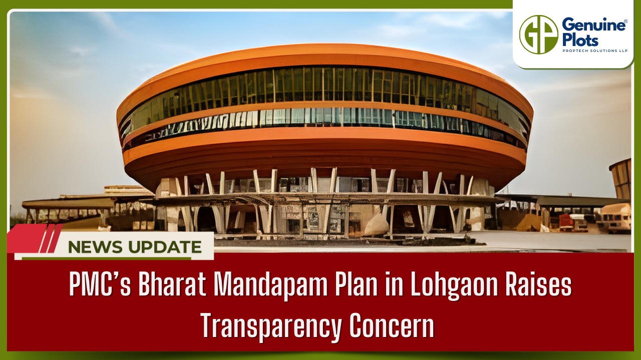
A proposed development of a “Bharat Mandapam” has been announced by the Pune Municipal Corporation (PMC), involving the allocation of a substantial 27 acres of land that was meant for public amenities in Lohgaon. This has stirred a debate among locals and activists regarding a possible lack of transparency.
Under the existing Development Plan, land use in Lohgaon was allocated for public utilities such as roads, gardens, hospitals, parking, and open spaces. The PMC proposal would shift this land use for the new “Bharat Mandapam” project, raising questions about what would happen for future needs.
The civic body has called for public suggestions for the plan, which has to reach them by December 28. However, many citizen forums and organisations feel that not many details are being shared for this purpose. Activists are now demanding that PMC share complete project documents in the public domain before citizens can finalise their objections and suggestions for the same.
Moreover, some critics have attributed any possible failure of infrastructure development to the cancellation of civic amenity sites. This may particularly happen in a region where development is taking place at a rapid rate.
As the debate goes on, the citizens, as well as activist groups, continue to call for an extension of the period of consultation.
Maharashtra to Appoint Licensed Private Surveyors to Complete Land Measurement Work within 30 Days

The government of the Indian state, Maharashtra, has declared that it will employ authorised private land surveyors to complete land measurements within 30 days, which is considerably shorter than the earlier period of 90 to 120 days. Notably, it can be said that this move will bring about a landmark change in land administration. Notably, this move in land administration will help significantly lessen pending land measurement cases.
Clearing the Backlog with Speed and Technology
Revenue Minister Chandrashekhar Bawankule described the move as “a revolutionary step in the history of the department. Chief Minister Devendra Fadnavis has supported the initiative as part of broader reforms to strengthen land governance through technology and citizen-centric systems.
Government verification ensures that the data is correct.
The actual fieldwork will be done by private surveyors, whose measurements will be verified and signed by senior government functionaries at the level of Taluka Land Records Inspectors, Deputy Superintendents of Land Records, or City Survey Officers. This two-tier verification is a fast track that ensures correct and legally valid land measurement results.
The deployment of about 150 private surveyors in each district was a plan to support the rollout of this by the government, extending the survey capacity and solving the shortage of government survey staff that slows operations.
Broader Vision: More Transparent Land Records
The policy is also expected to support a long-term shift in how land transactions are handled. Officials are exploring a “measure first, register later” approach—where land is surveyed before a sale deed is executed and mutation entries are made. This will help prevent disputes caused by discrepancies between the sale deed descriptions and actual on-ground boundaries.
Effects on Investors and Citizens
Landowners, farmers, developers, and constructors are among those who will greatly benefit from the reform. Fast measurement services will
- Speed up real estate transactions
- Decrease border-related legal disputes
- Enhance trust in land records.
Conclusion
The state of Maharashtra is also proceeding with the modernisation of its land administration system by incorporating private certified surveyors for land measurement, with a defined 30-day timeframe to complete the task. The move not only seeks to clear past arrears but will also enhance convenience in matters concerning land.
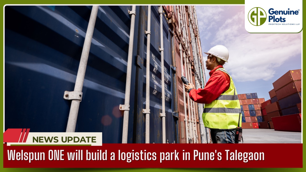
In order to support Pune's expanding logistics ecosystem, Welspun ONE has announced plans to build a massive logistics park in Talegaon, Pune, with a total investment of ₹550 crore.
Location of the Project: Talegaon, Pune
Talegaon, a major industrial and logistics hub close to Pune, is perfect for contemporary warehousing infrastructure because it has excellent highway connectivity and is close to manufacturing clusters.
Investment & Development Scope
The ₹550 crore investment will go into building a state-of-the-art logistics park with advanced warehousing, efficient logistics infrastructure, and scalable facilities for large occupiers.
Purpose of the Logistics Park
The project aims to meet rising demand from e-commerce, manufacturing, and third-party logistics companies seeking efficient supply chain solutions in Western India.
Economic & Regional Impact
The development is expected to:
Boost regional employment
Support industrial growth
Enhance Pune’s position as a logistics and distribution hub
Impact on Land & Real Estate
Large logistics investments typically increase demand for industrial land and warehouse-ready plots in nearby areas, potentially driving long-term land value appreciation around Talegaon.
Maharashtra Cabinet Abolishes Colonial-Era Non-Agricultural Tax, But Uncertainty Persists

The Maharashtra government’s recent decision to abolish the Non-Agricultural (NA) tax has been welcomed across urban housing societies. However, despite the cabinet approval, the lack of formal implementation has led to widespread confusion among residents and managing committees.
What Is the Non-Agricultural (NA) Tax?
NA tax is a colonial-era levy imposed on land converted from agricultural to non-agricultural use.
It applies to residential and commercial properties built on such land.
Housing societies pay this tax in addition to the regular property tax, which can lead to double taxation.
Cabinet Decision to Abolish NA Tax
The elimination of the NA tax on urban residential properties has been approved by the Maharashtra Cabinet.
The goal of the action is to lessen housing societies' financial burden.
The ruling is viewed as a step in the direction of doing away with unnecessary and antiquated taxes.
Lack of Government Resolution Causes Confusion
No formal Government Resolution (GR) has been issued, despite cabinet approval.
Without a GR, local revenue departments lack clear instructions.
Housing societies are uncertain about whether the tax has been abolished in practice
Housing Societies Still Receiving Tax Notices
Several housing societies, especially in cities like Mumbai and Pune, continue to receive NA tax demands.
Some societies are paying the tax to avoid penalties and legal complications.
Others have chosen to withhold payment, awaiting official clarification.
Impact on Residents and Managing Committees
Managing committees are caught between compliance and the anticipation of exemption.
Fear of fines, interest, or legal action adds to the anxiety.
Residents remain unsure about future refunds or adjustments.
Maharashtra Tables Bill to Remove Non-Farm Use Certificate Requirement for Conversion of Agricultural Land

The Maharashtra government has made a substantial step toward streamlining land-use procedures. During the winter session, Revenue Minister Chandrashekhar Bawankule presented the long-standing requirement of a non-farm use certificate called Sanad to the Legislative Assembly.
What Is Being Changed?
Until now, landowners in the state seeking to convert agricultural land into non-agricultural use had to navigate a multi-layered approval process. Even after securing the necessary non-agricultural (NA) permission, they still needed to obtain a Sanad — a legal certificate issued by revenue authorities — before legally developing or selling the land. This added layer often resulted in delays, higher costs, and bureaucratic hassles for ordinary landowners.
Under the Maharashtra Land Revenue Code (Second Amendment) Bill, 2025, the requirement to obtain this Sanad will be completely eliminated. Instead, landowners will be required to pay a one-time nominal premium based on the Ready Reckoner rate to regularise the change in land use. The new structure is as follows:
- Up to 1,000 sq. metres: 0.1% of the Ready Reckoner value
- 1,001 to 4,000 sq. metres: 0.25% of the Ready Reckoner value
- Above 4,001 sq. metres: 0.5% of Ready Reckoner value
This premium replaces the need for the Sanad, making the process simpler and more predictable for landowners.
Why This Matters
For decades, the Sanad certificate was seen as a bureaucratic bottleneck that slowed down land conversion and deterred investment and development. Even after earlier reforms between 2014 and 2018 relaxed the NA permission requirement, the Sanad remained a hurdle. The new amendment aims to eliminate that final administrative barrier.
Benefits for Citizens and Landowners
The reform is expected to have several practical benefits:
- Faster Approvals: Land use change will be processed more quickly without the need for a separate Sanad certificate.
- Reduced Costs: With a predictable premium based on Ready Reckoner rates, landowners can better plan their finances without multiple fees.
- Encourages Development: Simplified rules are likely to encourage more residential and commercial development, particularly in peri-urban and rural areas.
- Ease of Doing Business: By cutting red tape, Maharashtra is aligning its land administration with broader national goals of improving the business environment.
Government Assurances
The state government has clarified that the removal of the Sanad requirement will not impact the revenue of local self-governing bodies — such as municipal corporations and panchayats — which will continue to receive their share of taxes and fees as before.
What Happens Next?
The bill has been tabled in the Assembly and must be passed by both houses of the state legislature and receive the Governor’s assent before becoming law. If enacted, it would mark one of the most significant simplifications of land conversion procedures in the state in recent years.
Recent Posts
Tags
Bhunaksha,
genuine plots,
Land For Sale,
Maharashtra Bhunaksha,
plots for sale,
Gunthewari,
Gunthewari Land,
Gunthewari Rules,
Extract Documents,
Plots and Lands,
Saat Baara,
Extract Saat,
Baara Utara,
Jamabandi,
property tax payments,
Gram Panchayat,
lower prices,
non-agricultural land,
Lower Investment Cost,
Gram Panchayat lands,
Fresh Land Settlements,
Growing demand,
affordable homes,
genuine p,
legal Land,
bungalow plots,
Konkan,
Maharashtra,
Purandar,
Pune,
Karnataka,
Bangalore,
Farm Land,
Kolkata,
Rajarhat,
Indore,
Chhatrapati Sambhajinagar,
Aurangabad,
Mundhwa,
Agricultural Land,
Farmhouse Plot,
Rules And Penalties,
Residential Plots,
NA PLots,
Residential NA Plots,
Commercial NA Plots,
Animal Husbandry Land,
Tathawade,
Vahivat Land Maps,
Vahivat,
Indian Land Records,
Ownership Rights,
Red zone,
PCMC,
Dehu Road,
Land Registration Rules,
Land Investing,
Infrastructure Growth,
Land Ownership,
Land Encroachment,
Panshet Dam,
Varasgaon Dam,
Verified Land,
Plot For Sale,
Land Investment,
Verified Plots,
Land Acquisiton,
Hydrological Survey,
Invest In Land,
Verified Land Plots,
Panshet,
Khadakwasla,
Land Rules,
Dakhil Kharij,
Land Registry,
Property Onwership,
Clean Title Check List,
Property Verification,
Digital Registry,
Farm Plots,
Agro Property,
Land Value Growth,
Urban Expansion,
Senapati Bapat Road,
Registered Land,
Agricultral Plot,
Purandar Airport,
Safe Investment,
Secure Property,
Plot Buyers,
Approved Plots,
Land ROI,
NA Approved Plots,
NA Land,
Welspun One,
Logistic Park,
Talegaon,
PMC Bharat Mandapam,
Urban Development,
Lohgaon,
Close To Nature,
Gated Community Plots,
Buy Land VS Gold Investment,
NRI Investment,
Future Ready Living,
Trusted Plots,
Plot Investment,
Authentic Land,
Safe Land Buying,
Mumbai,
Premium Plots,
MMR Land Investment,
MMR Infrastructure,
Metro Connectivity,
Plots in Mahabaleshwar hill station investment,
Mahabaleshwar land prices and future growth,
Scenic residential plots in Mahabaleshwar,
Mumbai 3.0,
Mumbai 3.0 vs Mumbai 2.0,
Mumbai property investment,
Real estate investment in Mumbai,
Upcoming residential projects in Mumbai,
CIDCO plot auctions,
CIDCO auction Navi Mumbai,
Upcoming CIDCO plot auctions 2026,
CIDCO land auction dates,
Navi Mumbai plot auctions,
CIDCO plots in Navi Mumbai,
CIDCO plots in Kharghar,
CIDCO plots in Ulwe,
NMIA investment opportunities,
Mumbai 3.0 plotted development,
Mumbai 3.0 real estate,
Plots in Mumbai 3.0,
Land investment in Maharashtra,
Residential plots near Mumbai,
Land appreciation in Mumbai 3.0,
Residential land for sale in Mumbai 3.0,
Altamura NA Plots,
Altamura Nadar City,
NA Plots in Nadar City,
Nadar City Plots,
Plots in Nadar City,
YEIDA plots,
YEIDA plots near Noida Airport,
Noida Airport plots,
Jewar Airport investment,
Yamuna Expressway plots,
YEIDA plot scheme 2026,
Noida Airport real estate,
Zepto,
Zepto effect,
D2C brands India,
Urban consumer trends,
Marketplace evolution,
Urban infrastructure growth,
YEIDA Residential Plot Scheme,
Yamuna Expressway Plot Scheme,
YEIDA Residential Plots,
Yamuna Expressway Authority,
Noida Investment,
Residential Plots in Lucknow,
LDA Plots in Lucknow,
Lucknow Real Estate,
LDA Approved Plots,
Plots for Sale in Lucknow,
Lucknow Property Investment,
Land Investment in Lucknow,
Residential Land in Lucknow,
Buy Plot in Lucknow,
Lucknow Development Authority,
Maharashtra Fragmentation Law 2025,
Fragmentation Act Maharashtra,
Maharashtra land law update 2025,
Maharashtra land reforms 2025,
Land subdivision rules Maharashtra,
Maharashtra agriculture land purchase rules,
Agricultural land purchase restrictions Maharashtra,
Can non-farmers buy agricultural land in Maharashtra,
NA conversion process Maharashtra,
Collector permission for land purchase,
farmland prices in Nagpur,
agricultural land price in Nagpur per acre,
farmland cost in Nagpur Maharashtra,
Nagpur agricultural land investment,
per acre agricultural land rate in Nagpur,
Tukdebandi Law Maharashtra,
Maharashtra Fragmentation Act update,
Land subdivision law Maharashtra,
Agricultural land division Maharashtra,
Maharashtra land reform ordinance,
Plot registration Maharashtra,
Farmland prices Nagpur,
Nagpur agricultural land rates,
Farmland per acre Maharashtra,
Agricultural land price Nagpur,
Farm land cost Nagpur,
Nagpur real estate trends,
Land investment Nagpur,
Avani Farms,
Avani Farms Pune,
Farmland near Pune,
Farm plots for sale,
Agricultural land investment,
Gated farmland near Pune,
NRI agricultural land rules India,
Can NRI buy agricultural land in India,
FEMA rules for NRI property purchase,
RBI guidelines for NRI land investment,
NRI farmland investment India,
Agricultural land purchase by NRI,
Maharashtra Fragmentation Act,
Minimum plot size in Maharashtra,
Guntha rules Maharashtra,
Agricultural land division rules,
Minimum land area for sale in Maharashtra,
Legal plot size in guntha,
Guntha conversion rules,
NRI land purchase in India,
Can NRIs buy agricultural land in India,
NRI property investment India,
NRI buying residential land,
NRI real estate guidelines India,
Investment tips for NRIs in India,
Mutation Entry Process,
Land Mutation in India,
Property Mutation Process,
Land Ownership Transfer,
1 guntha na plot prices in pune 2026,
1 guntha plot price in pune,
na plots in pune,
residential na plots pune,
guntha plot rate in pune,
na plot investment in pune,
plots near purandar airport,
1 Acre Land Price in Pune,
Pune Land Rates 2025,
Pune Land Price 2026,
Pune Acre Land Cost,
Land Value Pune,
Agricultural Land Price Pune,
gated community plots in Hinjewadi,
Hinjewadi plots for sale,
residential plots in Hinjewadi Pune,
premium plots in Hinjewadi,
plots near Rajiv Gandhi Infotech Park,
land for sale in Hinjewadi Pune,
Pune property investment,
plots for sale in Pune below 5 lakhs,
Pune rural land investment,
gated plotting projects Pune,
MIDC growth corridor plots,
Residential plots for sale in Hinjewadi,
Plots in Hinjewadi Pune,
Land for sale in Hinjewadi,
Residential NA plots Hinjewadi,
Hinjewadi real estate trends 2026,
Nashik land investment,
Trimbakeshwar land for sale,
Simhastha Kumbh 2026,
Simhastha Kumbh 2027 real estate impact,
Trimbakeshwar property investment,
Land appreciation in Nashik,
plots for sale in pune,
types of plots in pune,
residential plots in pune,
agricultural land in pune,
villa plots in pune,
NRI agricultural land purchase India,
NRI property investment in India,
Agricultural land rules for NRIs,
NRI real estate investment India,
NA plot meaning,
what is NA land,
NA land in Maharashtra,
land investment guide,
NRI agricultural land in Telangana,
Telangana land laws for NRI,
Telangana real estate laws,
NRI investment guide Telangana,
Legal compliance for NRI property,
NRI farmhouse purchase India,
RBI guidelines for NRI property,
NRI land buying rules,
Godham Eco Village,
Godham Eco Village for NRIs,
NRI land investment in India,
Investment plots for NRIs,
Secure land investment India,
NRI property buying guide,
plots in Pune,
NRI buying property in India,
NRI guide to buying land in Pune,
NRI land investment in Pune,
NRI property documents checklist,
Maharashtra land reform 2025,
Maharashtra land laws update,
Agricultural land rules in Maharashtra,
Buying agricultural land in Maharashtra,
Non-agricultural land conversion Maharashtra,
Maharashtra agricultural land rules 2024,
agricultural land purchase in Maharashtra,
non agriculturist land purchase rules,
who can buy agricultural land in Maharashtra,
Maharashtra land laws for non farmers,
Guntha based land rules,
Minimum guntha rule Maharashtra,
Maharashtra land laws,
Maharashtra agricultural land laws,
farmland investment Maharashtra,
buying farmland legally in Maharashtra,
NA conversion rules Maharashtra,
agricultural land eligibility criteria,
Property Mutation in India,
Land Record Update,
Revenue Records,
Property Ownership Transfer,
Mutation of Property,
Farmhouse Plots Near Pune,
NRI Investment in Pune,
Pune Real Estate,
Plots for Sale Near Pune,
Luxury Farmhouse Plots,
Pune plot scams,
Plot buying checklist,
Legal verification for plots,
NA plot verification,
Plot buying tips Pune,
Godrej Properties,
Evora Estate Panipat,
Luxury plots in Panipat,
Premium land investment,
Residential plots in Panipat,
Lodha Developers,
Lodha Developers Q3 acquisition,
Lodha land parcels Q3,
Indian real estate news,
New residential projects India,
Real estate investment news,
Premium housing projects,
Srijan Group,
Kolkata Tech Park,
Commercial Real Estate,
Real Estate Investment,
Real Estate Deal News,
NRI investment in India,
NRI land investment,
Plots for sale in India,
NRI property investment,
Can NRI buy residential plot in India,
NRI land purchase rules,
Residential plots for NRIs,
NRI real estate investment,
NRIs buying property in India,
Can NRIs buy plots in India 2026,
RBI rules for NRI property purchase,
NRI land investment rules,
MMR 3.0,
MMR real estate 2026,
Mumbai real estate market,
Navi Mumbai investment,
Thane property market,
Mumbai property trends 2026,
Land investment in MMR,
Mumbai smart city project,
Korea Mumbai partnership,
MMRDA infrastructure projects,
Korean investment in India,
MMR GDP growth,
MMR economic roadmap 2030,
Mumbai real estate,
Public private partnership projects Mumbai,
Investment opportunities in MMR,
Mumbai Metropolitan Region,
Mumbai urban development,
MMR 2047 vision,
Mumbai infrastructure projects,
Navi Mumbai development,
Goa property investment,
Invest in Goa 2026,
Goa real estate market 2026,
Best places to invest in Goa,
North Goa property,
Property appreciation in Goa,
Goa plots for sale,
Commercial property in Goa,
Buy property in Goa,
YEIDA plots 2026,
Residential plots in YEIDA,
YEIDA new scheme update,
Plots near Noida International Airport,
Yamuna Expressway Authority plots,
YEIDA housing scheme details,
Lucknow land investment,
Property in Lucknow,
Buy plots in Lucknow,
Nashik plots for sale,
Kumbh Mela 2026 Nashik,
Land investment in Nashik,
Nashik property market 2026,
Plots near Kumbh Mela Nashik,
Residential plots in Nashik,
Upcoming projects in Nashik,
Property appreciation in Nashik,
Maharashtra land investment,
Nashik Kumbh Mela 2026,
Kumbh Mela investment opportunities,
Infrastructure development in Nashik,
Plots near Nashik Kumbh Mela,
High ROI land investment,
MIHAN,
MIHAN Nagpur,
Nagpur Real Estate,
Agricultural Land Nagpur,
Nagpur Property,
Plots Near In MIHAN,
Pune residential plots,
best areas to buy plots in Pune,
Pune land investment,
investment plots in Pune,
buy land in Pune,
real estate investment in Pune,
Godrej Plots Doddaballapur,
Doddaballapur plots for sale,
Plots in North Bangalore,
Godrej Properties plots,
Residential plots in Doddaballapur,
Investment plots near Bangalore,
Gated community plots Bangalore,
Premium plots in Doddaballapur,
plots in Mahabaleshwar,
Mahabaleshwar villa plots,
farmhouse plots in Mahabaleshwar,
land for sale in Mahabaleshwar,
bungalow plots in Mahabaleshwar,
hill station property investment,
agricultural land in Mahabaleshwar,
premium land in Mahabaleshwar,
Plots in Pune under 3 lakhs for sale,
Budget residential plots near Pune,
Low cost plots near Pune highway connectivity,
plots in Pune under 3 lakhs,
farmland plots near Pune city,
Investment plots near Pune under budget,
Residential land near Pune,
Godrej plots in Pune,
Premium plotted development by Godrej in Pune,
Residential land for sale by Godrej,
Premium plot by Godrej,
Plots for sale in Hadapsar Pune,
Residential plots in Hadapsar,
Investment plots in Hadapsar,
Gated community plots in Hadapsar,
Ready to build plots in Hadapsar,
1 Guntha plot in Pune,
1 Guntha plot in Pune for sale,
1 Guntha plots near Pune city,
Residential 1 Guntha land in Pune,
Clear title 1 Guntha plot in Pune,
1 guntha plot price in village,
village plot rate per guntha,
affordable 1 guntha land in rural area,
residential plot in village Pune,
farmland plot price per guntha,
Residential 1 Guntha plot near Pune city,
Investment plots in Pune 1 Guntha,
Clear title 1 Guntha land in Pune,
Agricultural 1 Guntha plot near Pune,
1 Guntha plot in Pune Katraj for sale,
Residential plot in Katraj Pune 1 Guntha,
Katraj Pune land for home construction,
1 Guntha NA plot in Katraj Pune,
Pune Katraj plot near highway connectivity,
Gated plot project in Katraj Pune,
NA plots in Pune under 10 lakhs,
Affordable NA plots near Pune city,
NA residential plots in Pune,
NA approved plots in Pune under 10 lakhs,
Investment plots in Pune under 10 lakhs,
Residential NA plots near Pune highway,
Best plots in Pune below 10 lakhs,
Premium villa plots in Pune,
Residential villa plots in Pune near city outskirts,
Luxury villa plots in Pune,
Gated villa plot project in Pune,
Villa plot site visit in Pune,
NA plots in Pimpri Chinchwad for sale,
Residential NA plots in PCMC area,
NA approved plots in Pimpri Chinchwad,
NA land with clear title in PCMC,
NA plots near Pune Mumbai Highway PCMC,


