Prev Post
Karnataka High Court: Even a 60-Year-Old Compensation Claim Is Maintainable When the State Admits to Illegal Land AcquisitionHydrological Survey for Groundwater: A Scientific Means to Ensure Water Supply
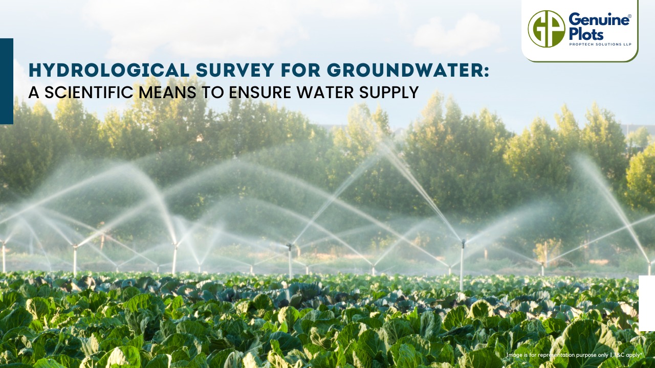
Water is perhaps one of the most vital natural resources, but its availability beneath the earth's surface is largely unseen and frequently uncertain. With expansion in urbanisation and increases in agricultural demands, the need for reliable groundwater becomes increasingly important. It is at this juncture that a hydrological survey plays a highly important role. In general, it is a complete, science-based methodology applied for locating, evaluating, and understanding underground water resources with precision and reliability.
A hydrological survey is far beyond just identifying a spot to dig a borewell; it is an elaborate methodology that combines geology, hydrogeology, geophysics, and environmental science in order to provide a full picture of the subsurface water conditions. With a combination of surface studies and advanced subsurface scanning technologies, experts are able to determine the best possible locations to access groundwater both safely and sustainably.
Understanding the Components of a Hydrological Survey
A proper hydrological survey encompasses various scientific steps that collectively help in the identification of groundwater reservoirs, better known as aquifers.
1. Geological and Terrain Study
This process is initiated by a detailed examination of the geological structure of the land, including rock types, soil conditions, and natural formations. Rocks like sandstone, fractured granite, and limestone can store sizeable volumes of water. The surveyors will study the nature of the terrain to predict the capability for water storage.
2. Hydrogeological Assessment
This step provides insight into the behaviour of underground water. Specialists study the infiltration of water into the soil, the discharge through fissures and pervious strata, and the speed of replenishment, which is the recharge rate. Hydrogeological studies will also lead to a conclusion on whether the area can sustain long-term abstraction of water without causing depletion of the resource.
3. Geophysical Investigation
The most important part of this survey is geophysical testing, which uses non-invasive tools to determine what is present underground. These include methods such as Electrical Resistivity Method, Seismic Surveys, and Electromagnetic Testing, which help to detect changes in underground materials. Water-filled layers carry electricity differently from dry rock, thus making these technologies immensely reliable for pinpointing the groundwater-bearing zone.
4. Water Table Mapping
Surveyors measure the depth to the water table and determine its variation with seasons, rainfall, and local usage. Such information is crucial to determine the optimal depth of drilling and predict the long-term availability of the groundwater.
5. Site Selection and Yield Estimation
Based on all the scientific data, experts recommend the most suitable spot for the drilling of a borewell. They also predict the expected water yield: low, medium, or high. All this is vitally important for planning agricultural, residential, or industrial usage.
Why Hydrological Surveys Are Important
Borewells drilled without proper scientific evaluation bring in costly failures and wastage of resources in many regions. A hydrological survey prevents such risks by offering accurate, science-backed insights. Here are key benefits:
Reduces Borewell Failure
An important advantage is a significant increase in the success rate of hitting water-rich zones. This prevents financial loss and frustration for farmers, developers, and homeowners.
- Ensures sustainable groundwater use
- Helps in Better Planning
- Saves Time and Money
Applications Across Industries
Hydrological surveys are widely employed in:
- Residential and commercial borewell planning
- Large-scale irrigation for agriculture
- Industrial water supply projects
- Government and community water management
- Urban planning and construction approvals
Conclusion
A hydrological survey is a cornerstone in the modern way of managing water resources. The blend of state-of-the-art scientific techniques with environmental appreciation ensures the pinpointing of well water resources and supports this resource's sustainable use. By depending on hydrological surveys, households and farms, as well as large-scale industries, enjoy long-term security with greater success rates and responsible access to one of our most prized natural resources: groundwater.
Recent Posts
Tags
Bhunaksha,
genuine plots,
Land For Sale,
Maharashtra Bhunaksha,
plots for sale,
Gunthewari,
Gunthewari Land,
Gunthewari Rules,
Extract Documents,
Plots and Lands,
Saat Baara,
Extract Saat,
Baara Utara,
Jamabandi,
property tax payments,
Gram Panchayat,
lower prices,
non-agricultural land,
Lower Investment Cost,
Gram Panchayat lands,
Fresh Land Settlements,
Growing demand,
affordable homes,
genuine p,
legal Land,
bungalow plots,
Konkan,
Maharashtra,
Purandar,
Pune,
Karnataka,
Bangalore,
Farm Land,
Kolkata,
Rajarhat,
Indore,
Chhatrapati Sambhajinagar,
Aurangabad,
Mundhwa,
Agricultural Land,
Farmhouse Plot,
Rules And Penalties,
Residential Plots,
NA PLots,
Residential NA Plots,
Commercial NA Plots,
Animal Husbandry Land,
Tathawade,
Vahivat Land Maps,
Vahivat,
Indian Land Records,
Ownership Rights,
Red zone,
PCMC,
Dehu Road,
Land Registration Rules,
Land Investing,
Infrastructure Growth,
Land Ownership,
Land Encroachment,
Panshet Dam,
Varasgaon Dam,
Verified Land,
Plot For Sale,
Land Investment,
Verified Plots,
Land Acquisiton,
Hydrological Survey,
Invest In Land,
Verified Land Plots,
Panshet,
Khadakwasla,
Land Rules,
Dakhil Kharij,
Land Registry,
Property Onwership,
Clean Title Check List,
Property Verification,
Digital Registry,
Farm Plots,
Agro Property,
Land Value Growth,
Urban Expansion,
Senapati Bapat Road,
Registered Land,
Agricultral Plot,
Purandar Airport,
Safe Investment,
Secure Property,
Plot Buyers,
Approved Plots,
Land ROI,
NA Approved Plots,
NA Land,
Welspun One,
Logistic Park,
Talegaon,
PMC Bharat Mandapam,
Urban Development,
Lohgaon,
Close To Nature,
Gated Community Plots,
Buy Land VS Gold Investment,
NRI Investment,
Future Ready Living,
Trusted Plots,
Plot Investment,
Authentic Land,
Safe Land Buying,
Mumbai,
Premium Plots,
MMR Land Investment,
MMR Infrastructure,
Metro Connectivity,
Plots in Mahabaleshwar hill station investment,
Mahabaleshwar land prices and future growth,
Scenic residential plots in Mahabaleshwar,
Mumbai 3.0,
Mumbai 3.0 vs Mumbai 2.0,
Mumbai property investment,
Real estate investment in Mumbai,
Upcoming residential projects in Mumbai,
CIDCO plot auctions,
CIDCO auction Navi Mumbai,
Upcoming CIDCO plot auctions 2026,
CIDCO land auction dates,
Navi Mumbai plot auctions,
CIDCO plots in Navi Mumbai,
CIDCO plots in Kharghar,
CIDCO plots in Ulwe,
NMIA investment opportunities,
Mumbai 3.0 plotted development,
Mumbai 3.0 real estate,
Plots in Mumbai 3.0,
Land investment in Maharashtra,
Residential plots near Mumbai,
Land appreciation in Mumbai 3.0,
Residential land for sale in Mumbai 3.0,
Altamura NA Plots,
Altamura Nadar City,
NA Plots in Nadar City,
Nadar City Plots,
Plots in Nadar City,
YEIDA plots,
YEIDA plots near Noida Airport,
Noida Airport plots,
Jewar Airport investment,
Yamuna Expressway plots,
YEIDA plot scheme 2026,
Noida Airport real estate,
Zepto,
Zepto effect,
D2C brands India,
Urban consumer trends,
Marketplace evolution,
Urban infrastructure growth,
YEIDA Residential Plot Scheme,
Yamuna Expressway Plot Scheme,
YEIDA Residential Plots,
Yamuna Expressway Authority,
Noida Investment,
Residential Plots in Lucknow,
LDA Plots in Lucknow,
Lucknow Real Estate,
LDA Approved Plots,
Plots for Sale in Lucknow,
Lucknow Property Investment,
Land Investment in Lucknow,
Residential Land in Lucknow,
Buy Plot in Lucknow,
Lucknow Development Authority,
Maharashtra Fragmentation Law 2025,
Fragmentation Act Maharashtra,
Maharashtra land law update 2025,
Maharashtra land reforms 2025,
Land subdivision rules Maharashtra,
Maharashtra agriculture land purchase rules,
Agricultural land purchase restrictions Maharashtra,
Can non-farmers buy agricultural land in Maharashtra,
NA conversion process Maharashtra,
Collector permission for land purchase,
farmland prices in Nagpur,
agricultural land price in Nagpur per acre,
farmland cost in Nagpur Maharashtra,
Nagpur agricultural land investment,
per acre agricultural land rate in Nagpur,
Tukdebandi Law Maharashtra,
Maharashtra Fragmentation Act update,
Land subdivision law Maharashtra,
Agricultural land division Maharashtra,
Maharashtra land reform ordinance,
Plot registration Maharashtra,
Farmland prices Nagpur,
Nagpur agricultural land rates,
Farmland per acre Maharashtra,
Agricultural land price Nagpur,
Farm land cost Nagpur,
Nagpur real estate trends,
Land investment Nagpur,
Avani Farms,
Avani Farms Pune,
Farmland near Pune,
Farm plots for sale,
Agricultural land investment,
Gated farmland near Pune,
NRI agricultural land rules India,
Can NRI buy agricultural land in India,
FEMA rules for NRI property purchase,
RBI guidelines for NRI land investment,
NRI farmland investment India,
Agricultural land purchase by NRI,
Maharashtra Fragmentation Act,
Minimum plot size in Maharashtra,
Guntha rules Maharashtra,
Agricultural land division rules,
Minimum land area for sale in Maharashtra,
Legal plot size in guntha,
Guntha conversion rules,
NRI land purchase in India,
Can NRIs buy agricultural land in India,
NRI property investment India,
NRI buying residential land,
NRI real estate guidelines India,
Investment tips for NRIs in India,
Mutation Entry Process,
Land Mutation in India,
Property Mutation Process,
Land Ownership Transfer,
1 guntha na plot prices in pune 2026,
1 guntha plot price in pune,
na plots in pune,
residential na plots pune,
guntha plot rate in pune,
na plot investment in pune,
plots near purandar airport,
1 Acre Land Price in Pune,
Pune Land Rates 2025,
Pune Land Price 2026,
Pune Acre Land Cost,
Land Value Pune,
Agricultural Land Price Pune,
gated community plots in Hinjewadi,
Hinjewadi plots for sale,
residential plots in Hinjewadi Pune,
premium plots in Hinjewadi,
plots near Rajiv Gandhi Infotech Park,
land for sale in Hinjewadi Pune,
Pune property investment,
plots for sale in Pune below 5 lakhs,
Pune rural land investment,
gated plotting projects Pune,
MIDC growth corridor plots,
Residential plots for sale in Hinjewadi,
Plots in Hinjewadi Pune,
Land for sale in Hinjewadi,
Residential NA plots Hinjewadi,
Hinjewadi real estate trends 2026,
Nashik land investment,
Trimbakeshwar land for sale,
Simhastha Kumbh 2026,
Simhastha Kumbh 2027 real estate impact,
Trimbakeshwar property investment,
Land appreciation in Nashik,
plots for sale in pune,
types of plots in pune,
residential plots in pune,
agricultural land in pune,
villa plots in pune,
NRI agricultural land purchase India,
NRI property investment in India,
Agricultural land rules for NRIs,
NRI real estate investment India,
NA plot meaning,
what is NA land,
NA land in Maharashtra,
land investment guide,
NRI agricultural land in Telangana,
Telangana land laws for NRI,
Telangana real estate laws,
NRI investment guide Telangana,
Legal compliance for NRI property,
NRI farmhouse purchase India,
RBI guidelines for NRI property,
NRI land buying rules,
Godham Eco Village,
Godham Eco Village for NRIs,
NRI land investment in India,
Investment plots for NRIs,
Secure land investment India,
NRI property buying guide,
plots in Pune,
NRI buying property in India,
NRI guide to buying land in Pune,
NRI land investment in Pune,
NRI property documents checklist,
Maharashtra land reform 2025,
Maharashtra land laws update,
Agricultural land rules in Maharashtra,
Buying agricultural land in Maharashtra,
Non-agricultural land conversion Maharashtra,
Maharashtra agricultural land rules 2024,
agricultural land purchase in Maharashtra,
non agriculturist land purchase rules,
who can buy agricultural land in Maharashtra,
Maharashtra land laws for non farmers,
Guntha based land rules,
Minimum guntha rule Maharashtra,
Maharashtra land laws,
Maharashtra agricultural land laws,
farmland investment Maharashtra,
buying farmland legally in Maharashtra,
NA conversion rules Maharashtra,
agricultural land eligibility criteria,
Property Mutation in India,
Land Record Update,
Revenue Records,
Property Ownership Transfer,
Mutation of Property,
Farmhouse Plots Near Pune,
NRI Investment in Pune,
Pune Real Estate,
Plots for Sale Near Pune,
Luxury Farmhouse Plots,
Pune plot scams,
Plot buying checklist,
Legal verification for plots,
NA plot verification,
Plot buying tips Pune,
Godrej Properties,
Evora Estate Panipat,
Luxury plots in Panipat,
Premium land investment,
Residential plots in Panipat,
Lodha Developers,
Lodha Developers Q3 acquisition,
Lodha land parcels Q3,
Indian real estate news,
New residential projects India,
Real estate investment news,
Premium housing projects,
Srijan Group,
Kolkata Tech Park,
Commercial Real Estate,
Real Estate Investment,
Real Estate Deal News,
NRI investment in India,
NRI land investment,
Plots for sale in India,
NRI property investment,
Can NRI buy residential plot in India,
NRI land purchase rules,
Residential plots for NRIs,
NRI real estate investment,
NRIs buying property in India,
Can NRIs buy plots in India 2026,
RBI rules for NRI property purchase,
NRI land investment rules,
MMR 3.0,
MMR real estate 2026,
Mumbai real estate market,
Navi Mumbai investment,
Thane property market,
Mumbai property trends 2026,
Land investment in MMR,
Mumbai smart city project,
Korea Mumbai partnership,
MMRDA infrastructure projects,
Korean investment in India,
MMR GDP growth,
MMR economic roadmap 2030,
Mumbai real estate,
Public private partnership projects Mumbai,
Investment opportunities in MMR,
Mumbai Metropolitan Region,
Mumbai urban development,
MMR 2047 vision,
Mumbai infrastructure projects,
Navi Mumbai development,
Goa property investment,
Invest in Goa 2026,
Goa real estate market 2026,
Best places to invest in Goa,
North Goa property,
Property appreciation in Goa,
Goa plots for sale,
Commercial property in Goa,
Buy property in Goa,
YEIDA plots 2026,
Residential plots in YEIDA,
YEIDA new scheme update,
Plots near Noida International Airport,
Yamuna Expressway Authority plots,
YEIDA housing scheme details,
Lucknow land investment,
Property in Lucknow,
Buy plots in Lucknow,
Nashik plots for sale,
Kumbh Mela 2026 Nashik,
Land investment in Nashik,
Nashik property market 2026,
Plots near Kumbh Mela Nashik,
Residential plots in Nashik,
Upcoming projects in Nashik,
Property appreciation in Nashik,
Maharashtra land investment,
Nashik Kumbh Mela 2026,
Kumbh Mela investment opportunities,
Infrastructure development in Nashik,
Plots near Nashik Kumbh Mela,
High ROI land investment,
MIHAN,
MIHAN Nagpur,
Nagpur Real Estate,
Agricultural Land Nagpur,
Nagpur Property,
Plots Near In MIHAN,
Pune residential plots,
best areas to buy plots in Pune,
Pune land investment,
investment plots in Pune,
buy land in Pune,
real estate investment in Pune,
Godrej Plots Doddaballapur,
Doddaballapur plots for sale,
Plots in North Bangalore,
Godrej Properties plots,
Residential plots in Doddaballapur,
Investment plots near Bangalore,
Gated community plots Bangalore,
Premium plots in Doddaballapur,
plots in Mahabaleshwar,
Mahabaleshwar villa plots,
farmhouse plots in Mahabaleshwar,
land for sale in Mahabaleshwar,
bungalow plots in Mahabaleshwar,
hill station property investment,
agricultural land in Mahabaleshwar,
premium land in Mahabaleshwar,
Plots in Pune under 3 lakhs for sale,
Budget residential plots near Pune,
Low cost plots near Pune highway connectivity,
plots in Pune under 3 lakhs,
farmland plots near Pune city,
Investment plots near Pune under budget,
Residential land near Pune,
Godrej plots in Pune,
Premium plotted development by Godrej in Pune,
Residential land for sale by Godrej,
Premium plot by Godrej,
Plots for sale in Hadapsar Pune,
Residential plots in Hadapsar,
Investment plots in Hadapsar,
Gated community plots in Hadapsar,
Ready to build plots in Hadapsar,
1 Guntha plot in Pune,
1 Guntha plot in Pune for sale,
1 Guntha plots near Pune city,
Residential 1 Guntha land in Pune,
Clear title 1 Guntha plot in Pune,
1 guntha plot price in village,
village plot rate per guntha,
affordable 1 guntha land in rural area,
residential plot in village Pune,
farmland plot price per guntha,
Residential 1 Guntha plot near Pune city,
Investment plots in Pune 1 Guntha,
Clear title 1 Guntha land in Pune,
Agricultural 1 Guntha plot near Pune,
1 Guntha plot in Pune Katraj for sale,
Residential plot in Katraj Pune 1 Guntha,
Katraj Pune land for home construction,
1 Guntha NA plot in Katraj Pune,
Pune Katraj plot near highway connectivity,
Gated plot project in Katraj Pune,
NA plots in Pune under 10 lakhs,
Affordable NA plots near Pune city,
NA residential plots in Pune,
NA approved plots in Pune under 10 lakhs,
Investment plots in Pune under 10 lakhs,
Residential NA plots near Pune highway,
Best plots in Pune below 10 lakhs,
Premium villa plots in Pune,
Residential villa plots in Pune near city outskirts,
Luxury villa plots in Pune,
Gated villa plot project in Pune,
Villa plot site visit in Pune,
NA plots in Pimpri Chinchwad for sale,
Residential NA plots in PCMC area,
NA approved plots in Pimpri Chinchwad,
NA land with clear title in PCMC,
NA plots near Pune Mumbai Highway PCMC,


