Prev Post
Maharashtra Makes Land Records Fully Digital — A Big Win for Property OwnersHow to Choose the Right Agricultural Land for Farming — A Deep Guide

Choosing good farmland is the first and perhaps the most important step in starting any successful agricultural venture. The “right” land can spell the difference between healthy yields and repeated losses.
1. Legal Title, Land Classification & Zoning — Clear Ownership is Non-Negotiable
Check the title deed, sale deed, mutation records, and land‑use classification. Agricultural land should be properly classified as “agricultural” and not reserved for forest, protected land, or non-agricultural uses.
Also obtain the Encumbrance Certificate (EC) — this ensures there are no mortgages, legal disputes, or pending claims on the land.
If the land fails these checks — even if it looks perfect — skip it. Legal disputes or improper classification can ruin your investment or prevent you from farming successfully.
2.Soil Quality & Soil Testing — The Foundation of Productivity
Soil is literally the foundation of farming. Without good soil, even the best water supply won’t yield good crops.
What to check:
- Soil type: Alluvial soils (common in plains) are often very fertile; black soil may suit certain crops like cotton or pulses; red soils or laterite may suit others.
- pH level and nutrient content: To test pH, N-P-K (nitrogen, phosphorus, potassium), micronutrients (such as zinc, boron, and iron), organic carbon, water retention, drainage, etc., use a reputable lab (government agri-lab or accredited private lab).
- Drainage and water-logging risk: Examine the land's natural slope, how it absorbs rainfall, and whether water stagnates. Many crops can be harmed by inadequate drainage or vulnerability to waterlogging.
A thorough soil test gives you clarity on the kind of crops you can grow, what fertilisers you may need, and whether the land can support long-term agriculture or plantation.
3. Water Availability & Irrigation Infrastructure
Farming becomes dangerous if the water supply is unpredictable or inadequate, regardless of how fertile the soil is. Prior to purchasing land, make sure:
Is there a canal, river, pond, lake, or dependable groundwater obtained through a borewell or tube well for irrigation?
- Water table and quality: Irrigation may not be sustainable if there are deep water tables or if the water is contaminated or salinized. Always visit the location to verify the depth of groundwater and the quality of the water.
- Existing irrigation/water infrastructure: Sometimes, land comes with wells, pumps, storage facilities, or rainwater harvesting — a big plus. This significantly reduces startup costs.
Consistency in water supply — via rainfall, groundwater, or irrigation — is critical, especially for water-intensive crops or multiple cropping cycles.
4. Location, Connectivity & Infrastructure — For Logistics, Markets & Future Value
Farming isn’t just about planting and harvesting — you need to transport inputs in, and finished crops out. Good connectivity and infrastructure matter.
Check for: Proximity to roads/highways — land accessible via all-weather good roads reduces transport cost for inputs and produce.
Access to markets, mandi, cold storage, supply stores — easier logistics and better returns.
Utilities: electricity, storage facilities, power for pumps, fencing, security — especially if you plan plantations or long-term farming.
Future growth potential: If there are upcoming infrastructure developments (new roads, industrial zones, market hubs nearby), the land value may appreciate.
Good connectivity not only supports daily farming operations but also adds to long-term investment value, especially if you hope to resell or lease the land later.
5. Topography, Drainage, and Natural Risks — Know the Land’s Behaviour
The shape and slope of land — its topography — influence water flow, erosion risk, crop suitability, and even mechanisation ease. Ideal farmland is usually flat or gently sloping, well‑drained, and not prone to flooding or erosion.
If the land is too steep or has uneven terrain, you may face soil erosion, poor water retention, and difficulty in using machinery. In such cases — unless you are prepared for terracing or heavy soil conservation — avoid buying.
6. Crop Suitability & Long-Term Use Plans
If you plan long-term agriculture — maybe plantations, orchards, agroforestry, or multiple cropping — choose land whose soil, water, and climate match those crops’ needs.
Don’t restrict yourself to short-term gains — consider long-term viability, soil health, and sustainability. Lands with good soil structure, stable water supply, gentle terrain, and legal clarity are better suited.
7 Due Diligence
Boundary disputes, illegal encroachments, and title disputes can cause farmland deals to go awry. Constantly:
- Compare official records (Khasra map, mutation records) with physical boundaries by conducting a thorough land survey.
- To prevent inherited disputes, cross-check ownership history, ideally spanning 20 to 30 years.
- Make sure there are no pending mortgages, court cases, or unpaid loans tied to the land by obtaining a clean Encumbrance Certificate.
- Skipping this due diligence is one of the biggest mistakes — and leads to legal trouble, wasted money, and even loss of land.
Conclusion
Buying agricultural land is more than just picking a green-looking plot. It’s a long-term commitment — and demands careful evaluation of soil, water, legal status, infrastructure, and your own farming goals.

Buying land in a village or rural area can be different from buying a flat in a city. To make sure your purchase is safe and legal, you need some important documents. These papers show that the land really belongs to the seller and that you can own it without problems later.
1. Sale Deed
This is the main document. It proves that the seller is giving the land to you. It must be signed by both buyer and seller and then registered at the local Sub-Registrar Office. Without this, the land does not legally belong to you.
2. Title Deed
This shows the history of ownership — who owned the land before, and that the seller really has the right to sell it. You should check this carefully to make sure there are no disputes or missing owners.
3. 7/12 Extract (for states like Maharashtra and Gujarat)
This document shows:
- The owner’s name
- Survey number
- Land area
- Land type (agriculture, dry, wet)
This helps confirm that the person selling the land is the true owner.
4. Encumbrance Certificate (EC)
An EC proves that the land is free from loans, mortgages, legal cases, or dues. It is usually checked for the past several years to make sure no one else has a claim.
5. Record of Rights / Property Records
In many rural areas, records like Adangal, Patta, or Record of Rights show how the land has been used and owned over time. These help you understand if the land is agricultural and if it can be used as you want.
6. Mutation / Khata Documents
After you buy the land, you need to update the local government records with your name — this is called mutation (sometimes called Khata). This makes sure tax bills and official records show that you are the owner.
7. Tax Receipts
Ask the seller to show all land tax bills paid for previous years. If taxes are not paid, you may have to pay them later.
8. No Objection Certificates (NOCs)
Sometimes, the local village or revenue office must give a “No Objection Certificate” showing they have no problem with the sale. This is extra protection for you.
9. Power of Attorney (If Applicable)
If the seller cannot be present in person to sign the sale deed, they may give someone else the right to sign on their behalf. This document must be registered too.
10. Zoning / Land Use Certificates
In some areas, land is meant only for farming or agricultural use. If you want to build a house or change land use, you may need a special certificate saying that the land can be used for your purpose.
Final Tips Before You Sign
✔ Always check if the seller really owns the land and has the right to sell it.
✔ Verify all documents carefully — ask a local expert or lawyer if unsure.
✔ Do not pay large amounts of money before the sale deed is registered.

Buying a plot of land is a significant investment decision, whether you plan to construct your dream home in the future or hold it as a long-term asset for capital appreciation. However, unlike home loans, plot loans come with unique terms, eligibility criteria, and interest rates. Choosing the right bank for your plot loan is crucial to ensure affordable repayment options and smooth processing.
What Is a Plot Loan?
A land loan is a type of financing offered specifically for purchasing residential plots. While home loans cater to the construction or purchase of ready homes, plot loans are designed for the purchase of land.
Higher Interest Rates: Plot loans typically carry higher interest rates compared to home loans due to the higher risk associated with lending for land.
Shorter Repayment Tenure: Unlike home loans, which can extend up to 30 years, plot loans usually have a tenure of 5–15 years.
Strict Approval Norms: Banks evaluate factors such as the location of the plot, land title clarity, and zoning regulations before approving a loan.
Factors to Consider Before Applying for a Plot Loan
Before applying, you should take into consideration:
1. Eligibility: Banks have eligibility criteria that mandate applicants to be Indian residents, of a particular age group (between 21 & 65 years), and have a fixed source of income.
2. Amount of Loan: The banks will finance a maximum of 50%-80% of the cost of the plot, depending on the location and market price.
3. Type of Interest Rate: Banks can offer fixed interest rates or floating interest rates. The latter is subject to change based on market situations.
4. Processing Fees & Other Charges: Some banks charge a processing fee, a document charge, or a prepayment charge.
5. Land Title Verification: A good and marketable title to the land is a must before any lending takes place. Banks can demand a legal confirmation of the title.
Top Banks for Plot Loans in India
Several banks in India have introduced competitive plot loan schemes. Some of these include:
1. State Bank of India (SBI): SBI is a widely used bank for plot loans, which provides a mortgage facility up to a maximum of 80% of the cost of the plot, based on location and eligibility. The interest rate charged is quite competitive, too.
2. HDFC Bank: HDFC Bank provides plot loans for residential plots in both urban and semi-urban regions. The repayment term can be anywhere from 5 to 15 years, and interest can be fixed or floating.
3. ICICI Bank: ICICI Bank offers plot loans with simple documentation and processing steps. The quantum of loan may vary depending on the plot's location, and the bank charges a competitive interest rate with flexible repayment terms.
4. Axis Bank: Axis Bank is famous for providing plot loans with high LTV ratios and fast approval procedures. They offer such schemes to both salaried and self-employed people.
5. Punjab National Bank (PNB): PNB provides plot loans with competitive interest rates and flexible repayment terms. Additionally, PNB offers top-up loans to construct more spaces after acquiring a plot.
Conclusion
Planting a plot is a long-term financial investment, and selecting the right bank for a plot loan is critical. Prior to applying for a plot loan, you need to check your eligibility criteria, interest rate, and other requirements. To get a better deal among various banks such as SBI, HDFC, ICICI, Axis Bank, and PNB, you can choose a plot loan according to your budget and future investment.
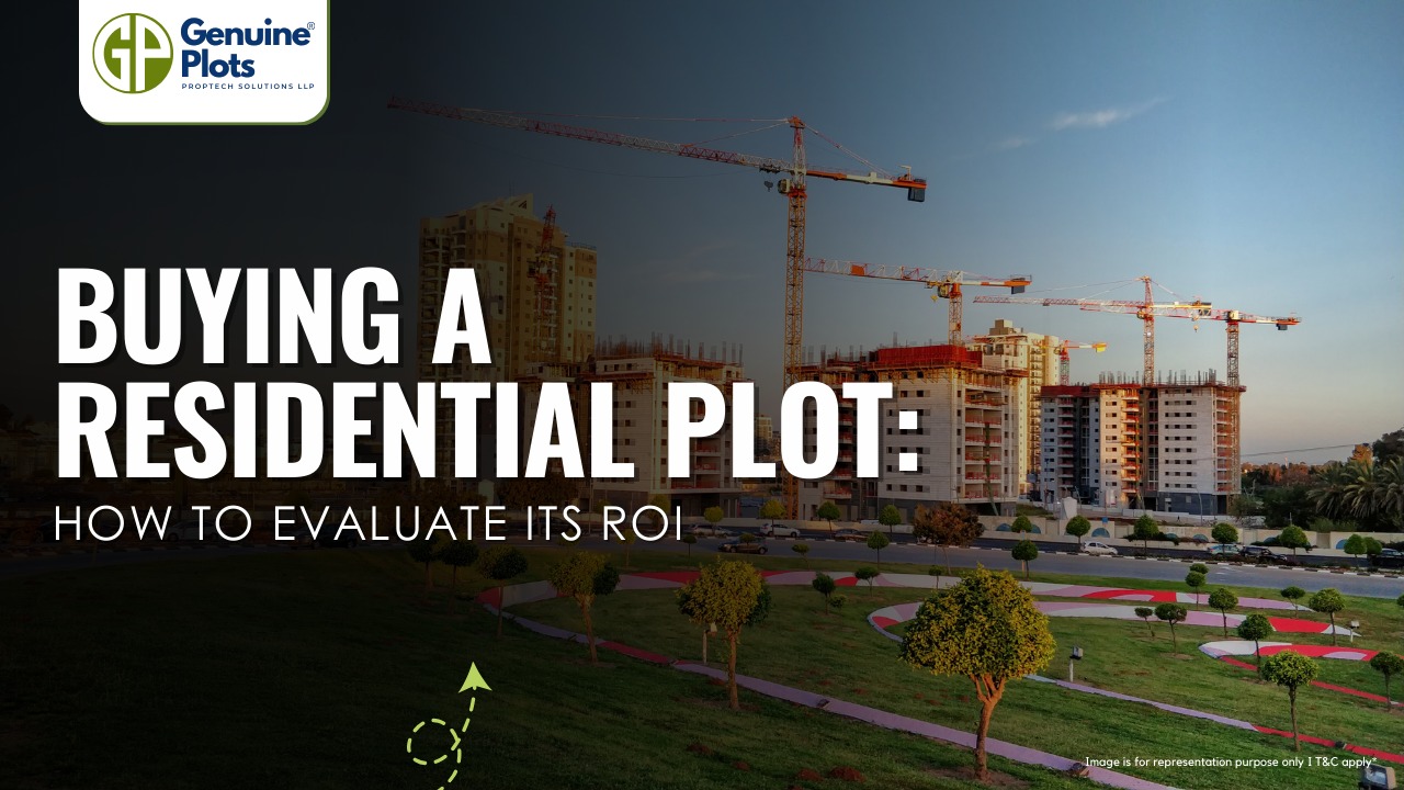
Buying a residential plot is often viewed as one of the most lucrative long-term investments. Unlike apartments, land does not depreciate with age and gives the owner the flexibility for usage in the near or far future. However, for the best ROI, several factors have to be looked into by the buyer before purchase.
1. Location Is the Biggest ROI Driver
Location is the most critical factor in determining the future value of a residential plot.
Distance to cities, employment and commercial centres.
Connectivity through highways, metro lines, and public transportation
Infrastructure plans like airports, IT parks, and industrial zones
Plots near developing corridors or future growth zones often appreciate much more in value than plots that are already saturated.
2. Infrastructure & Development Potential
A plot's ROI increases manifold times if surrounded by strong infrastructure or planned development like road access, electricity, water supply and drainage.
Development plans by the government or zoning upgrades
Areas where infrastructure is expanding normally show a faster price increase over time.
3. Legal Clarity & Verification of Title
No ROI is important with legal issues in the land. A clean title will provide both safety and resale value.
Verify:
- Clear ownership records
- Approved layout and zoning status
- Absence of disputes, encroachments, or acquisition notices
4. Market Demand & Buyer Profile
Being able to determine who would buy it or build on the plot in the future helps to estimate correct ROI.
Consider:
- Demand for villas/independent homes/ plotted development.
- Interest of the buyer - end-users vs investors
- Rental potential if you plan to build later
Plots in areas with high residential demand appreciate more and sell faster.
5. Plot Size, Shape & Usability
Not all plots are of equal value, even in the same location.
Check:
- Regular shape, proper road frontage
- Usable land area without reservations or access issues
- Compliance with local construction norms
6. Holding Period & Appreciation Timeline
Residential plots tend to perform better over a medium-to-long-term horizon in general.
Understand:
- Any short-term gains may be limited.
- Everything is represented symbolically:
- Long-term holding, usually in the range of 5–10 years, often sees very strong appreciation.
- Price growth is influenced by the completion times of infrastructure.
- Patience is a virtue in making land investments for ROI.
7. Cost Factors Beyond Purchase Price
For real ROI, calculate all the associated costs.
Account for:
- Stamp duty and registration charges
- Charges of development or maintenance
- Above all, expenses for property tax and fencing
Attention:
A realistic cost computation conveys a clearer picture of net returns.
8. Exit Strategy & Liquidity
An investment is successful only if you can exit profitably.
Ask yourself:
How easy will it be to resell this plot?
- Is there active demand in this location?
- Are properties in comparable plots selling for more?
9. Comparison with Other Investments
Residential plots have better performance compared to conventional investments over time for the following reasons:
- Limited availability of land
- Urban expansion
- Inflation-linked appreciation
However, unlike stocks or mutual funds, land requires much patience and due diligence.
Closing Thoughts
Calculating the residential plot's ROI is far beyond price appreciation. It requires a deep understanding of location dynamics, legal safety, infrastructure growth, and demand trends, with long-term planning being the keyword. A well-chosen plot in the right location may give excellent returns on flexibility and security. Before investing, always do a comprehensive study, consult experts where necessary, and select land with potential that will go hand in hand with your financial objective and future development plans.

When you buy or inherit a property — be it land, a home, or a commercial building — the initial sale deed/registry only records that a sale took place. But to be recognised as the legal owner in government records, there’s an essential follow-up step: Mutation, commonly known as Dakhil Kharij.
What Exactly Is Dakhil Kharij?
-
Dakhil means “entry/record,” and Kharij means “removal.” Together, they describe the process of entering the new owner’s name and deleting the previous owner’s name from official land/ property records.
-
It is essential after a sale, inheritance, gift, or partition — without it, official records may continue to show the prior owner, causing major issues later.
Why Dakhil Kharij Is Critical
-
Legal Ownership Proof — It confirms to the government (revenue department), banks, courts and other authorities that you are the rightful owner.
-
Correct Tax & Assessment Records — Taxes and dues become the responsibility of the legal owner post-mutation.
-
Easier Future Transactions — Whether you want to sell, gift, mortgage, or inherit the property later — proper mutation ensures smooth legal and financial transactions.
-
Loan & Mortgage Approvals — Banks and lenders almost always require mutation (Dakhil Kharij) as proof of clear ownership before approving home or property loans.
-
Avoids Disputes or Fraud — When records are mismatched, it can lead to legal conflicts or ownership disputes. Mutation helps prevent those.
Types of Properties Covered
Dakhil Kharij applies to:
- Agricultural land (farms, orchards)
- Residential plots, homes, apartments
- Commercial or industrial plots
- Vacant land or mixed-use plots
Documents Required for Dakhil Kharij
To apply for mutation, you usually need:
- Sale deed / Gift deed / Will (as proof of transfer)
- Identity proof (Aadhaar, PAN, Voter ID)
- Address proof
- Previous land-record copy or mutation certificate (if any)
- Tax receipts or related land tax documents
- Application form to the revenue department or the relevant authority
Paperwork and exact requirements can vary by state or region, but having complete documentation from the start helps avoid delays.
Typical Process & Timelines
-
Application submission (online or offline)
-
Verification by revenue officials (and sometimes field inspection)
-
Mutation entry update in government records/land database
-
Issuance of updated mutation certificate (digital or print)
Fee and timeline vary by state: sometimes mutation is completed within a few weeks, other times it may take longer, depending on document completeness and administrative workload.
What Happens If You Skip Dakhil Kharij?
-
The property may still appear under the previous owner’s name in official records.
-
It can cause major problems during sales, inheritance, legal disputes, or applying for a loan.
-
Banks may reject loan applications if ownership records are not updated.
-
You may remain liable for taxes or dues incurred before the mutation was carried out.
In short, registration (sale deed) is just the first step — mutation via Dakhil Kharij is what legalises your ownership on government records.
Final Word
For investors and land buyers — especially those dealing with plots, resale, or mortgage — updated mutation records are essential for a clean, secure, and transparent transaction.
How to Find Undervalued Land That Delivers High Returns: A Comprehensive Research Guide

Buying land is one of the most potent wealth-building strategies, only if one knows how to find undervalued parcels with clear upside potential. Unlike ready homes, land appreciates based on what the future could hold for it: infrastructure, zoning shifts, demand cycles, and strategic location advantages.
1. Begin with a sharp investment thesis
Undervalued land often lies in locations with future catalysts. Seek land supported by at least one powerful driver:
- Upside Triggers to Watch
- Upcoming infrastructure: metro corridors, new highways, airports, and ring roads.
- Zoning or FAR, FSI changes: when land-use changes from agricultural to residential/commercial.
- Government/bank distress sales: NPA auctions, DRT sales, liquidation cases.
- Peripheral but fast-growing pockets: areas just outside major development zones.
- Commercial clusters in the future: IT parks, universities, logistics hubs, and industrial zones.
Land in such pockets may be undervalued because current demand hasn't caught up with future potential.
2. Use Maps, Planning Documents & GIS Tools
Analyse the land using government and public data before visiting any site.
- Checklist of equipment needed to survey a location
- Google Maps / Google Earth : terrain, access roads, elevation, neighbourhood quality
- City development plan / Master Plan
- Infrastructure project tenders & DPRs: metro alignment, bridges, widened roads.
- Land-use zoning maps
- Satellite imagery to check encroachments, water bodies, and drainage issues
- Municipal land-value records
- Surrounding transaction data from registrars
These tools help eliminate 70% of “bad land” before ever stepping foot on it.
3. Best Places to Source Undervalued Land Deals
The best deals sometimes never make it onto property portals. They are often offered through the following channels:
a) Bank & Government Auctions
NPA auctions
IBAPI, e-auctions, bank disposal lists
Court/DRT auctions
These often sell 10–30% below market value — but require due diligence.
b) Farmers & Local Owners
Owners sell for various reasons in developing belts: moving, debts, and family division.
c) Off-market / Pre-announcement zones
Areas where large developers have started land aggregation tend to appreciate quite quickly.
d) Word-of-mouth & Local Networks
Local brokers, surveyors, talathi offices, and Gram Panchayats know which plots may soon enter the market.
4. Valuation Techniques to Identify Underpriced Land
Employ multiple valuation angles rather than relying on one price quote.
a) CMA - Comparable Market Analysis
Study:
- Recently registered sale deeds
- current plot rates in the neighbourhood
- Road width & frontage
- Terrain advantages
b) Residual Development Value
For land that could be developed, compute:
- (Future sale value of a project – construction cost – developer margin = Max. land value)
- If the current quote is far below this, then the land is undervalued.
c) Infrastructure Appreciation Estimate
Land near:
- Metro stations
- New highways
- Industrial clusters
usually sees significant appreciation once projects reach the 30–50% completion mark.
-
Legal Due Diligence (Non-Negotiable)
Never invest one dime without reviewing the following:
- Essential checks
- Clear Title Chain minimum 30 years
- Encumbrance Certificate (EC)
- Mutation / 7/12 extract / Khata
- Tax receipts paid to date
- Land-use category (agricultural, NA, residential, commercial)
- Pending litigation or acquisition notices
- NOCs are especially required if the area is near a forest, lake, or a restricted zone.
- A land deal is only undervalued if the title to it is clean.
-
Technical Due Diligence
Beyond paperwork, the land must be usable and build-friendly.
- Survey Checklist
- Quality of soil- rocky, clayey, black soil- foundation cost
- Flood risk mapping
- Water table depth
- Electricity and approach road access
- Slope, contour & drainage pattern
- Exact measurements by a licensed surveyor
- Bad soil or drainage can wipe out profits.
-
Understand Conversion and Permissions
The raw agricultural land might need
- NA Conversion (Non-Agricultural)
- CLU - Change of Land Use
- Layout approvals (for plotting)
Check the feasibility of conversion and the cost involved before purchasing.
Conclusion
Finding undervalued land isn't luck; it is a method. Combine map analysis, legal checks, infrastructure tracking, valuation discipline, and local intelligence, and the result is uncovering opportunities that others miss. The process described here is exactly followed by investors who consistently profit from land. If you do the same with patience and due diligence, you will find land that delivers strong, long-term returns.
Recent Posts
Tags
Bhunaksha,
genuine plots,
Land For Sale,
Maharashtra Bhunaksha,
plots for sale,
Gunthewari,
Gunthewari Land,
Gunthewari Rules,
Extract Documents,
Plots and Lands,
Saat Baara,
Extract Saat,
Baara Utara,
Jamabandi,
property tax payments,
Gram Panchayat,
lower prices,
non-agricultural land,
Lower Investment Cost,
Gram Panchayat lands,
Fresh Land Settlements,
Growing demand,
affordable homes,
genuine p,
legal Land,
bungalow plots,
Konkan,
Maharashtra,
Purandar,
Pune,
Karnataka,
Bangalore,
Farm Land,
Kolkata,
Rajarhat,
Indore,
Chhatrapati Sambhajinagar,
Aurangabad,
Mundhwa,
Agricultural Land,
Farmhouse Plot,
Rules And Penalties,
Residential Plots,
NA PLots,
Residential NA Plots,
Commercial NA Plots,
Animal Husbandry Land,
Tathawade,
Vahivat Land Maps,
Vahivat,
Indian Land Records,
Ownership Rights,
Red zone,
PCMC,
Dehu Road,
Land Registration Rules,
Land Investing,
Infrastructure Growth,
Land Ownership,
Land Encroachment,
Panshet Dam,
Varasgaon Dam,
Verified Land,
Plot For Sale,
Land Investment,
Verified Plots,
Land Acquisiton,
Hydrological Survey,
Invest In Land,
Verified Land Plots,
Panshet,
Khadakwasla,
Land Rules,
Dakhil Kharij,
Land Registry,
Property Onwership,
Clean Title Check List,
Property Verification,
Digital Registry,
Farm Plots,
Agro Property,
Land Value Growth,
Urban Expansion,
Senapati Bapat Road,
Registered Land,
Agricultral Plot,
Purandar Airport,
Safe Investment,
Secure Property,
Plot Buyers,
Approved Plots,
Land ROI,
NA Approved Plots,
NA Land,
Welspun One,
Logistic Park,
Talegaon,
PMC Bharat Mandapam,
Urban Development,
Lohgaon,
Close To Nature,
Gated Community Plots,
Buy Land VS Gold Investment,
NRI Investment,
Future Ready Living,
Trusted Plots,
Plot Investment,
Authentic Land,
Safe Land Buying,
Mumbai,
Premium Plots,
MMR Land Investment,
MMR Infrastructure,
Metro Connectivity,
Plots in Mahabaleshwar hill station investment,
Mahabaleshwar land prices and future growth,
Scenic residential plots in Mahabaleshwar,
Mumbai 3.0,
Mumbai 3.0 vs Mumbai 2.0,
Mumbai property investment,
Real estate investment in Mumbai,
Upcoming residential projects in Mumbai,
CIDCO plot auctions,
CIDCO auction Navi Mumbai,
Upcoming CIDCO plot auctions 2026,
CIDCO land auction dates,
Navi Mumbai plot auctions,
CIDCO plots in Navi Mumbai,
CIDCO plots in Kharghar,
CIDCO plots in Ulwe,
NMIA investment opportunities,
Mumbai 3.0 plotted development,
Mumbai 3.0 real estate,
Plots in Mumbai 3.0,
Land investment in Maharashtra,
Residential plots near Mumbai,
Land appreciation in Mumbai 3.0,
Residential land for sale in Mumbai 3.0,
Altamura NA Plots,
Altamura Nadar City,
NA Plots in Nadar City,
Nadar City Plots,
Plots in Nadar City,
YEIDA plots,
YEIDA plots near Noida Airport,
Noida Airport plots,
Jewar Airport investment,
Yamuna Expressway plots,
YEIDA plot scheme 2026,
Noida Airport real estate,
Zepto,
Zepto effect,
D2C brands India,
Urban consumer trends,
Marketplace evolution,
Urban infrastructure growth,
YEIDA Residential Plot Scheme,
Yamuna Expressway Plot Scheme,
YEIDA Residential Plots,
Yamuna Expressway Authority,
Noida Investment,
Residential Plots in Lucknow,
LDA Plots in Lucknow,
Lucknow Real Estate,
LDA Approved Plots,
Plots for Sale in Lucknow,
Lucknow Property Investment,
Land Investment in Lucknow,
Residential Land in Lucknow,
Buy Plot in Lucknow,
Lucknow Development Authority,
Maharashtra Fragmentation Law 2025,
Fragmentation Act Maharashtra,
Maharashtra land law update 2025,
Maharashtra land reforms 2025,
Land subdivision rules Maharashtra,
Maharashtra agriculture land purchase rules,
Agricultural land purchase restrictions Maharashtra,
Can non-farmers buy agricultural land in Maharashtra,
NA conversion process Maharashtra,
Collector permission for land purchase,
farmland prices in Nagpur,
agricultural land price in Nagpur per acre,
farmland cost in Nagpur Maharashtra,
Nagpur agricultural land investment,
per acre agricultural land rate in Nagpur,
Tukdebandi Law Maharashtra,
Maharashtra Fragmentation Act update,
Land subdivision law Maharashtra,
Agricultural land division Maharashtra,
Maharashtra land reform ordinance,
Plot registration Maharashtra,
Farmland prices Nagpur,
Nagpur agricultural land rates,
Farmland per acre Maharashtra,
Agricultural land price Nagpur,
Farm land cost Nagpur,
Nagpur real estate trends,
Land investment Nagpur,
Avani Farms,
Avani Farms Pune,
Farmland near Pune,
Farm plots for sale,
Agricultural land investment,
Gated farmland near Pune,
NRI agricultural land rules India,
Can NRI buy agricultural land in India,
FEMA rules for NRI property purchase,
RBI guidelines for NRI land investment,
NRI farmland investment India,
Agricultural land purchase by NRI,
Maharashtra Fragmentation Act,
Minimum plot size in Maharashtra,
Guntha rules Maharashtra,
Agricultural land division rules,
Minimum land area for sale in Maharashtra,
Legal plot size in guntha,
Guntha conversion rules,
NRI land purchase in India,
Can NRIs buy agricultural land in India,
NRI property investment India,
NRI buying residential land,
NRI real estate guidelines India,
Investment tips for NRIs in India,
Mutation Entry Process,
Land Mutation in India,
Property Mutation Process,
Land Ownership Transfer,
1 guntha na plot prices in pune 2026,
1 guntha plot price in pune,
na plots in pune,
residential na plots pune,
guntha plot rate in pune,
na plot investment in pune,
plots near purandar airport,
1 Acre Land Price in Pune,
Pune Land Rates 2025,
Pune Land Price 2026,
Pune Acre Land Cost,
Land Value Pune,
Agricultural Land Price Pune,
gated community plots in Hinjewadi,
Hinjewadi plots for sale,
residential plots in Hinjewadi Pune,
premium plots in Hinjewadi,
plots near Rajiv Gandhi Infotech Park,
land for sale in Hinjewadi Pune,
Pune property investment,
plots for sale in Pune below 5 lakhs,
Pune rural land investment,
gated plotting projects Pune,
MIDC growth corridor plots,
Residential plots for sale in Hinjewadi,
Plots in Hinjewadi Pune,
Land for sale in Hinjewadi,
Residential NA plots Hinjewadi,
Hinjewadi real estate trends 2026,
Nashik land investment,
Trimbakeshwar land for sale,
Simhastha Kumbh 2026,
Simhastha Kumbh 2027 real estate impact,
Trimbakeshwar property investment,
Land appreciation in Nashik,
plots for sale in pune,
types of plots in pune,
residential plots in pune,
agricultural land in pune,
villa plots in pune,
NRI agricultural land purchase India,
NRI property investment in India,
Agricultural land rules for NRIs,
NRI real estate investment India,
NA plot meaning,
what is NA land,
NA land in Maharashtra,
land investment guide,
NRI agricultural land in Telangana,
Telangana land laws for NRI,
Telangana real estate laws,
NRI investment guide Telangana,
Legal compliance for NRI property,
NRI farmhouse purchase India,
RBI guidelines for NRI property,
NRI land buying rules,
Godham Eco Village,
Godham Eco Village for NRIs,
NRI land investment in India,
Investment plots for NRIs,
Secure land investment India,
NRI property buying guide,
plots in Pune,
NRI buying property in India,
NRI guide to buying land in Pune,
NRI land investment in Pune,
NRI property documents checklist,
Maharashtra land reform 2025,
Maharashtra land laws update,
Agricultural land rules in Maharashtra,
Buying agricultural land in Maharashtra,
Non-agricultural land conversion Maharashtra,
Maharashtra agricultural land rules 2024,
agricultural land purchase in Maharashtra,
non agriculturist land purchase rules,
who can buy agricultural land in Maharashtra,
Maharashtra land laws for non farmers,
Guntha based land rules,
Minimum guntha rule Maharashtra,
Maharashtra land laws,
Maharashtra agricultural land laws,
farmland investment Maharashtra,
buying farmland legally in Maharashtra,
NA conversion rules Maharashtra,
agricultural land eligibility criteria,
Property Mutation in India,
Land Record Update,
Revenue Records,
Property Ownership Transfer,
Mutation of Property,
Farmhouse Plots Near Pune,
NRI Investment in Pune,
Pune Real Estate,
Plots for Sale Near Pune,
Luxury Farmhouse Plots,
Pune plot scams,
Plot buying checklist,
Legal verification for plots,
NA plot verification,
Plot buying tips Pune,
Godrej Properties,
Evora Estate Panipat,
Luxury plots in Panipat,
Premium land investment,
Residential plots in Panipat,
Lodha Developers,
Lodha Developers Q3 acquisition,
Lodha land parcels Q3,
Indian real estate news,
New residential projects India,
Real estate investment news,
Premium housing projects,
Srijan Group,
Kolkata Tech Park,
Commercial Real Estate,
Real Estate Investment,
Real Estate Deal News,
NRI investment in India,
NRI land investment,
Plots for sale in India,
NRI property investment,
Can NRI buy residential plot in India,
NRI land purchase rules,
Residential plots for NRIs,
NRI real estate investment,
NRIs buying property in India,
Can NRIs buy plots in India 2026,
RBI rules for NRI property purchase,
NRI land investment rules,
MMR 3.0,
MMR real estate 2026,
Mumbai real estate market,
Navi Mumbai investment,
Thane property market,
Mumbai property trends 2026,
Land investment in MMR,
Mumbai smart city project,
Korea Mumbai partnership,
MMRDA infrastructure projects,
Korean investment in India,
MMR GDP growth,
MMR economic roadmap 2030,
Mumbai real estate,
Public private partnership projects Mumbai,
Investment opportunities in MMR,
Mumbai Metropolitan Region,
Mumbai urban development,
MMR 2047 vision,
Mumbai infrastructure projects,
Navi Mumbai development,
Goa property investment,
Invest in Goa 2026,
Goa real estate market 2026,
Best places to invest in Goa,
North Goa property,
Property appreciation in Goa,
Goa plots for sale,
Commercial property in Goa,
Buy property in Goa,
YEIDA plots 2026,
Residential plots in YEIDA,
YEIDA new scheme update,
Plots near Noida International Airport,
Yamuna Expressway Authority plots,
YEIDA housing scheme details,
Lucknow land investment,
Property in Lucknow,
Buy plots in Lucknow,
Nashik plots for sale,
Kumbh Mela 2026 Nashik,
Land investment in Nashik,
Nashik property market 2026,
Plots near Kumbh Mela Nashik,
Residential plots in Nashik,
Upcoming projects in Nashik,
Property appreciation in Nashik,
Maharashtra land investment,
Nashik Kumbh Mela 2026,
Kumbh Mela investment opportunities,
Infrastructure development in Nashik,
Plots near Nashik Kumbh Mela,
High ROI land investment,
MIHAN,
MIHAN Nagpur,
Nagpur Real Estate,
Agricultural Land Nagpur,
Nagpur Property,
Plots Near In MIHAN,
Pune residential plots,
best areas to buy plots in Pune,
Pune land investment,
investment plots in Pune,
buy land in Pune,
real estate investment in Pune,
Godrej Plots Doddaballapur,
Doddaballapur plots for sale,
Plots in North Bangalore,
Godrej Properties plots,
Residential plots in Doddaballapur,
Investment plots near Bangalore,
Gated community plots Bangalore,
Premium plots in Doddaballapur,
plots in Mahabaleshwar,
Mahabaleshwar villa plots,
farmhouse plots in Mahabaleshwar,
land for sale in Mahabaleshwar,
bungalow plots in Mahabaleshwar,
hill station property investment,
agricultural land in Mahabaleshwar,
premium land in Mahabaleshwar,
Plots in Pune under 3 lakhs for sale,
Budget residential plots near Pune,
Low cost plots near Pune highway connectivity,
plots in Pune under 3 lakhs,
farmland plots near Pune city,
Investment plots near Pune under budget,
Residential land near Pune,
Godrej plots in Pune,
Premium plotted development by Godrej in Pune,
Residential land for sale by Godrej,
Premium plot by Godrej,
Plots for sale in Hadapsar Pune,
Residential plots in Hadapsar,
Investment plots in Hadapsar,
Gated community plots in Hadapsar,
Ready to build plots in Hadapsar,
1 Guntha plot in Pune,
1 Guntha plot in Pune for sale,
1 Guntha plots near Pune city,
Residential 1 Guntha land in Pune,
Clear title 1 Guntha plot in Pune,
1 guntha plot price in village,
village plot rate per guntha,
affordable 1 guntha land in rural area,
residential plot in village Pune,
farmland plot price per guntha,
Residential 1 Guntha plot near Pune city,
Investment plots in Pune 1 Guntha,
Clear title 1 Guntha land in Pune,
Agricultural 1 Guntha plot near Pune,
1 Guntha plot in Pune Katraj for sale,
Residential plot in Katraj Pune 1 Guntha,
Katraj Pune land for home construction,
1 Guntha NA plot in Katraj Pune,
Pune Katraj plot near highway connectivity,
Gated plot project in Katraj Pune,
NA plots in Pune under 10 lakhs,
Affordable NA plots near Pune city,
NA residential plots in Pune,
NA approved plots in Pune under 10 lakhs,
Investment plots in Pune under 10 lakhs,
Residential NA plots near Pune highway,
Best plots in Pune below 10 lakhs,
Premium villa plots in Pune,
Residential villa plots in Pune near city outskirts,
Luxury villa plots in Pune,
Gated villa plot project in Pune,
Villa plot site visit in Pune,
NA plots in Pimpri Chinchwad for sale,
Residential NA plots in PCMC area,
NA approved plots in Pimpri Chinchwad,
NA land with clear title in PCMC,
NA plots near Pune Mumbai Highway PCMC,
Godrej Villa Plots Doddaballapur,
Godrej plotted development Bangalore,
villa plots in North Bangalore,
premium villa plots Bangalore,
Godrej Properties plots Bangalore,
Brigade Plots Malur,
Brigade Malur plots,
plots in Malur East Bangalore,
investment plots in East Bangalore,
residential plots in Malur Bangalore,
Brigade Group plots Bangalore,
land investment in East Bangalore,
gated community plots in Malur,
prestige plots devanahalli,
prestige plots in devanahalli bangalore,
plots for sale in devanahalli,
prestige plots investment,
premium plots in devanahalli,
residential plots near kempegowda airport,
What is NA plot in real estate,
NA land meaning in property,
NA approved plotsDifference between NA and agricultural land,
Buying NA plots in Maharashtra,
NA plot vs agricultural land,
Plot prices in Mysore,
Mysore infrastructure projects,
Mysore property investment,
Land investment in Mysore,
Plot investment opportunities,
land buying guide in goa,
buy land in goa,
plots for sale in goa,
legal process to buy land in goa,
property in goa,
residential plots in goa,
Nashik Simhastha Kumbh Mela 2026,
Sadhugram expansion Nashik,
Maharashtra Kumbh Mela planning,
Nashik Kumbh Mela preparations,
tourism development in Nashik,
plots in Nagpur,
Nagpur plot investment,
land for sale in Nagpur,
residential plots in Nagpur,
golden rules before buying plots in Nagpur,
Nagpur land investment,
plot investment in Nagpur,
land investment in Nagpur,
plots for sale in Nagpur,
best areas to buy plots in Nagpur,
buying plots in Nagpur,
plot purchase checklist,
legal checklist for buying land,
documents required for plot purchase,
NA plots in Nagpur,
Tattvana,
Tattvana in Kamshet,
Moregaon Farmland Estates,
farmland investment Pune,
agricultural land investment,,
farmland for sale near Pune,
farm plots in Pune,
gated farmland projects,
agricultural plots Maharashtra,
open plot vs NA plot,
difference between open plot and NA plot,
what is NA plot in India,
open plot meaning in real estate,
NA land vs agricultural land,
residential NA plots benefits,
land investment in India,
buying NA plot vs open land,
capital gains on agricultural land,
rural vs urban agricultural land tax,
agricultural land tax rules India,
capital gains tax India property,
is agricultural land taxable,
rural agricultural land exemption,
urban agricultural land tax India,
Runwal Enterprises Alibaug township,
Alibaug real estate,
coastal real estate India,
township projects in Alibaug,
luxury properties in Alibaug,
Mumbai weekend homes investment,
Alibaug property investment,
isprava south goa,
ultra luxury villas in goa,
south goa real estate,
luxury homes in goa,
isprava projects goa,
premium villas in south goa,
land investment advisory services,
secure land investment,
real estate advisory services,
verified land deals,
investment plots near Pune,
land buying guide India,,
#KanpurRealEstate,
#KDAPlots,
#KanpurProperty,
#RealEstateKanpur,
#PropertyTrends,
Gokul Plots investment,,
real estate investment Gokul,,
plots with high appreciation potential,
smart land investment strategies,
plots for sale in North Bangalore,
land investment Bangalore,,
emerging areas in North Bangalore,
residential plots Bangalore,,
Bangalore real estate investment,,
North Bangalore property trends,,
plots near airport Bangalore,,
HUDA plots in Gurgaon,
HUDA plots in Faridabad,
residential plots Haryana,
HUDA approved plots,
plots for sale in Gurgaon,
plots in Faridabad investment,
Prestige Marigold plots,,
Bangalore plotted developments,
land investment Bangalore,
best plots in North Bangalore,
#PlotsForSaleInNellore,
#NelloreRealEstate,
#NellorePlots,
#RealEstate2026,
#PropertyInvestment,
#NelloreProperty,
#AndhraPradeshRealEstate,
GMADA E Auction 2026,
GMADA plots Mohali,
plots in Mohali for sale,
GMADA Mohali auction process,
buy plots in Mohali,
Punjab property investment,
GMADA scheme 2026,
Mohali real estate,
HSVP plots 2026,
HSVP plot investment,
HSVP plots Haryana,
land investment benefits,
residential plots investment,
government approved plots,
buy plot in New Chandigarh,
flats in New Chandigarh,
New Chandigarh real estate,
property investment in New Chandigarh,
residential plots in New Chandigarh,
apartments in New Chandigarh,
#WaveCityGhaziabad,
#GhaziabadPlots,
#PlotsInGhaziabad,
#NCRRealEstate,
#RealEstateInvestment,
#ResidentialPlots,
APIIC vacant plots,
APIIC plots for sale,
industrial plots in Andhra Pradesh,
commercial land for MSMEs,
startup investment plots,
APIIC industrial land,
HUDA plots,
HUDA plots investment,
property appreciation,
plot investment benefits,
high return property investment,
land appreciation,
#GDAPlotsInGhaziabad,
#PlotsForSaleInGhaziabad,
#ResidentialPlotsGhaziabad,
#InvestmentPlots,
#RealEstateGhaziabad,
#GDAApprovedPlots,
#BaliProperty,
#PropertyInBali,
#IndiansInBali,
#BaliRealEstate,
#InternationalPropertyInvestment,
buy plots in Sarjapur Road Bangalore,
plots in Sarjapur Road,
residential plots in Sarjapur Road,
land for sale in Sarjapur Road Bangalore,
investment plots in Bangalore,
plots near IT corridor Bangalore,
how Indians can buy property in Bali,
buy property in Bali for Indians,
Bali property investment,
property in Bali for Indian buyers,
Bali real estate guide,
foreign property investment Bali,
legal checks before buying property in Bali,
Indians invest in Bali property,
due diligence for Bali property,
Bali real estate for Indians,
Bali property legal verification,
verified farmland plots,
100% verified farmland plots,
farmland investment India,
legal farmland plots,
farmland plots for sale,
Konkan land investment,,
high-growth corridors Maharashtra,
land investment 2026,
plots for sale in Maharashtra,


