Prev Post
Maharashtra Building Bye Laws for Safe Construction
Zoning is like a map the government makes to organize how land can be used. It's really important for planning our towns and cities. Here's a simple explanation for everyone:
What is Zoning?
Zoning is when the government rules what you can do on different pieces of land. They do this to make sure land is used properly and safely. Without zoning, things could get messy, and people might build things anywhere they want.
How Zoning Works:
Zoning divides land into different categories:
- Residential: This is for houses and places where people live.
- Commercial: It's for businesses like shops and offices.
- Agricultural: This is for farming.
- Industrial: It's for factories and heavy machines.
- Public: These areas are for things like schools and parks.
- Mixed Use: This is when you have a mix of homes and businesses in one area.
Colors and What They Mean:
Zoning maps use colors to show what each area is for:
- Light Yellow: It's for homes.
- Dark Yellow: This is mixed - you can have some stores and services here.
- Red: This is for schools, temples, and public stuff.
- Green: Green areas are for nature like parks and forests.
- Light Blue: It's for offices and business areas.
- Dark Blue: This is where you find malls and places to eat.
- Light Purple: It's for factories and industry.
- Dark Purple: This is for high-tech stuff.
- Gray: It's for really heavy industry.
Patterns on Maps:
Sometimes, you'll see patterns on the map:
- Cross Hatches: Means it's for houses.
- Slanted Lines: This is for businesses.
- Points, Diamonds, Stars: These show land for different things like industry or transportation.
- Vertical Lines: It's for public things like schools.
- Stipple Patterns: These are for parks and fun places.
- Curved Lines: For farming areas.
Final Thoughts:
In India, zoning is a bit different. Sometimes, you can have houses and businesses together. The main idea is to keep things organized and safe. Zoning helps our cities and towns work better, so everyone can live and work happily.
Top High-Growth Corridors in Maharashtra & Konkan for Land Investment in 2026

Investment in land in Maharashtra is shifting to a new phase of momentum with the transformation of infrastructure, industrialisation, and tourism-driven growth. As we look forward to 2026, we are seeing investors increasingly looking at key corridors driven by enhanced connectivity upgrades and growth initiatives taken by the government. The Konkan region, which is next to Maharashtra, is also showing signs of becoming another key location with tourism and large-scale growth drivers.
Raigad–Pen Growth Centre: A Rising Power Zone
Raigad Pen has witnessed growing interest in land investment due to its close proximity to the upcoming Navi Mumbai International Airport. New initiatives taken by FDI are making this region one of the most promising sectors for investments in residential layouts as well as for acquiring industrial plots of land.
Nashik’s Trimbak Road & Pathardi Phatha: A 2027-Ready Growth Corridor
The city of Nashik is witnessing unprecedented growth and development in the run-up to the 2027 Kumbh Mela. The city's major roads, such as the Trimbak Road and the Pathardi Phatha, are witnessing road widening and smart city developments, as well as the establishment of many new commercial establishments. The area of Pathardi Phatha is witnessing the development of a hybrid industrial and residential area.
The Mumbai–Nagpur Expressway: Unlocking Tier-2 Investment Potential
The Mumbai–Nagpur Expressway has become a catalyst for opening up central Maharashtra. Enhanced logistics efficiency is turning several Tier-2 and Tier-3 towns into industrial magnets. The expressway is reshaping movement between metros and facilitating rapid urbanisation in intermediate regions, making land along the corridor highly sought after.
Pune Peripheral Growth Belt: Kondhwa & Emerging East Pune Zones
The city of Pune has remained an unstoppable real estate hotspot in the country. The peripheral areas, such as Kondhwa, have now been recommended as promising zones due to the infrastructure development and rising residential demands in the region. Established locations such as Kharadi and Balewadi have remained successful due to the economic growth generated by the IT industry; however, the outskirts have now begun to emerge as promising locations.
Konkan’s Coastal Belt: A New Hub for Tourism-Driven Appreciation
The Konkan belt is fast becoming the most promising zone in the country due to its rising popularity as a hub for tourism-driven investments. The development of the coastal highways, as well as the rise of eco-tourism and hospitality projects, has begun to generate increased demand for the purchase of picturesque tracts of land in the region.
Key Drivers Powering 2026 Land Investment
- Infrastructural Development
Development of new expressways, airport facilities, and coastal routes, particularly the Mumbai-Nagpur Expressway, is opening new towns to investment opportunities while shortening travel times in the state of Maharashtra.
- Industrialisation
Development of new industrial hubs along routes such as Pune, Raigad, and Nashik is creating new opportunities for new industries, logistics, and warehousing facilities, thereby creating demand for both industrial and residential land.
- Expansion of Tourism Infrastructure
Increased tourist activity in the Konkan belt, coupled with the upcoming Kumbh Mela in Nashik in 2027, provides a promising opportunity for land investment in the state of Maharashtra.
Conclusion
Land investment opportunities in Maharashtra, as well as the Konkan belt, are likely to be driven by infrastructural alignment, industrialisation, and tourism activities in the state of Maharashtra until the year 2026. Raigad-Pen, Nashik, Pune, as well as the Mumbai-Nagpur Expressway, are some of the best opportunities for land appreciation in Western India, and investors are likely to reap huge benefits as the regions develop into hubs of economic activity in the coming years.

Investors across India are increasingly looking beyond urban apartments and commercial complexes, turning their attention to the long-ignored farmland sector. Rising land prices, demand for sustainable living, and scarcity of clean, titled land have pushed farmland investment into the mainstream. Regions like Maharashtra, Konkan, and emerging belts across the country are witnessing a surge in investor interest.
In the past, the purchase of land in India has always been a risky proposition because of the lack of clarity in ownership and documentation. The 100% verification process acts as a safety net in this regard. This includes tracing the title, checking for encumbrances, verifying mutations, and zoning compliance. The plots are verified before they are offered, making them much more reliable and less risky than other options.
Legal Clarity and Transparency as Key Drivers
However, land verification is not just about paperwork; it also includes checking restrictions on land use, different kinds of agricultural use, and construction permissions. Due to stricter rules from the government in schemes like PMRDA and RERA, the need for clean and verified land is on the rise. Investors are looking for transparency in their decisions, and verified plots of farmland are just what this new wave of optimism demands.
How Verified Farmland Unlocks Long-Term Appreciation
Infrastructure development—new highways, airports, industrial zones, and tourism corridors—is opening up previously undervalued regions. Verified farmland in these high-growth corridors ensures that appreciation is not just possible but predictable. Since the land is development-ready, it positions investors to capitalise on the rising demand for weekend homes, eco-retreats, and resort-style living.
A Shift Toward Sustainable and Legacy-Oriented Investments
Modern investors increasingly seek assets that build long-term value. Farmland investments offer the opportunity to create a legacy—whether through agriculture, hospitality projects, or future residential development. With verification processes eliminating ambiguity, farmland has transformed from a high-risk category to a prime, growth-oriented asset class.
Important Due Diligence Checks Before Indians Invest in Bali Property

Investing in properties located in Bali can yield significant returns. However, the investor should conduct proper due diligence before making such an investment. Indian nationals or any foreign buyers must also ensure they perform the necessary legal and financial checks on properties being considered for purchase in order to avoid any potential risks and document a safe transaction during the acquisition of the property.
Verify Land Title Ownership
The first and most critical step is verifying land title ownership. Authentic Indonesian Land Titles must be correctly recorded with the National Land Office of Indonesia. The buyer also has to confirm that the property seller is the actual owner of the land and that there exists a valid title (i.e., Hak Pakai or Hak Guna Bangunan types of title) to the property before proceeding with the purchase/closing of the real estate transaction on behalf of a third party.
Understand Zoning Laws and Land Use Regulations
In Bali, zoning laws are in effect that stipulate the permissible usage of land. Different land zones are designated for commercial uses, residential uses, or agricultural uses. If you purchase land in an area where commercial activity is prohibited, you may find yourself unable to construct your resort and/or hotel and/or other types of businesses.
Check for Legal Disputes and Financial Liabilities
Another critical step is to verify that the property is free and clear of any legal disputes or outstanding debts. Investors should also conduct a legal search of the property to confirm that it is not subject to any kind of legal actions, such as lawsuits, ownership disputes or financial obligations like delinquent taxes or debt owed.
Evaluate Infrastructure and Accessibility
Infrastructure access is another important consideration for buyers. Buyers should also determine if there are appropriate roads, electricity connections, water supply and drainage systems for the property they wish to purchase. If there is insufficient infrastructure present, this will likely decrease the value of the property and increase the amount of money required to develop the property.
Foreign buyers should also thoroughly review all contracts and leases associated with a piece of real estate prior to making their purchase. All legal documents that relate to your purchase of a piece of real estate should establish the length of time during which you have the right to own that piece of real estate, the terms under which you can renew your right to own that piece of real estate, the payment timeline, and the procedure for resolving disputes. Having an experienced and knowledgeable attorney working with an investor during the negotiation process can assist the investor in protecting their interests.
It is also a good idea to study the market where you will be investing, as well as the trends of tourism activity around that location. Highly demanded areas for tourism typically provide the best return on rental for your villa or holiday home.
Summary
Conducting ample due diligence prior to purchasing property within Bali provides Indian investors with a way to reduce risk with their investment and allows them to make educated decisions regarding their investment characteristics. When verified and professionally guided on your purchase, Bali is still one of the most desirable locations of international real estate investment for foreign lifestyle and/or investment buyers.

Property investment in Bali has become increasingly popular among international buyers. For Indian investors, the island offers excellent opportunities in tourism-driven real estate such as villas, rental apartments, and hospitality properties. However, purchasing property in Bali requires following several legal and administrative steps to ensure a secure investment.
The first step for Indian investors is choosing the correct ownership structure. As Indonesian law does not allow foreigners to directly own freehold land, buyers must select an alternative, such as Hak Pakai (Right to Use), a leasehold agreement, or ownership through a PT PMA company if the property is intended for business purposes.
Finding the Right Property in Bali
After the ownership structure is in place, you will want to consider your next step - finding a suitable property. Bali has numerous properties available, such as beachside villas, high end resorts, residential land and investment properties within tourist areas. Things to consider when evaluating property are location, how mature the surrounding area is with respect to infrastructure, current levels of demand for tourism, expected rental yields, and possible resale of the property.
Verifying Property Documents and Legal Status
The third step involves completing legal due diligence. Legal due diligence helps identify any issues with the title on the property, ensure there are no claims or disputes associated with the property, and ensure any zoning laws allow for the intended purpose of the property, etc. Typically, a lawyer will verify title certificates, land use permits, and any encumbrances on the property before completing the purchase.
Finalising the Property Purchase Agreement
After the verification process is complete, the buyer and seller move forward with the purchase agreement. This agreement outlines the price, payment schedule, legal rights, and obligations of both parties. The document should always be reviewed by a qualified legal advisor to avoid future complications.
The next step is payment and contract finalisation. Payments are usually made in stages according to the agreed terms. Once the transaction is completed, the ownership or usage rights must be formally registered with the Indonesian land authority.
Summary
In conclusion, an investor has a responsibility to comply with tax obligations as well as regulatory obligations regarding property transactions in Indonesia. There are various taxes paid in connection with a property transaction, depending on the type of ownership or type of property purchased.
These steps are very important for Indian investors to minimise their legal exposure concerning their purchase of property in Bali to maximise the potential for their investment to provide either rental income or appreciation over time, if good planning processes are applied.
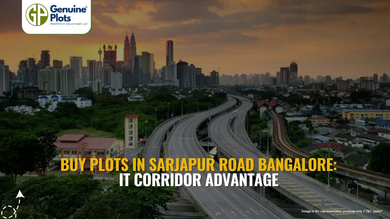
Why should I buy plots in Sarjapur Road, Bangalore?
You should buy plots in Sarjapur Road, Bangalore, because of its strategic location between major IT hubs like Whitefield and Electronic City, offering high appreciation potential and strong demand from professionals.
What is the price range for plots for sale in Sarjapur Road, Bangalore?
Plots for sale in Sarjapur Road, Bangalore typically range from ₹60 lakh to ₹2.7 crore, with an average rate of around ₹7,400 per sq. ft., depending on location and amenities.
Are residential plots in Sarjapur Road, Bangalore, a good investment?
Yes, residential plots in Sarjapur Road, Bangalore, offer excellent long-term returns, with projected appreciation of 15–18% annually due to rapid infrastructure growth and IT corridor demand.
What are the benefits of villa plots in Sarjapur Road, Bangalore?
Villa plots in Sarjapur Road, Bangalore, allow buyers to build customised homes in premium gated communities while enjoying modern amenities, security, and a high-quality lifestyle.
Is it better to buy land in Sarjapur Road, Bangalore, than flats?
Yes, choosing to buy land in Sarjapur Road, Bangalore, offers better long-term appreciation and flexibility compared to flats, which may depreciate over time.
Who should invest in plots in Sarjapur Road, Bangalore?
Plots for sale in Sarjapur Road, Bangalore, are ideal for IT professionals, long-term investors, and homebuyers looking for high-growth residential plots in Sarjapur Road, Bangalore, with strong connectivity.
Recent Posts
Tags
Bhunaksha,
genuine plots,
Land For Sale,
Maharashtra Bhunaksha,
plots for sale,
Gunthewari,
Gunthewari Land,
Gunthewari Rules,
Extract Documents,
Plots and Lands,
Saat Baara,
Extract Saat,
Baara Utara,
Jamabandi,
property tax payments,
Gram Panchayat,
lower prices,
non-agricultural land,
Lower Investment Cost,
Gram Panchayat lands,
Fresh Land Settlements,
Growing demand,
affordable homes,
genuine p,
legal Land,
bungalow plots,
Konkan,
Maharashtra,
Purandar,
Pune,
Karnataka,
Bangalore,
Farm Land,
Kolkata,
Rajarhat,
Indore,
Chhatrapati Sambhajinagar,
Aurangabad,
Mundhwa,
Agricultural Land,
Farmhouse Plot,
Rules And Penalties,
Residential Plots,
NA PLots,
Residential NA Plots,
Commercial NA Plots,
Animal Husbandry Land,
Tathawade,
Vahivat Land Maps,
Vahivat,
Indian Land Records,
Ownership Rights,
Red zone,
PCMC,
Dehu Road,
Land Registration Rules,
Land Investing,
Infrastructure Growth,
Land Ownership,
Land Encroachment,
Panshet Dam,
Varasgaon Dam,
Verified Land,
Plot For Sale,
Land Investment,
Verified Plots,
Land Acquisiton,
Hydrological Survey,
Invest In Land,
Verified Land Plots,
Panshet,
Khadakwasla,
Land Rules,
Dakhil Kharij,
Land Registry,
Property Onwership,
Clean Title Check List,
Property Verification,
Digital Registry,
Farm Plots,
Agro Property,
Land Value Growth,
Urban Expansion,
Senapati Bapat Road,
Registered Land,
Agricultral Plot,
Purandar Airport,
Safe Investment,
Secure Property,
Plot Buyers,
Approved Plots,
Land ROI,
NA Approved Plots,
NA Land,
Welspun One,
Logistic Park,
Talegaon,
PMC Bharat Mandapam,
Urban Development,
Lohgaon,
Close To Nature,
Gated Community Plots,
Buy Land VS Gold Investment,
NRI Investment,
Future Ready Living,
Trusted Plots,
Plot Investment,
Authentic Land,
Safe Land Buying,
Mumbai,
Premium Plots,
MMR Land Investment,
MMR Infrastructure,
Metro Connectivity,
Plots in Mahabaleshwar hill station investment,
Mahabaleshwar land prices and future growth,
Scenic residential plots in Mahabaleshwar,
Mumbai 3.0,
Mumbai 3.0 vs Mumbai 2.0,
Mumbai property investment,
Real estate investment in Mumbai,
Upcoming residential projects in Mumbai,
CIDCO plot auctions,
CIDCO auction Navi Mumbai,
Upcoming CIDCO plot auctions 2026,
CIDCO land auction dates,
Navi Mumbai plot auctions,
CIDCO plots in Navi Mumbai,
CIDCO plots in Kharghar,
CIDCO plots in Ulwe,
NMIA investment opportunities,
Mumbai 3.0 plotted development,
Mumbai 3.0 real estate,
Plots in Mumbai 3.0,
Land investment in Maharashtra,
Residential plots near Mumbai,
Land appreciation in Mumbai 3.0,
Residential land for sale in Mumbai 3.0,
Altamura NA Plots,
Altamura Nadar City,
NA Plots in Nadar City,
Nadar City Plots,
Plots in Nadar City,
YEIDA plots,
YEIDA plots near Noida Airport,
Noida Airport plots,
Jewar Airport investment,
Yamuna Expressway plots,
YEIDA plot scheme 2026,
Noida Airport real estate,
Zepto,
Zepto effect,
D2C brands India,
Urban consumer trends,
Marketplace evolution,
Urban infrastructure growth,
YEIDA Residential Plot Scheme,
Yamuna Expressway Plot Scheme,
YEIDA Residential Plots,
Yamuna Expressway Authority,
Noida Investment,
Residential Plots in Lucknow,
LDA Plots in Lucknow,
Lucknow Real Estate,
LDA Approved Plots,
Plots for Sale in Lucknow,
Lucknow Property Investment,
Land Investment in Lucknow,
Residential Land in Lucknow,
Buy Plot in Lucknow,
Lucknow Development Authority,
Maharashtra Fragmentation Law 2025,
Fragmentation Act Maharashtra,
Maharashtra land law update 2025,
Maharashtra land reforms 2025,
Land subdivision rules Maharashtra,
Maharashtra agriculture land purchase rules,
Agricultural land purchase restrictions Maharashtra,
Can non-farmers buy agricultural land in Maharashtra,
NA conversion process Maharashtra,
Collector permission for land purchase,
farmland prices in Nagpur,
agricultural land price in Nagpur per acre,
farmland cost in Nagpur Maharashtra,
Nagpur agricultural land investment,
per acre agricultural land rate in Nagpur,
Tukdebandi Law Maharashtra,
Maharashtra Fragmentation Act update,
Land subdivision law Maharashtra,
Agricultural land division Maharashtra,
Maharashtra land reform ordinance,
Plot registration Maharashtra,
Farmland prices Nagpur,
Nagpur agricultural land rates,
Farmland per acre Maharashtra,
Agricultural land price Nagpur,
Farm land cost Nagpur,
Nagpur real estate trends,
Land investment Nagpur,
Avani Farms,
Avani Farms Pune,
Farmland near Pune,
Farm plots for sale,
Agricultural land investment,
Gated farmland near Pune,
NRI agricultural land rules India,
Can NRI buy agricultural land in India,
FEMA rules for NRI property purchase,
RBI guidelines for NRI land investment,
NRI farmland investment India,
Agricultural land purchase by NRI,
Maharashtra Fragmentation Act,
Minimum plot size in Maharashtra,
Guntha rules Maharashtra,
Agricultural land division rules,
Minimum land area for sale in Maharashtra,
Legal plot size in guntha,
Guntha conversion rules,
NRI land purchase in India,
Can NRIs buy agricultural land in India,
NRI property investment India,
NRI buying residential land,
NRI real estate guidelines India,
Investment tips for NRIs in India,
Mutation Entry Process,
Land Mutation in India,
Property Mutation Process,
Land Ownership Transfer,
1 guntha na plot prices in pune 2026,
1 guntha plot price in pune,
na plots in pune,
residential na plots pune,
guntha plot rate in pune,
na plot investment in pune,
plots near purandar airport,
1 Acre Land Price in Pune,
Pune Land Rates 2025,
Pune Land Price 2026,
Pune Acre Land Cost,
Land Value Pune,
Agricultural Land Price Pune,
gated community plots in Hinjewadi,
Hinjewadi plots for sale,
residential plots in Hinjewadi Pune,
premium plots in Hinjewadi,
plots near Rajiv Gandhi Infotech Park,
land for sale in Hinjewadi Pune,
Pune property investment,
plots for sale in Pune below 5 lakhs,
Pune rural land investment,
gated plotting projects Pune,
MIDC growth corridor plots,
Residential plots for sale in Hinjewadi,
Plots in Hinjewadi Pune,
Land for sale in Hinjewadi,
Residential NA plots Hinjewadi,
Hinjewadi real estate trends 2026,
Nashik land investment,
Trimbakeshwar land for sale,
Simhastha Kumbh 2026,
Simhastha Kumbh 2027 real estate impact,
Trimbakeshwar property investment,
Land appreciation in Nashik,
plots for sale in pune,
types of plots in pune,
residential plots in pune,
agricultural land in pune,
villa plots in pune,
NRI agricultural land purchase India,
NRI property investment in India,
Agricultural land rules for NRIs,
NRI real estate investment India,
NA plot meaning,
what is NA land,
NA land in Maharashtra,
land investment guide,
NRI agricultural land in Telangana,
Telangana land laws for NRI,
Telangana real estate laws,
NRI investment guide Telangana,
Legal compliance for NRI property,
NRI farmhouse purchase India,
RBI guidelines for NRI property,
NRI land buying rules,
Godham Eco Village,
Godham Eco Village for NRIs,
NRI land investment in India,
Investment plots for NRIs,
Secure land investment India,
NRI property buying guide,
plots in Pune,
NRI buying property in India,
NRI guide to buying land in Pune,
NRI land investment in Pune,
NRI property documents checklist,
Maharashtra land reform 2025,
Maharashtra land laws update,
Agricultural land rules in Maharashtra,
Buying agricultural land in Maharashtra,
Non-agricultural land conversion Maharashtra,
Maharashtra agricultural land rules 2024,
agricultural land purchase in Maharashtra,
non agriculturist land purchase rules,
who can buy agricultural land in Maharashtra,
Maharashtra land laws for non farmers,
Guntha based land rules,
Minimum guntha rule Maharashtra,
Maharashtra land laws,
Maharashtra agricultural land laws,
farmland investment Maharashtra,
buying farmland legally in Maharashtra,
NA conversion rules Maharashtra,
agricultural land eligibility criteria,
Property Mutation in India,
Land Record Update,
Revenue Records,
Property Ownership Transfer,
Mutation of Property,
Farmhouse Plots Near Pune,
NRI Investment in Pune,
Pune Real Estate,
Plots for Sale Near Pune,
Luxury Farmhouse Plots,
Pune plot scams,
Plot buying checklist,
Legal verification for plots,
NA plot verification,
Plot buying tips Pune,
Godrej Properties,
Evora Estate Panipat,
Luxury plots in Panipat,
Premium land investment,
Residential plots in Panipat,
Lodha Developers,
Lodha Developers Q3 acquisition,
Lodha land parcels Q3,
Indian real estate news,
New residential projects India,
Real estate investment news,
Premium housing projects,
Srijan Group,
Kolkata Tech Park,
Commercial Real Estate,
Real Estate Investment,
Real Estate Deal News,
NRI investment in India,
NRI land investment,
Plots for sale in India,
NRI property investment,
Can NRI buy residential plot in India,
NRI land purchase rules,
Residential plots for NRIs,
NRI real estate investment,
NRIs buying property in India,
Can NRIs buy plots in India 2026,
RBI rules for NRI property purchase,
NRI land investment rules,
MMR 3.0,
MMR real estate 2026,
Mumbai real estate market,
Navi Mumbai investment,
Thane property market,
Mumbai property trends 2026,
Land investment in MMR,
Mumbai smart city project,
Korea Mumbai partnership,
MMRDA infrastructure projects,
Korean investment in India,
MMR GDP growth,
MMR economic roadmap 2030,
Mumbai real estate,
Public private partnership projects Mumbai,
Investment opportunities in MMR,
Mumbai Metropolitan Region,
Mumbai urban development,
MMR 2047 vision,
Mumbai infrastructure projects,
Navi Mumbai development,
Goa property investment,
Invest in Goa 2026,
Goa real estate market 2026,
Best places to invest in Goa,
North Goa property,
Property appreciation in Goa,
Goa plots for sale,
Commercial property in Goa,
Buy property in Goa,
YEIDA plots 2026,
Residential plots in YEIDA,
YEIDA new scheme update,
Plots near Noida International Airport,
Yamuna Expressway Authority plots,
YEIDA housing scheme details,
Lucknow land investment,
Property in Lucknow,
Buy plots in Lucknow,
Nashik plots for sale,
Kumbh Mela 2026 Nashik,
Land investment in Nashik,
Nashik property market 2026,
Plots near Kumbh Mela Nashik,
Residential plots in Nashik,
Upcoming projects in Nashik,
Property appreciation in Nashik,
Maharashtra land investment,
Nashik Kumbh Mela 2026,
Kumbh Mela investment opportunities,
Infrastructure development in Nashik,
Plots near Nashik Kumbh Mela,
High ROI land investment,
MIHAN,
MIHAN Nagpur,
Nagpur Real Estate,
Agricultural Land Nagpur,
Nagpur Property,
Plots Near In MIHAN,
Pune residential plots,
best areas to buy plots in Pune,
Pune land investment,
investment plots in Pune,
buy land in Pune,
real estate investment in Pune,
Godrej Plots Doddaballapur,
Doddaballapur plots for sale,
Plots in North Bangalore,
Godrej Properties plots,
Residential plots in Doddaballapur,
Investment plots near Bangalore,
Gated community plots Bangalore,
Premium plots in Doddaballapur,
plots in Mahabaleshwar,
Mahabaleshwar villa plots,
farmhouse plots in Mahabaleshwar,
land for sale in Mahabaleshwar,
bungalow plots in Mahabaleshwar,
hill station property investment,
agricultural land in Mahabaleshwar,
premium land in Mahabaleshwar,
Plots in Pune under 3 lakhs for sale,
Budget residential plots near Pune,
Low cost plots near Pune highway connectivity,
plots in Pune under 3 lakhs,
farmland plots near Pune city,
Investment plots near Pune under budget,
Residential land near Pune,
Godrej plots in Pune,
Premium plotted development by Godrej in Pune,
Residential land for sale by Godrej,
Premium plot by Godrej,
Plots for sale in Hadapsar Pune,
Residential plots in Hadapsar,
Investment plots in Hadapsar,
Gated community plots in Hadapsar,
Ready to build plots in Hadapsar,
1 Guntha plot in Pune,
1 Guntha plot in Pune for sale,
1 Guntha plots near Pune city,
Residential 1 Guntha land in Pune,
Clear title 1 Guntha plot in Pune,
1 guntha plot price in village,
village plot rate per guntha,
affordable 1 guntha land in rural area,
residential plot in village Pune,
farmland plot price per guntha,
Residential 1 Guntha plot near Pune city,
Investment plots in Pune 1 Guntha,
Clear title 1 Guntha land in Pune,
Agricultural 1 Guntha plot near Pune,
1 Guntha plot in Pune Katraj for sale,
Residential plot in Katraj Pune 1 Guntha,
Katraj Pune land for home construction,
1 Guntha NA plot in Katraj Pune,
Pune Katraj plot near highway connectivity,
Gated plot project in Katraj Pune,
NA plots in Pune under 10 lakhs,
Affordable NA plots near Pune city,
NA residential plots in Pune,
NA approved plots in Pune under 10 lakhs,
Investment plots in Pune under 10 lakhs,
Residential NA plots near Pune highway,
Best plots in Pune below 10 lakhs,
Premium villa plots in Pune,
Residential villa plots in Pune near city outskirts,
Luxury villa plots in Pune,
Gated villa plot project in Pune,
Villa plot site visit in Pune,
NA plots in Pimpri Chinchwad for sale,
Residential NA plots in PCMC area,
NA approved plots in Pimpri Chinchwad,
NA land with clear title in PCMC,
NA plots near Pune Mumbai Highway PCMC,
Godrej Villa Plots Doddaballapur,
Godrej plotted development Bangalore,
villa plots in North Bangalore,
premium villa plots Bangalore,
Godrej Properties plots Bangalore,
Brigade Plots Malur,
Brigade Malur plots,
plots in Malur East Bangalore,
investment plots in East Bangalore,
residential plots in Malur Bangalore,
Brigade Group plots Bangalore,
land investment in East Bangalore,
gated community plots in Malur,
prestige plots devanahalli,
prestige plots in devanahalli bangalore,
plots for sale in devanahalli,
prestige plots investment,
premium plots in devanahalli,
residential plots near kempegowda airport,
What is NA plot in real estate,
NA land meaning in property,
NA approved plotsDifference between NA and agricultural land,
Buying NA plots in Maharashtra,
NA plot vs agricultural land,
Plot prices in Mysore,
Mysore infrastructure projects,
Mysore property investment,
Land investment in Mysore,
Plot investment opportunities,
land buying guide in goa,
buy land in goa,
plots for sale in goa,
legal process to buy land in goa,
property in goa,
residential plots in goa,
Nashik Simhastha Kumbh Mela 2026,
Sadhugram expansion Nashik,
Maharashtra Kumbh Mela planning,
Nashik Kumbh Mela preparations,
tourism development in Nashik,
plots in Nagpur,
Nagpur plot investment,
land for sale in Nagpur,
residential plots in Nagpur,
golden rules before buying plots in Nagpur,
Nagpur land investment,
plot investment in Nagpur,
land investment in Nagpur,
plots for sale in Nagpur,
best areas to buy plots in Nagpur,
buying plots in Nagpur,
plot purchase checklist,
legal checklist for buying land,
documents required for plot purchase,
NA plots in Nagpur,
Tattvana,
Tattvana in Kamshet,
Moregaon Farmland Estates,
farmland investment Pune,
agricultural land investment,,
farmland for sale near Pune,
farm plots in Pune,
gated farmland projects,
agricultural plots Maharashtra,
open plot vs NA plot,
difference between open plot and NA plot,
what is NA plot in India,
open plot meaning in real estate,
NA land vs agricultural land,
residential NA plots benefits,
land investment in India,
buying NA plot vs open land,
capital gains on agricultural land,
rural vs urban agricultural land tax,
agricultural land tax rules India,
capital gains tax India property,
is agricultural land taxable,
rural agricultural land exemption,
urban agricultural land tax India,
Runwal Enterprises Alibaug township,
Alibaug real estate,
coastal real estate India,
township projects in Alibaug,
luxury properties in Alibaug,
Mumbai weekend homes investment,
Alibaug property investment,
isprava south goa,
ultra luxury villas in goa,
south goa real estate,
luxury homes in goa,
isprava projects goa,
premium villas in south goa,
land investment advisory services,
secure land investment,
real estate advisory services,
verified land deals,
investment plots near Pune,
land buying guide India,,
#KanpurRealEstate,
#KDAPlots,
#KanpurProperty,
#RealEstateKanpur,
#PropertyTrends,
Gokul Plots investment,,
real estate investment Gokul,,
plots with high appreciation potential,
smart land investment strategies,
plots for sale in North Bangalore,
land investment Bangalore,,
emerging areas in North Bangalore,
residential plots Bangalore,,
Bangalore real estate investment,,
North Bangalore property trends,,
plots near airport Bangalore,,
HUDA plots in Gurgaon,
HUDA plots in Faridabad,
residential plots Haryana,
HUDA approved plots,
plots for sale in Gurgaon,
plots in Faridabad investment,
Prestige Marigold plots,,
Bangalore plotted developments,
land investment Bangalore,
best plots in North Bangalore,
#PlotsForSaleInNellore,
#NelloreRealEstate,
#NellorePlots,
#RealEstate2026,
#PropertyInvestment,
#NelloreProperty,
#AndhraPradeshRealEstate,
GMADA E Auction 2026,
GMADA plots Mohali,
plots in Mohali for sale,
GMADA Mohali auction process,
buy plots in Mohali,
Punjab property investment,
GMADA scheme 2026,
Mohali real estate,
HSVP plots 2026,
HSVP plot investment,
HSVP plots Haryana,
land investment benefits,
residential plots investment,
government approved plots,
buy plot in New Chandigarh,
flats in New Chandigarh,
New Chandigarh real estate,
property investment in New Chandigarh,
residential plots in New Chandigarh,
apartments in New Chandigarh,
#WaveCityGhaziabad,
#GhaziabadPlots,
#PlotsInGhaziabad,
#NCRRealEstate,
#RealEstateInvestment,
#ResidentialPlots,
APIIC vacant plots,
APIIC plots for sale,
industrial plots in Andhra Pradesh,
commercial land for MSMEs,
startup investment plots,
APIIC industrial land,
HUDA plots,
HUDA plots investment,
property appreciation,
plot investment benefits,
high return property investment,
land appreciation,
#GDAPlotsInGhaziabad,
#PlotsForSaleInGhaziabad,
#ResidentialPlotsGhaziabad,
#InvestmentPlots,
#RealEstateGhaziabad,
#GDAApprovedPlots,
#BaliProperty,
#PropertyInBali,
#IndiansInBali,
#BaliRealEstate,
#InternationalPropertyInvestment,
buy plots in Sarjapur Road Bangalore,
plots in Sarjapur Road,
residential plots in Sarjapur Road,
land for sale in Sarjapur Road Bangalore,
investment plots in Bangalore,
plots near IT corridor Bangalore,
how Indians can buy property in Bali,
buy property in Bali for Indians,
Bali property investment,
property in Bali for Indian buyers,
Bali real estate guide,
foreign property investment Bali,
legal checks before buying property in Bali,
Indians invest in Bali property,
due diligence for Bali property,
Bali real estate for Indians,
Bali property legal verification,
verified farmland plots,
100% verified farmland plots,
farmland investment India,
legal farmland plots,
farmland plots for sale,
Konkan land investment,,
high-growth corridors Maharashtra,
land investment 2026,
plots for sale in Maharashtra,


